- Too much to do, too little time
I never leave things so late. I love the planning element of trips – but this trip was going to be improvised, until I changed my mind and decided on a plan just a few short days ago. So I am plotting and planning and booking motels like it is going out of fashion. Come what may, I will be heading out Friday morning (which is in about 35 hours time).
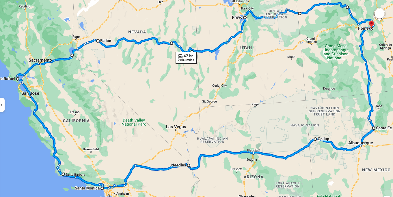
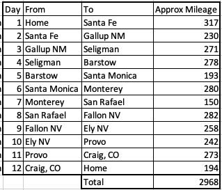
My rough itinerary and mileage look like this:
- The night before
I am cutting things fine. Which I am not comfortable with. By this stage of any bike trip, I have been planning for weeks, and all is ready to rock n roll. But not this one.
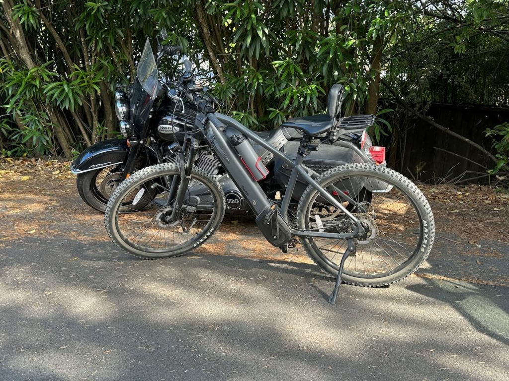
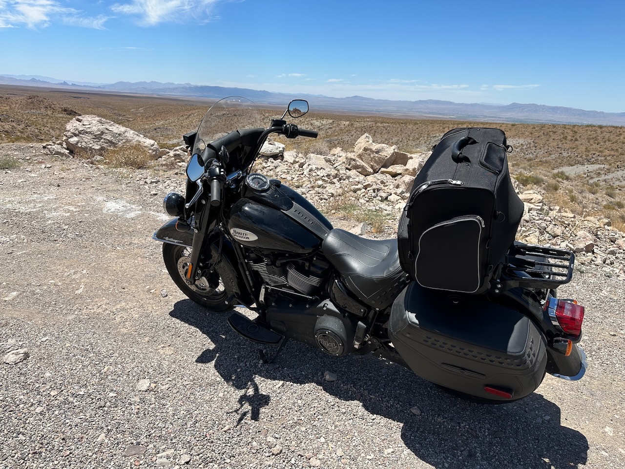
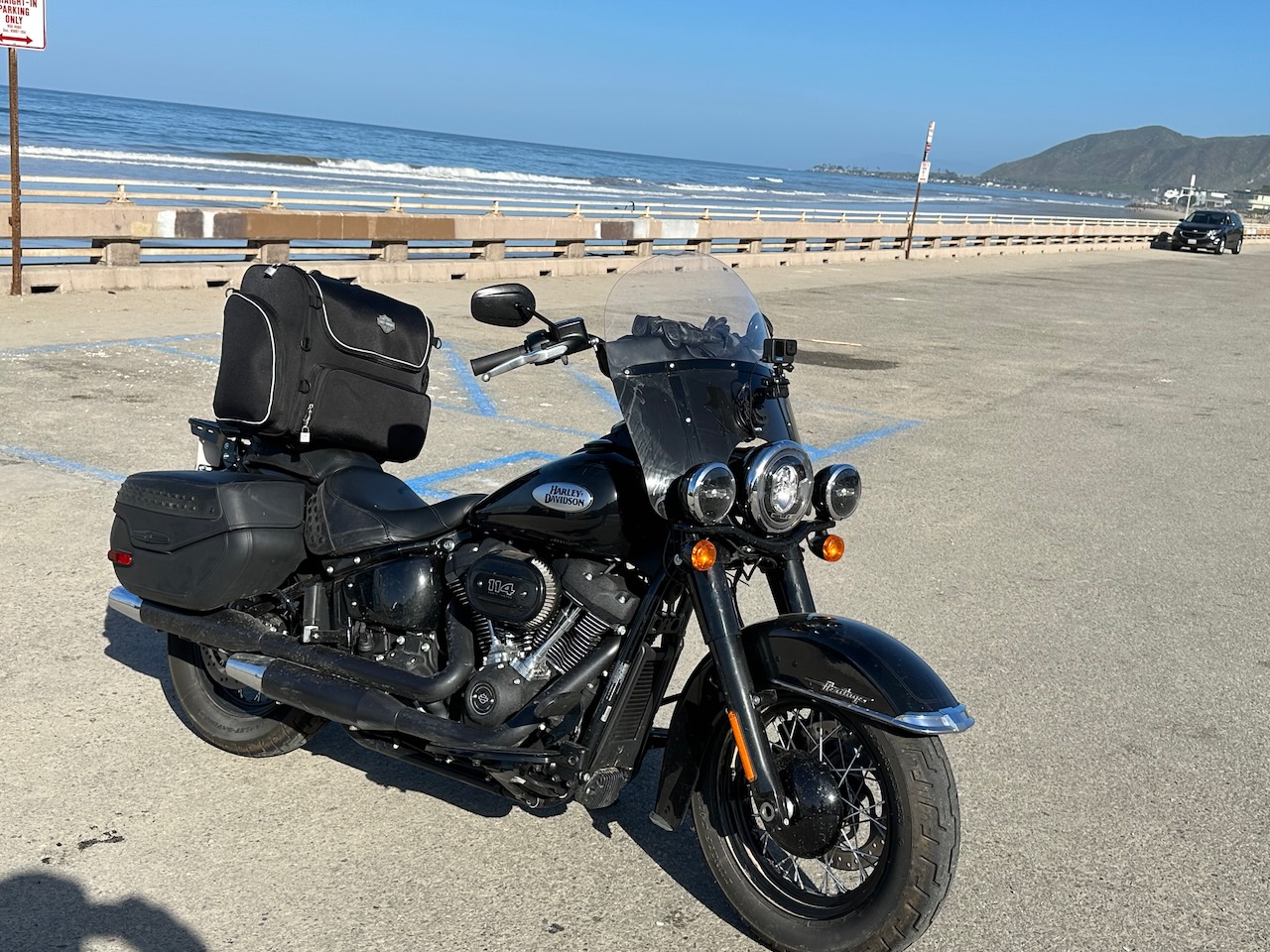
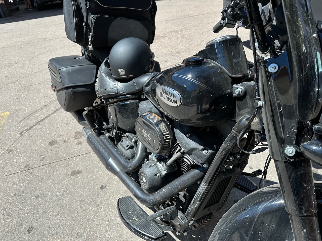
About 2 weeks ago I decided to trade in the bike I have been riding for the past 2 years. I loved it, and it is the most comfortable bike I have ever ridden – with all the mod cons; CarPlay, luggage and the rest. However, it was a monster, weighing over 900 lbs dry. It was really tough to maneuver and handle at parking speeds, and I was always afraid I’d drop it. I never did, but it is too much for anyone to pick up, so I would be screwed if I was anywhere vaguely remote (which I often am on my trips).
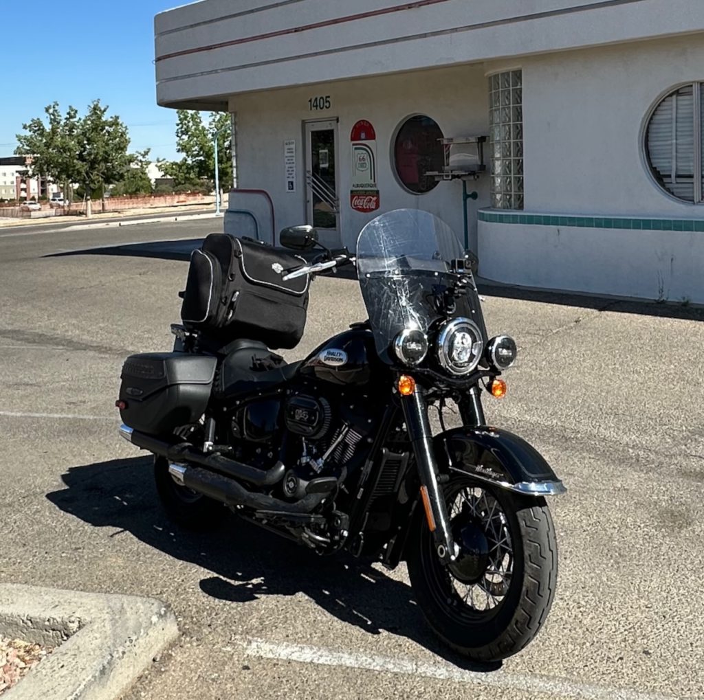
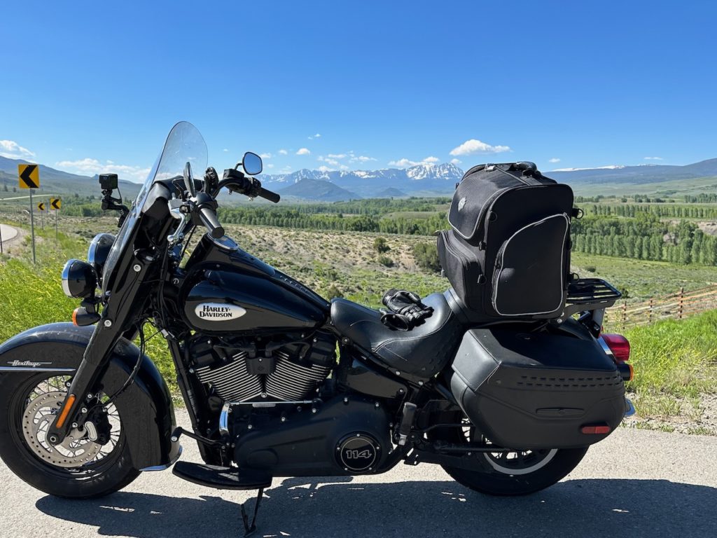
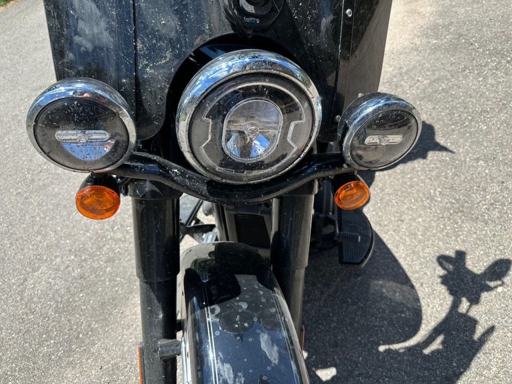
Anyway, it was time to go back to a ride that was easier for me, and the decision of which bike to trade it in for was a no-brainer. I have always loved the Softail Heritage Classic, and so I swapped the beast for a smaller (but still substantial) piece of beauty. This is my 3rd Heritage Classic, which tells you how much I love them. Of the 10 bikes I have owned in my long life, 30% of them are Harley Davidsons own Heritage Classics.
Anyway, digression over with. I got the bike, but needed a bunch of add-ons before I could undertake a serious tour. Also, the bike needs a full service before I head out on such a ride, so I booked it in for all the things – today was the day. It wasn’t possible any earlier, so a 90th minute service and fitting it was to be.
I brought the bike to the dealer yesterday, so they could start work first thing today, and they said it would be ready for collection at 3 pm today. Due to Lena’s work schedule, She could only drop me at the dealers around 1pm, so I turned up, prepared to wait patiently for a couple of hours. However, I was politely informed that “he hasn’t started on your bike quite yet – we are rather busy”, and that it would still be a few hours before it was ready.
Fortunately, I had brought my maps and laptop with me, in case of just such delay – so I have spent the last 4 hours patiently waiting for my iron horse to be groomed and fettled in readiness for my odyssey. I am not sure how much longer I will have to patiently wait (or impatiently – the waiting is the same) until it is ready – but it may be a bit longer yet. I will update.
Meanwhile, I have been poring over maps, doing some housekeeping emails etc, and soaking up the rocking beats that the Harley shop have been playing full blast all afternoon. Tonight happens to be a bikes, music and competition night, so the greasy biker public are starting to turn up. I assume things that are probably along the lines of free drink, burgers or hot dogs, lots of leather and loud music, and plenty of talk about replacing gaskets, how many horsepowers per square mile and other such aficionado talk that has always been beyond me. I love riding comfortable bikes, and admiring pretty bikes, but I have never been a geek about them (or pretty much anything else). Still – a lot of folk are, so more power to them.
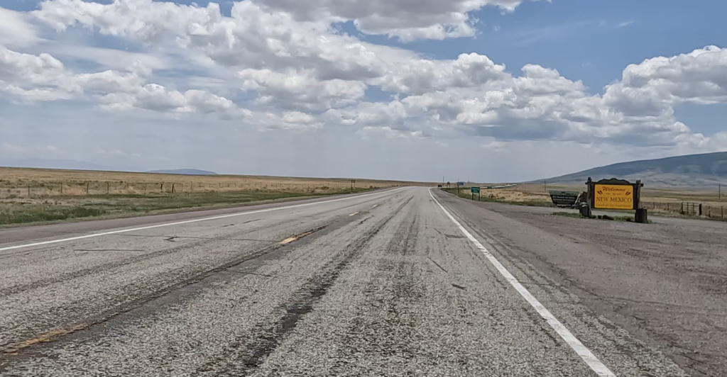
Tomorrow is a very easy day navigationally. I leave home, and within a couple of miles arrive on highway 285. I follow it south for the best part of 320 miles, and turn up in Santa Fe, New Mexico. Long ride and will be tiring but I love love love being on the road with my bike, so bring it on.
- Day 1 – Bailey, CO to Santa Fe, NM: 340 miles
Yay. I am on the road and underway. Currently sat in a restaurant in Santa Fe, having some kinda ‘rita and waiting for my food. I skipped lunch, so I am very ready for all the things. It has been a long day mile-wise, but easy enough on the travel.
Yesterday did not go that well. If you read the previous blog entry, you will know that I had a long wait for my bike to be serviced and readied for travel. In the end, I waited 5 hours past the time it was supposed to be ready. I am a patient person, but this was quite a lot to ask. Then, it was raining hard on the ride home (about 40 minutes), and I got totally soaked AND battered by hail to boot. Not fun in the dark.
Then, when I got home, I realised I had lost the bike key along the way – sad face indeed. It had fallen out of my pocket when I fueled up, so a quick call to the gas station confirmed that they had found it, so my wonderful Lena went off to the gas station (about 20 miles away) to get my keys while I packed. The bike starts if the fob is in the proximity of it, so obviously the key had fallen next to the bike so I could get it started, but then the bike would not respond once I got home.
Anyway, it all felt a bit much, but I got everything sorted and ready-ish, and we went to bed quite late. I was up early with excitement. I tried to sleep a bit more, but it wasn’t happening, so I finally got up, let the dogs out (now we know who!!), then showered and loaded up.
Moments before departure I did have a cup of coffee before starting out, but my tradition is to breakfast on the road. About 80 miles from home, after riding through a bit of rain and a fair amount of cold (it was about 6 or 7 degrees C, which is about 90 million in fahrenheit I think – who understands these things?), I stopped in Buena Vista for a great bagel and a good cup of coffee at a lovely little spot. We have rafted in Buena a few times, and it is a cute little mountain town. The day was warming up a bit, but rain still threatened, so I kept my wet gear on.
The ride to Santa Fe is kinda boring. At least it is the way I went. I followed the highway that we live right next – US 285 – for most of the day. Aside from the odd detour dictated by Google maps, the 285 took me pretty much door to door.
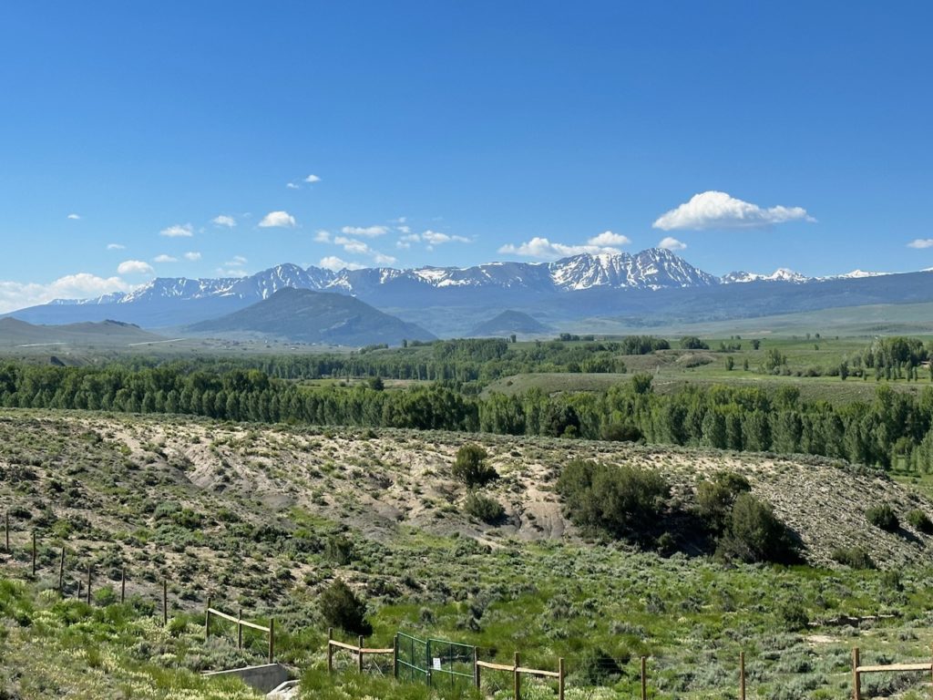
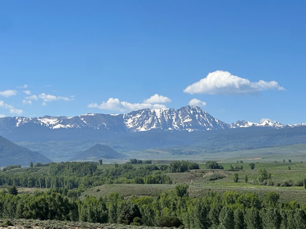
Poncha Pass was quite pretty, and I have not been through much of the terrain that I crossed today, but large tracts of it were unremarkable. I transited into New Mexico around the middle of the day, by which time the scenery was pretty uniform: scrub and dry sand and rock. It was wonderfully warm though. I stopped for a comfort break somewhere about 90 minutes from Santa Fe, and the temperature was 28 degrees (again, about 90 something million in fahrenheit). I de-layered to suit, and changed my gloves to the lightest pair.
Crossing the state line I always travel with multiple pairs of motorcycle gloves. If one gets wet, you can switch to another pair while the first dries. Some are suited to wet or cold, and some are light and breathe nicely. I have three pairs with me on this trip, a heavy, medium and light pair for maximum flexibility. My medium pair did not age well, but Lena did an emergency sewing job yesterday, so hopefully they will hold up for the trip.
Anyway, after a lot of highway miles and a couple of wee/fuel stops, I arrived in Santa Fe mid afternoon. I went first to the local Harley Dealer – I found that my handlebars needed a slight adjustment to make my riding position more comfortable. The local dealer was very near my motel, so I stopped there, and one of the service people was very helpful and tweaked the angle of the bars in a quick minute. I browsed through the store but didn’t buy any paraphernalia (I have almost no space on the bike). Then, on to the motel, which was about 4 minutes away.
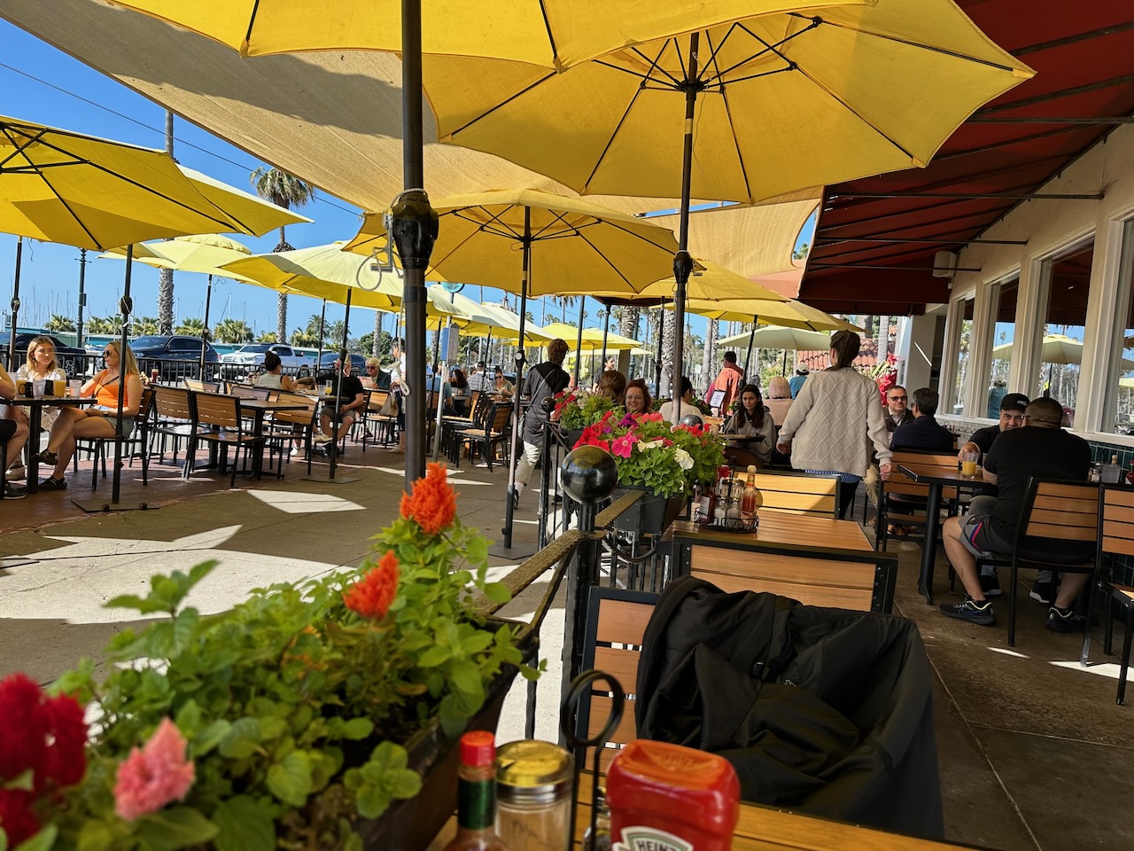
The lodge is fine – I worry about cheaper accommodation, even if I rely on ratings on booking.com for my guide. There was a small pool, so I unloaded the bike and took a dip. I am currently about 10 minutes walk from the motel at a little plaza with a few restaurants and a cinema, enjoying my second margarita and overcoming the disappointment I felt when they brought my starter and main course within 3 minutes of each other. Tequila is a wonderful thing.
I am going to head back to my sumptuous accommodations shortly, where I plan to try review the hours of footage my GoPro captured today, and see if there is anything worth keeping.
Tomorrow morning I get onto Route 66 almost directly from the motel, the route which will accompany me (or, I think more fittingly, I will accompany the famous roadway) and follow it for 1000 miles to the Pacific Ocean. Do come back for more episodes each day. TTFN
- Day 2 – Santa Fe, NM to Gallup, NM: 252 miles
The first few days of a long trip always involve a bit of re-packing and stacking as you figure out the optimum stowage and loading. Today was no different, though I was pretty quick about it. Maybe I am learning something from all these years of experience on the road.
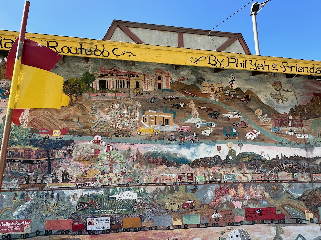
Anyway – I did the loading and stuff this morning, and set off just after 7am. The day was already gorgeous, with blue skies and warm sun touching everything. After the past 6 weeks of rain in Colorado, I am very ready for sunshine. I took the highway to start with, as the old 66 ran along where it is now, but left after about 15 miles and joined the old road. It was a joy, for nostalgia sake. I have dreamed of driving Route 66 since I heard Chuck Berry do his take on Nat King Coles song (Cole didn’t write it, but he was the first to record it). Now I was on the fabled road, and feeling good about it, too.
I appreciated the olde time road signs and markers identifying Route 66 everywhere. You certainly can’t miss the fact that you are on it. The towns I went through were small and sleepy (who isn’t at this time on a Saturday morning?), and I enjoyed the quiet roads.
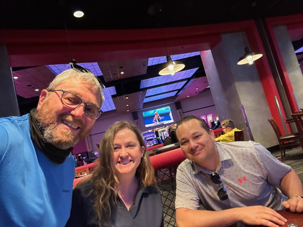
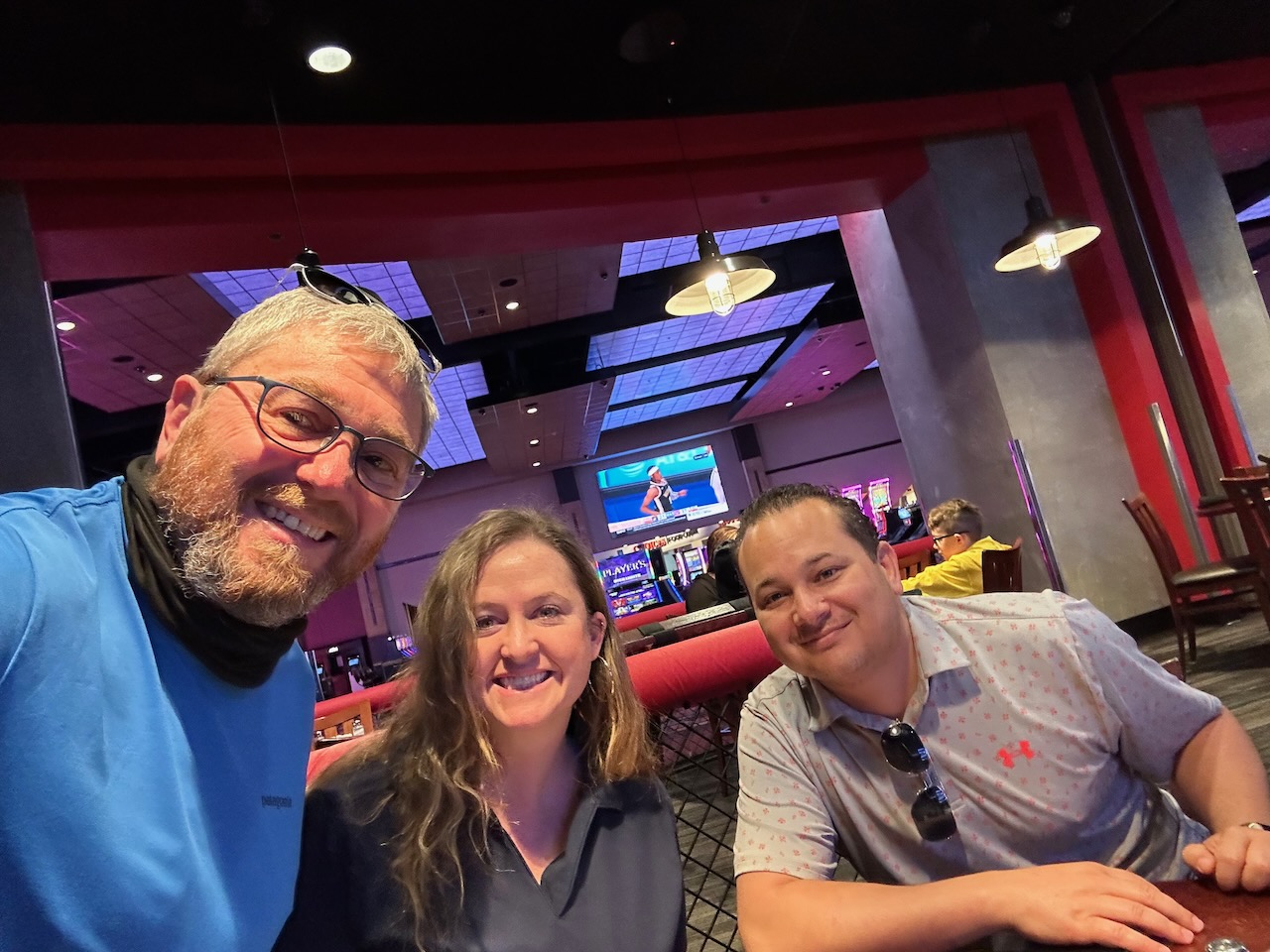
My first destination was Bernalillo, about 40 miles from Santa Fe. I was visiting a Casino – of which there are far too many in this part of the world. Those of you who know me would immediately ask “Brad, you don’t like casinos, why did you go to one for breakfast?”. Well, let me tell you – our good friends Younes and Abby were staying there for the weekend, and I couldn’t ride right past without stopping to say hi. We have a nice get-together and a mediocre breakfast (confirming – as if I needed it – my suspicion about casinos).
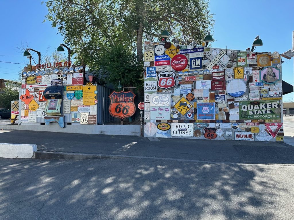
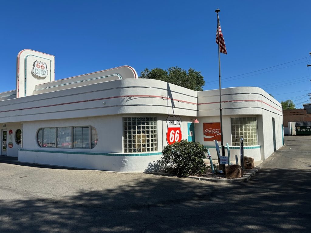
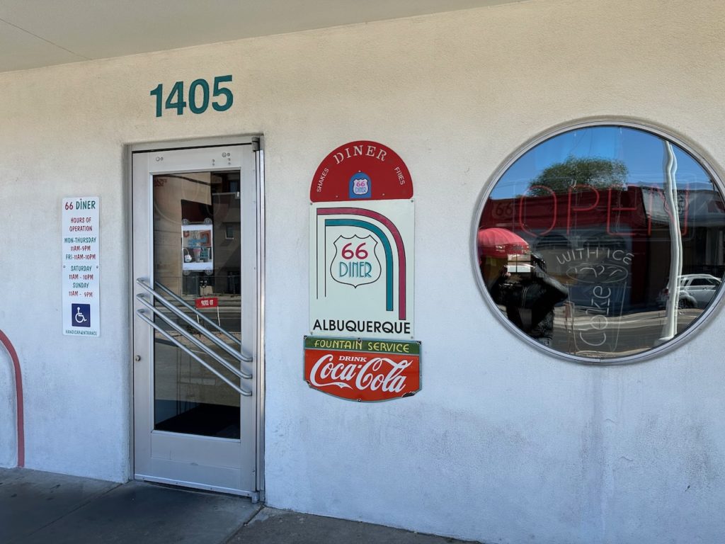
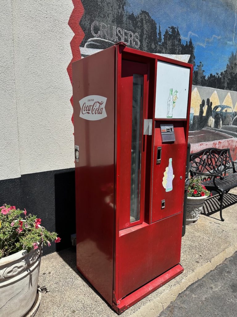
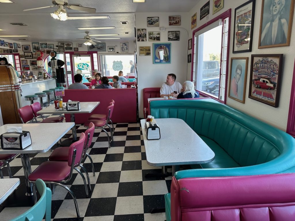
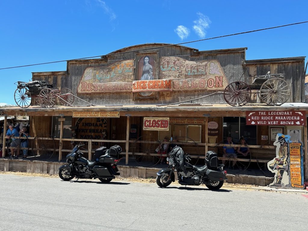
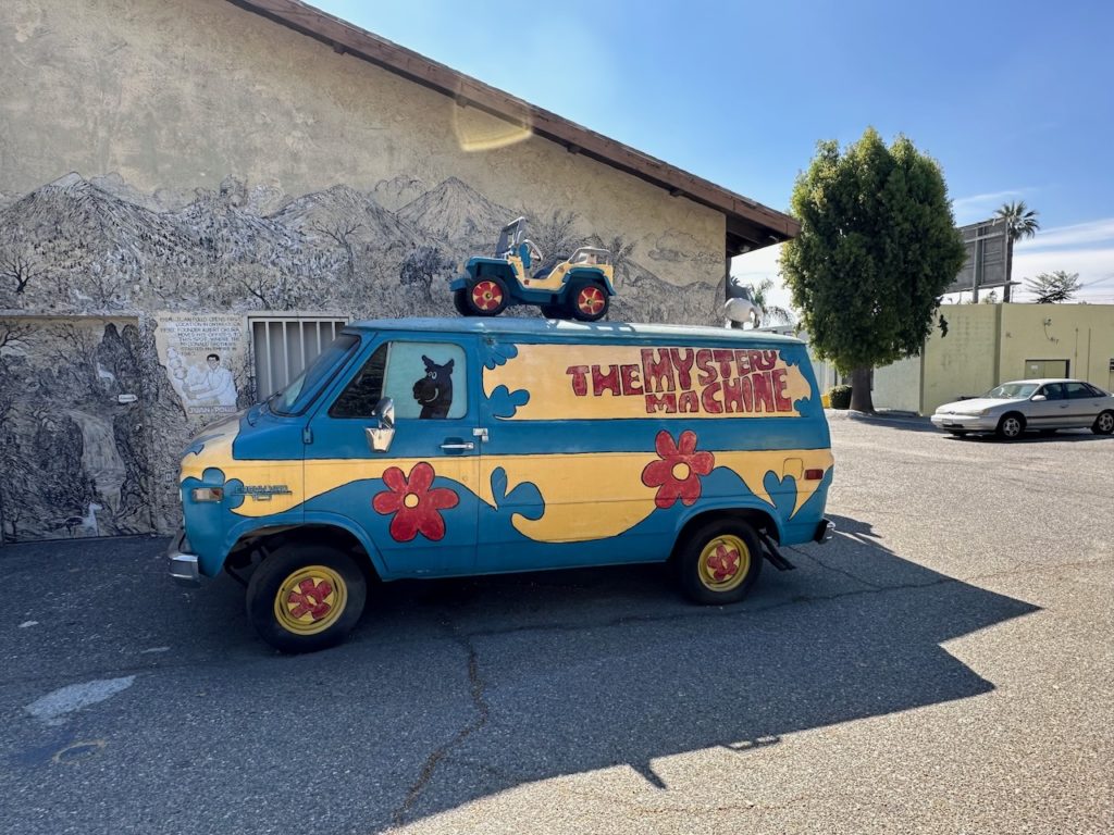
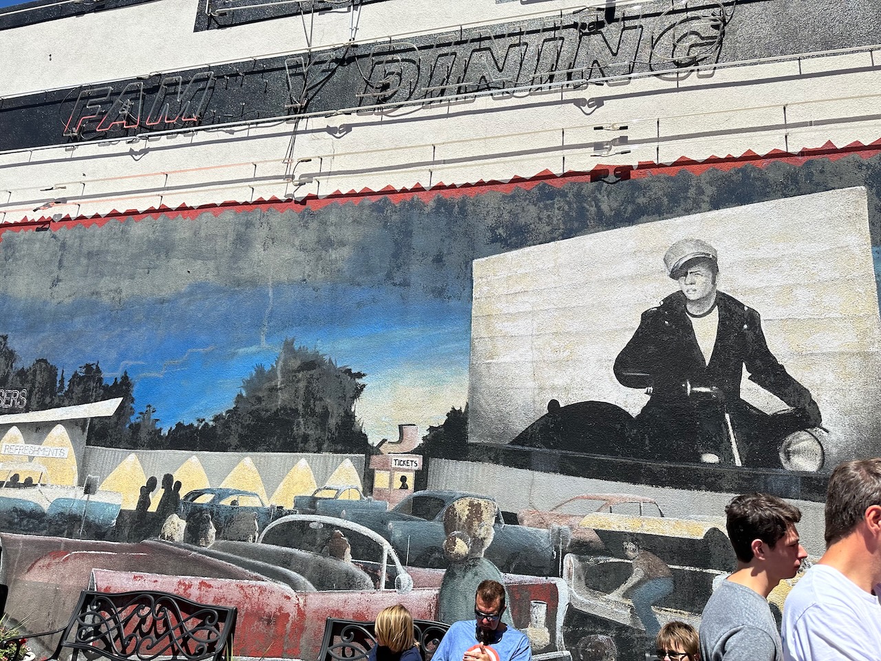
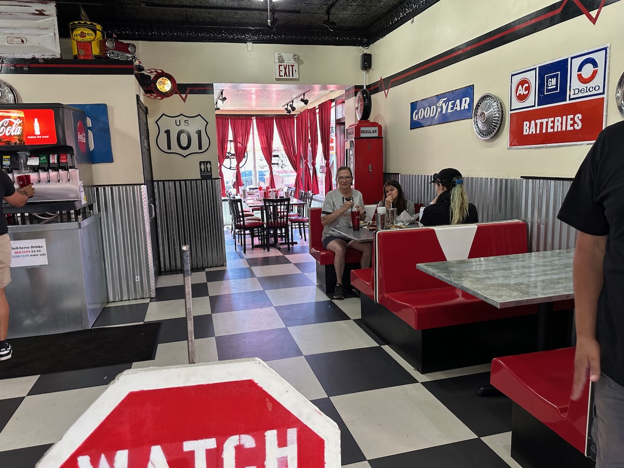
Back on the road, I soon rejoined the main motorway (I25) towards Albuquerque (I absolutely love the name and spelling). I dropped off the big road into the old town, and visited a few 66 highlights. The first was a 66 diner, which was fabulous.
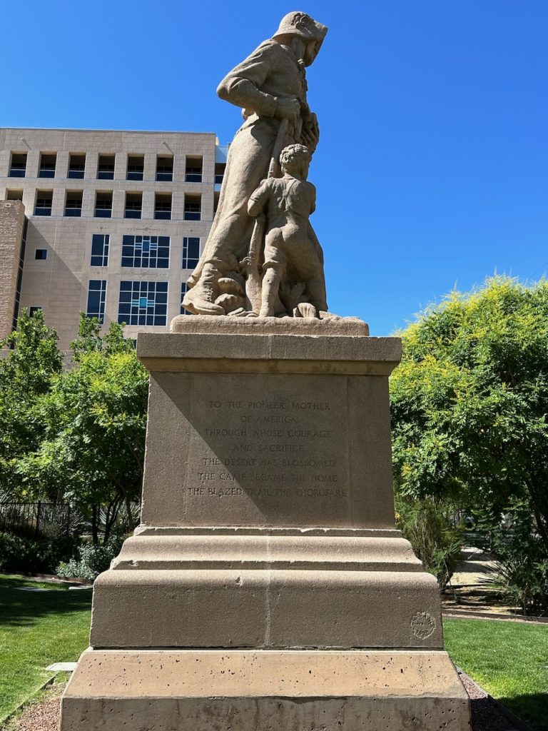
I stopped at a memorial statue to “The Pioneer Mother” of America – the countless thousands of women who crossed the wild west in covered wagons looking after the families so that the men could hunt for food and shoot native people for fun. All in a pioneers job description.
I realized that I had lost my goggles somewhere between Santa Fe and Albuquerque. I think the were on my helmet and flew off somewhere. Anyway, doing the Route 66 roads where you pootle along at a sensible speed is fine without goggles, but if you have to do any motorway mileage, where speeds reach up to 1,000 miles per hour, then goggles are a must to keep the eyes from drying out or filling with dust and specks of spattered insect. So I rode back from whence I had come for 15 minutes to the nearest Harley store, in order to replace the eye protection.
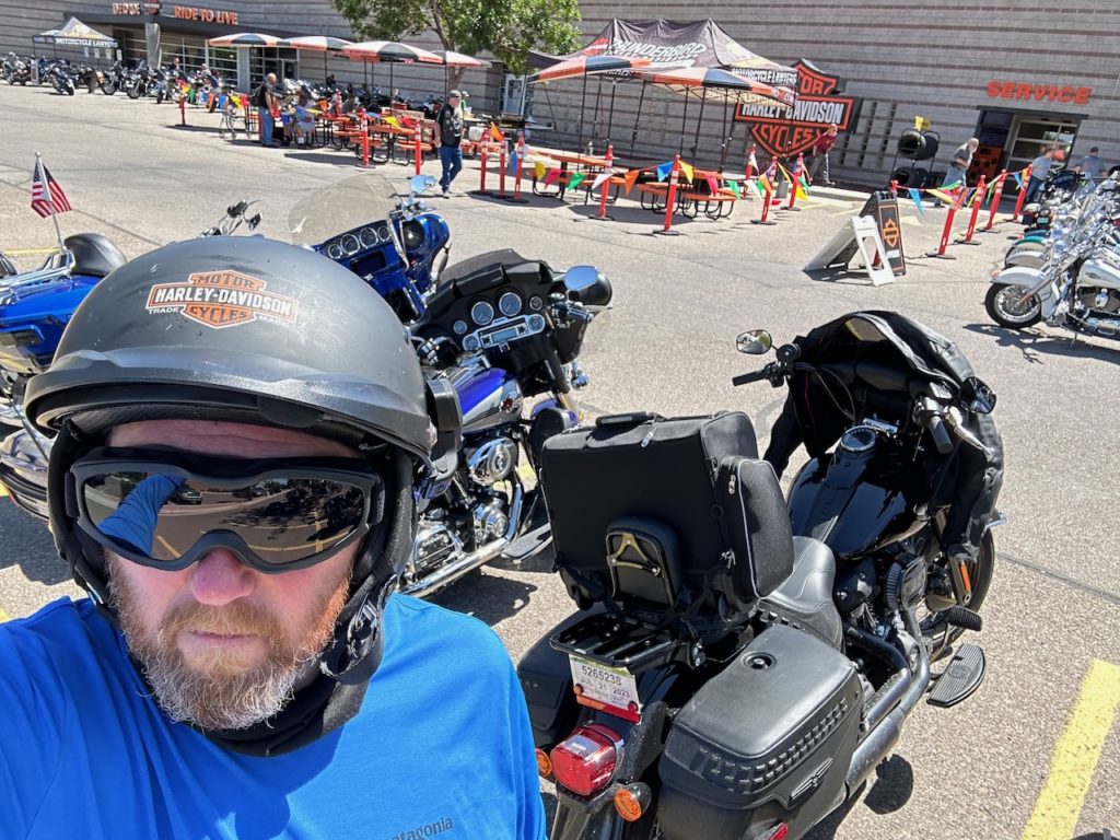
New goggles – all the better to see you with! It was a very busy summer Saturday morning at the Harley shop, and there were all kinds of fun and festivities underway. Lots of sales people swooping in on you as soon as you walked in, but they are generally a good natured bunch, and like a good chat. I browsed for a bit, bought the goggles, and returned to the road.
A good hour or so of non-motorway riding followed. It got pretty hot, and there were some long stretches of pretty much, well, nothing. Sand, stone and scrub abound, along with the odd horse, abandoned motel or vehicle workshop/graveyard. Why are there so many scruffy looking places, with 1980’s advertising outside, playing host to so many dead cars and trucks? I now know where America sends it dead cars. I also saw a lot of (unrelated, I think) trains. More than one would usually expect to see.

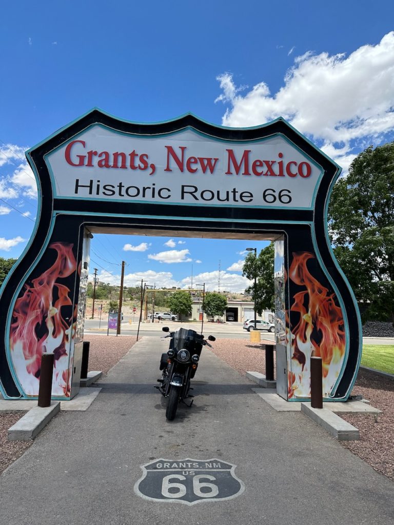
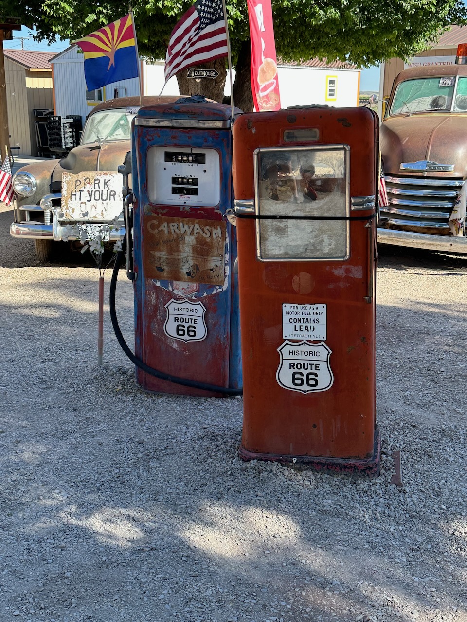
I stopped in Grants – a small town which was pretty around the centre, but full of sadly abandoned or empty businesses, motels and gas stations on the outside. There is a famous Route 66 photo opportunity there, so I stopped to take advantage. In the 5 minutes that I was there after taking my picture, two more cars came through and did the same.
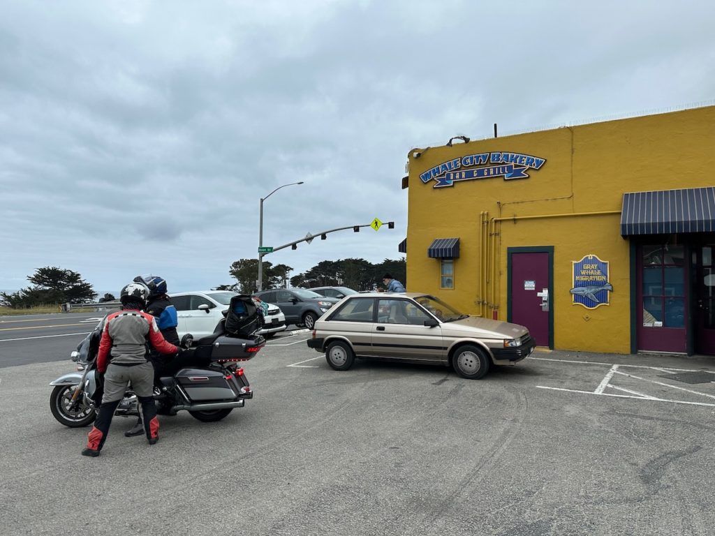
Gallup, New Mexico, is mentioned in the famous song, so I chose it for tonights accommodation. The motel room is a little nicer than yesterdays, but the pool here is broken or lost or something, so sadly I could not take a dip. The afternoon is a warm 25 Centigrade (not sure what the conversion rate from Roubles to Euros is to help you with the American temperature). I unpacked and did a bit of admin in my hotel room, then hopped back on the bike and rode a mile down the road to Grandpa’s Grill. Small and rustic, but great spare ribs. No alcohol, but I didn’t need the margarita like I did last night to compensate for the bad food service. Now back in the hotel room to blog like a good ‘un, and then plan to route and some stops for tomorrow. See you in Seligman, Arizona.
- Day 3 – Gallup, NM to Seligman, AZ: 289 miles
881 miles so far. In 3 days – pretty good going, right? This morning saw the usual faffing and readying for departure from Gallup. I took the old 66 where it exists, but much of today was on the I40, which runs over a bunch of the old road. I road 100 miles to Holbrook, and had the obligatory diner breakfast.
I don’t do many rules, but one I hold myself to while on the road is “No chain restaurants”. I try find a breakfast diner about an hour or so away from my overnight location, so I can get a few miles under my belt to start the day. I also like to eat a bit later to that I can get through the day without needing a lunch. Anyway, todays breakfast was standard diner fare, and it suited me fine.
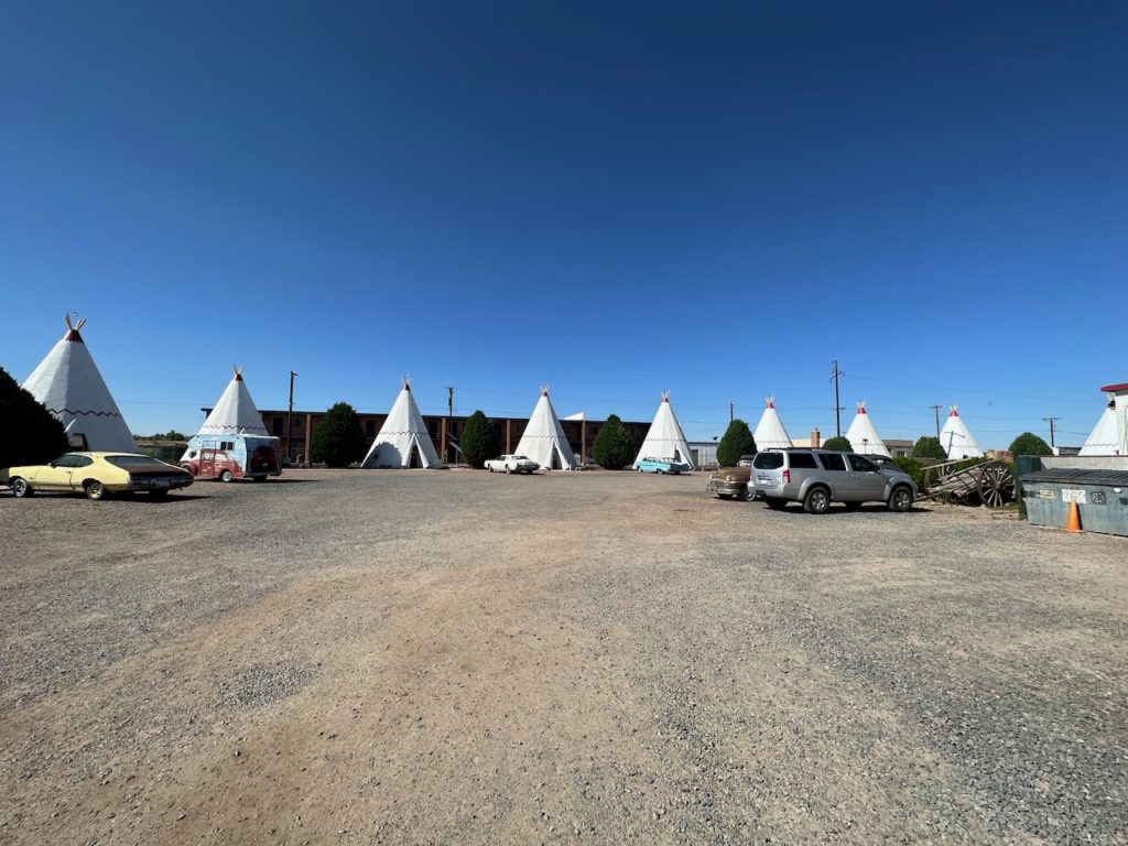
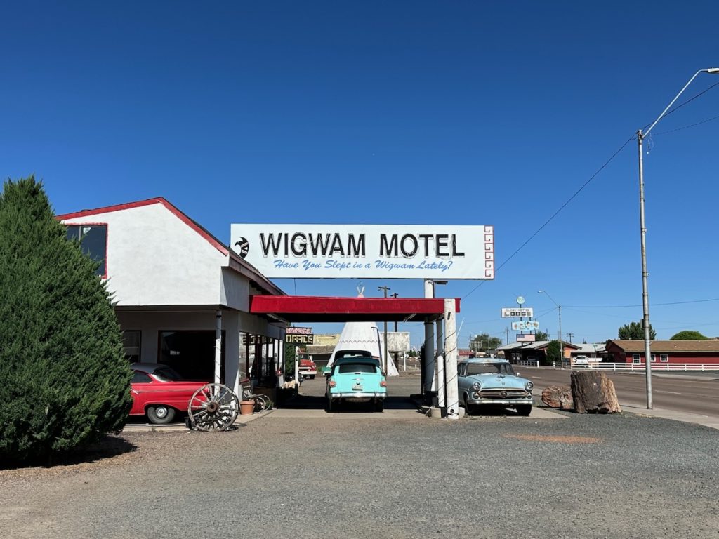
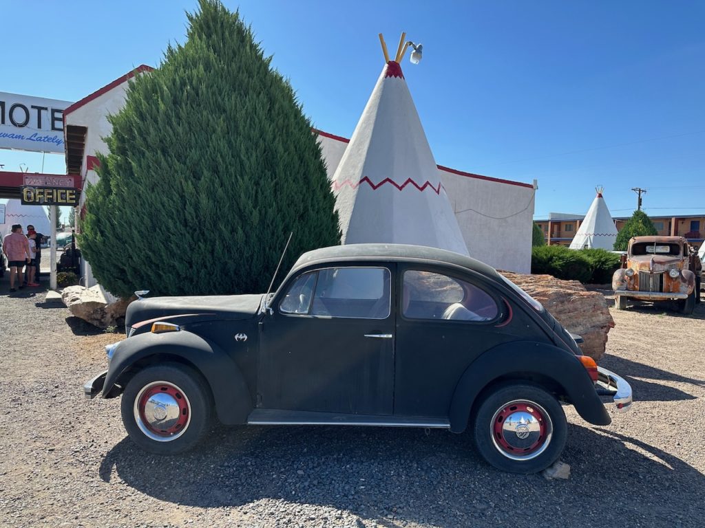
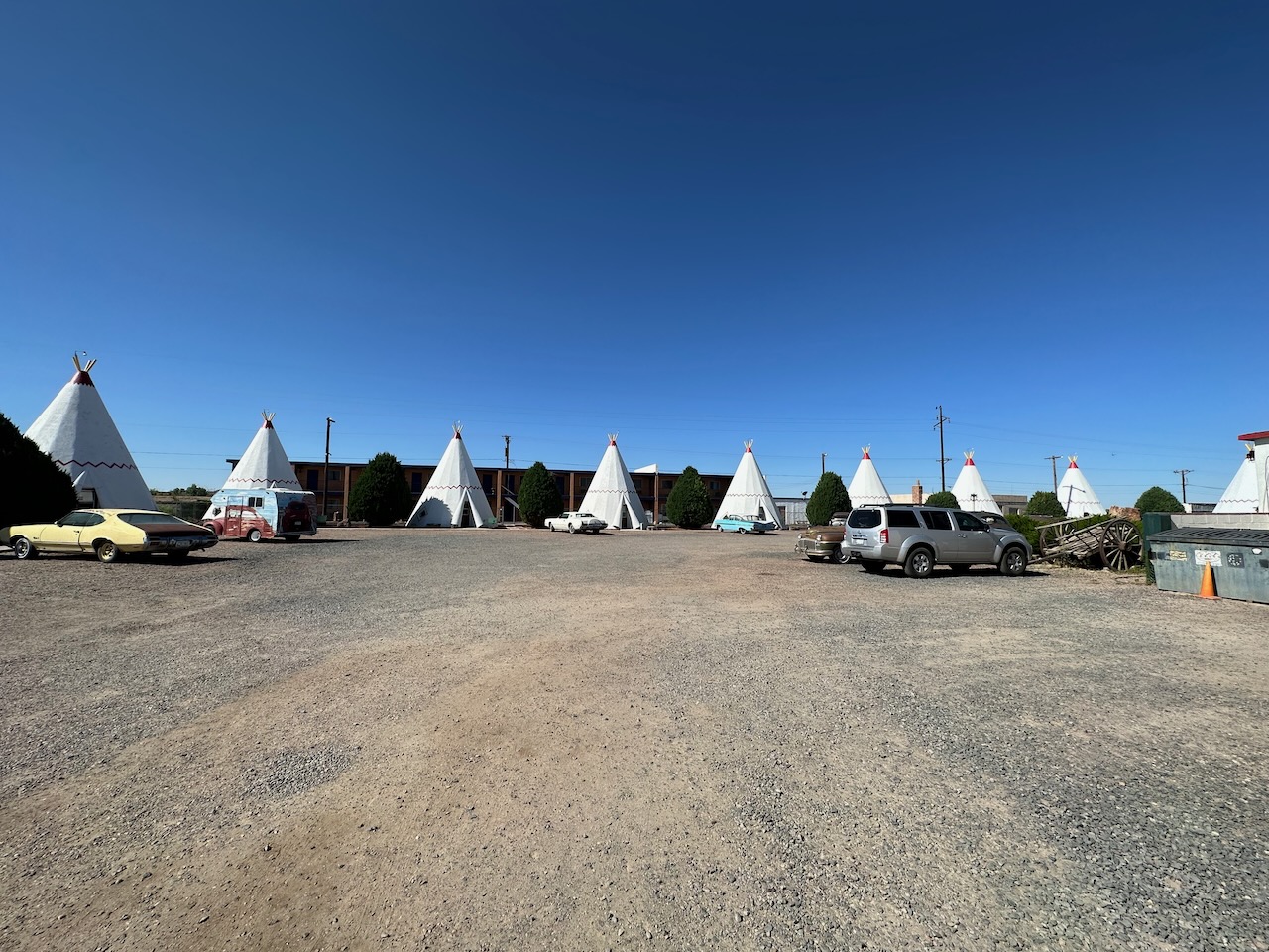
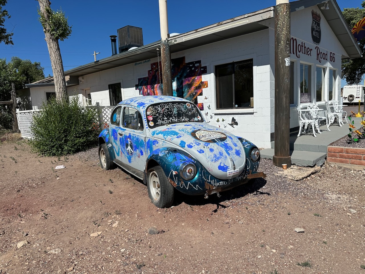
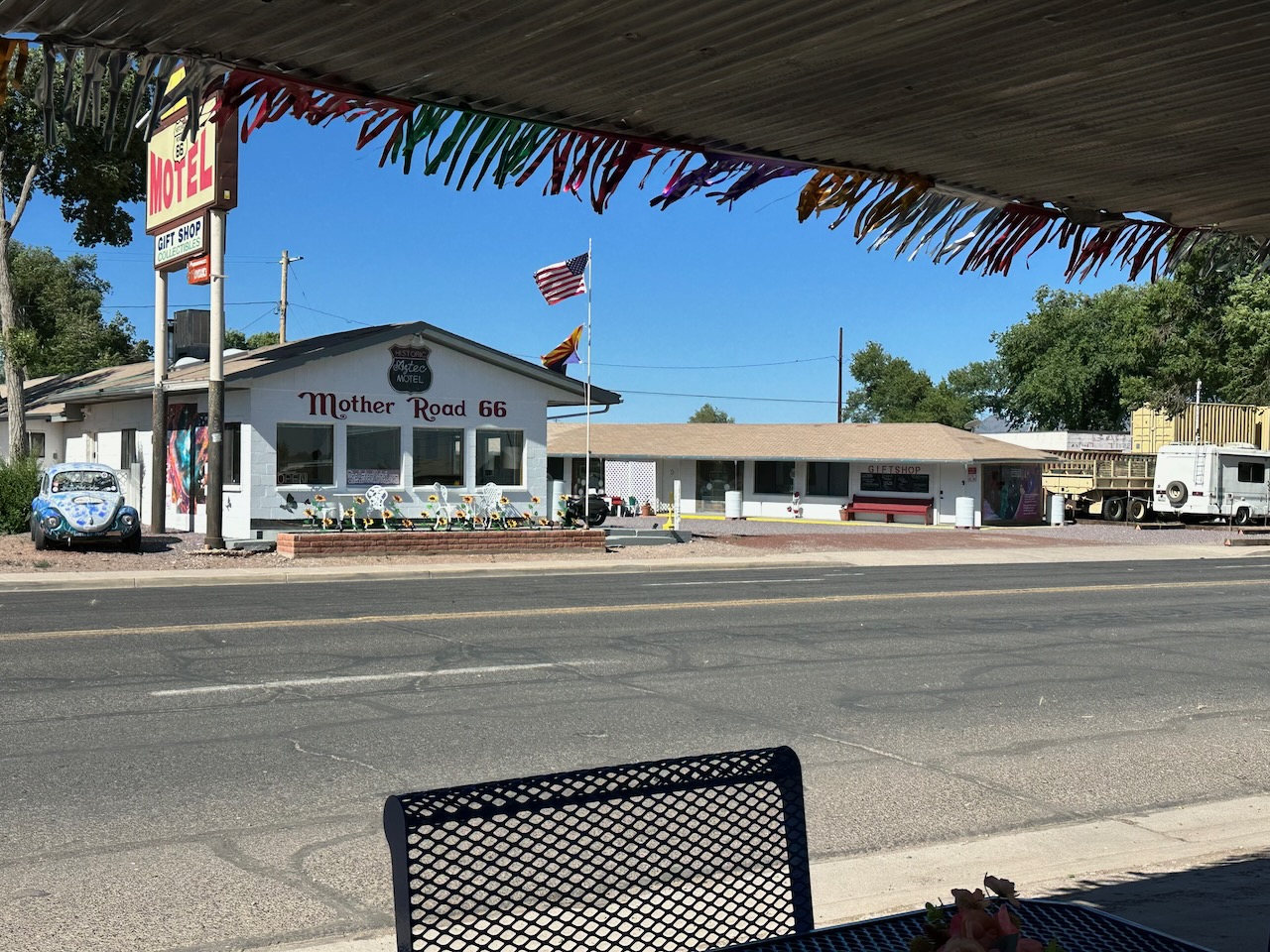
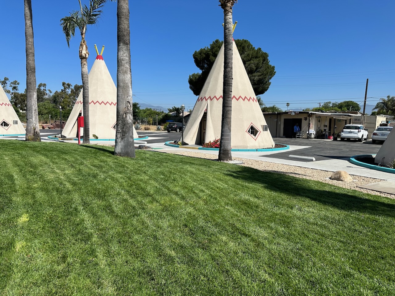
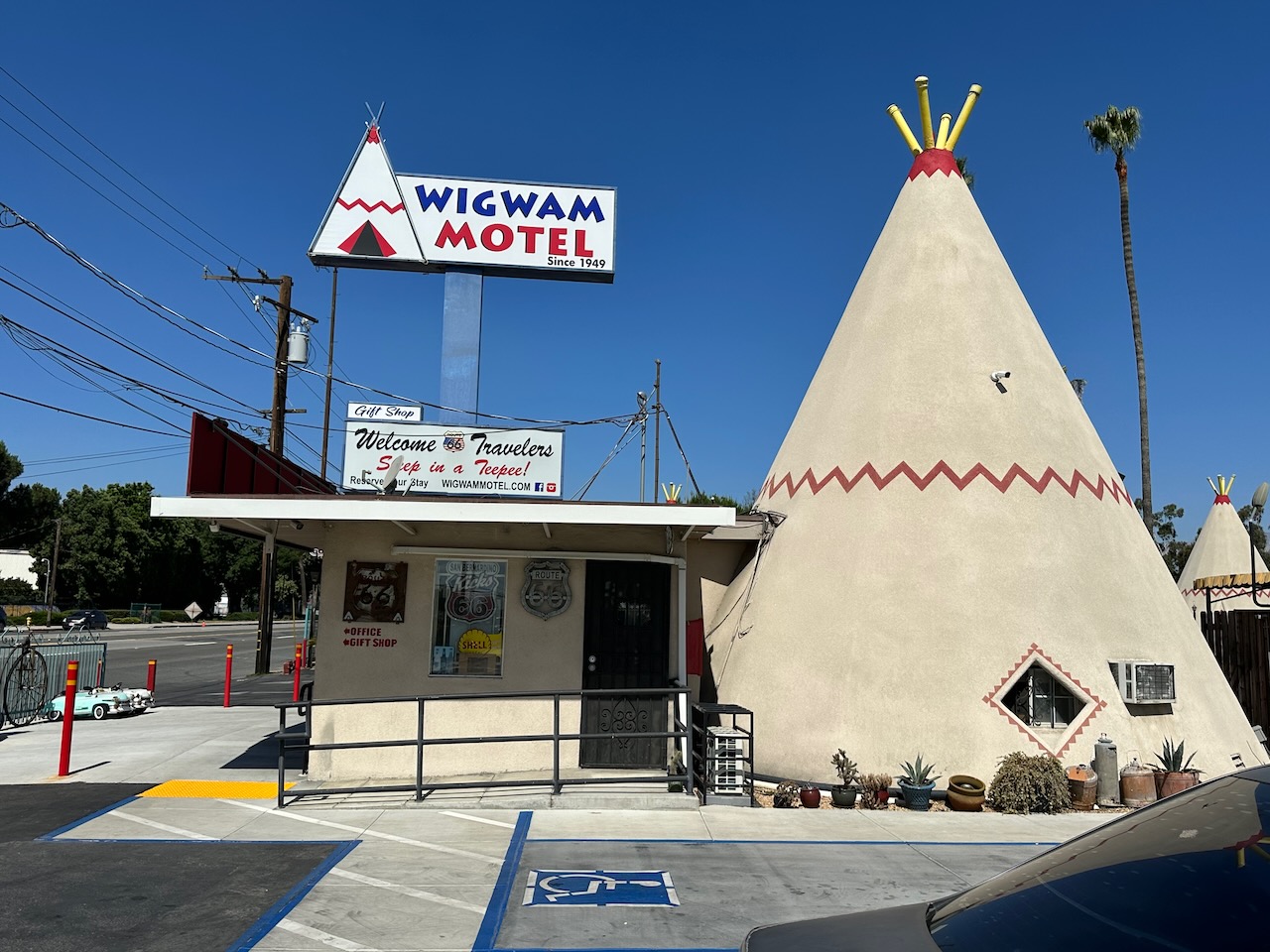
Very soon post-breakfast I stopped at the Wigwam motel. There is a square of wigwams, and each is an actual motel room you can sleep in. They are obviously not made of wood and canvas, but I think they are popular with 66 travelers. They enclose a large collection of rusting cars from days bygone. A few folk stopped to join me in taking pictures during the ten minutes I was there. Apparently there are 6 Wigwam motels dotted around the US – I think I visit another one tomorrow in California.
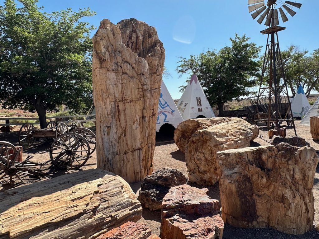
Every trip brings you to “the worlds oldest xyz” or “the country’s highest apple tree” or something noteworthy. My next stop was the worlds largest petrified tree. This was broken in chunks, but nonetheless impressive, and the biggest pieces were at least 3 metres high. The tree was removed from the nearby National Park – a petrified forest – in days gone by, when one did this type of thing.
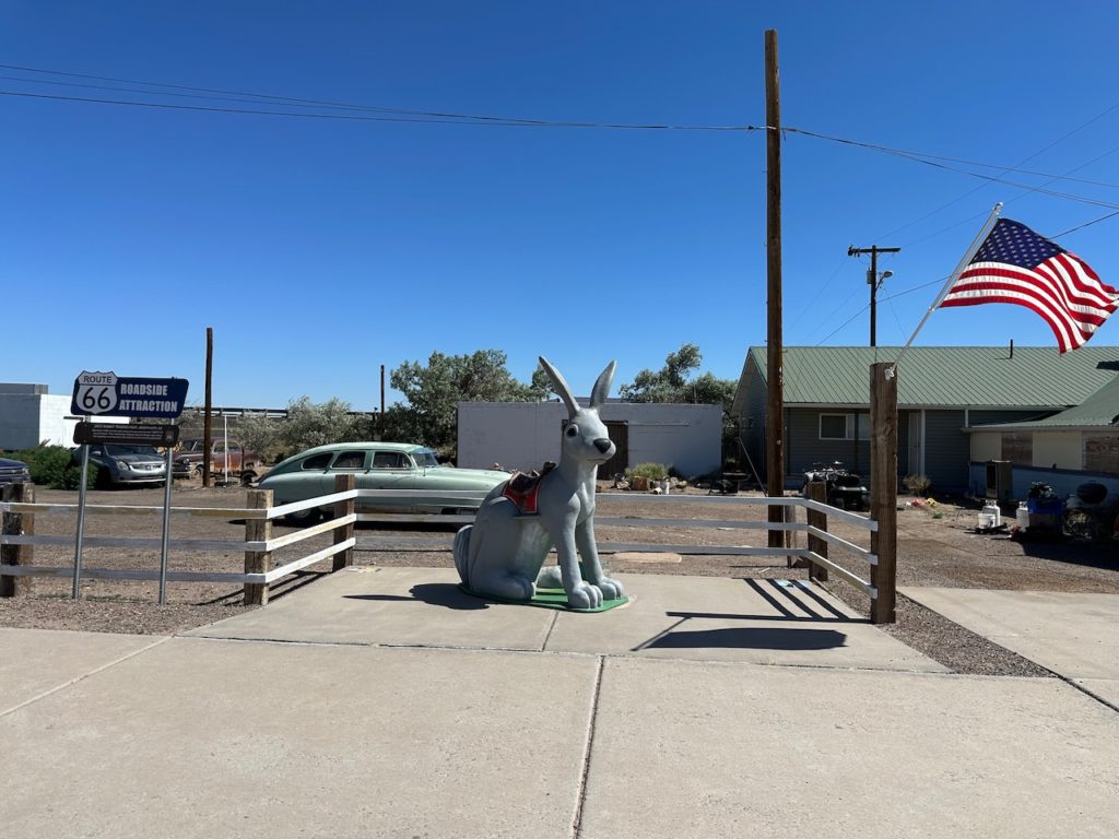
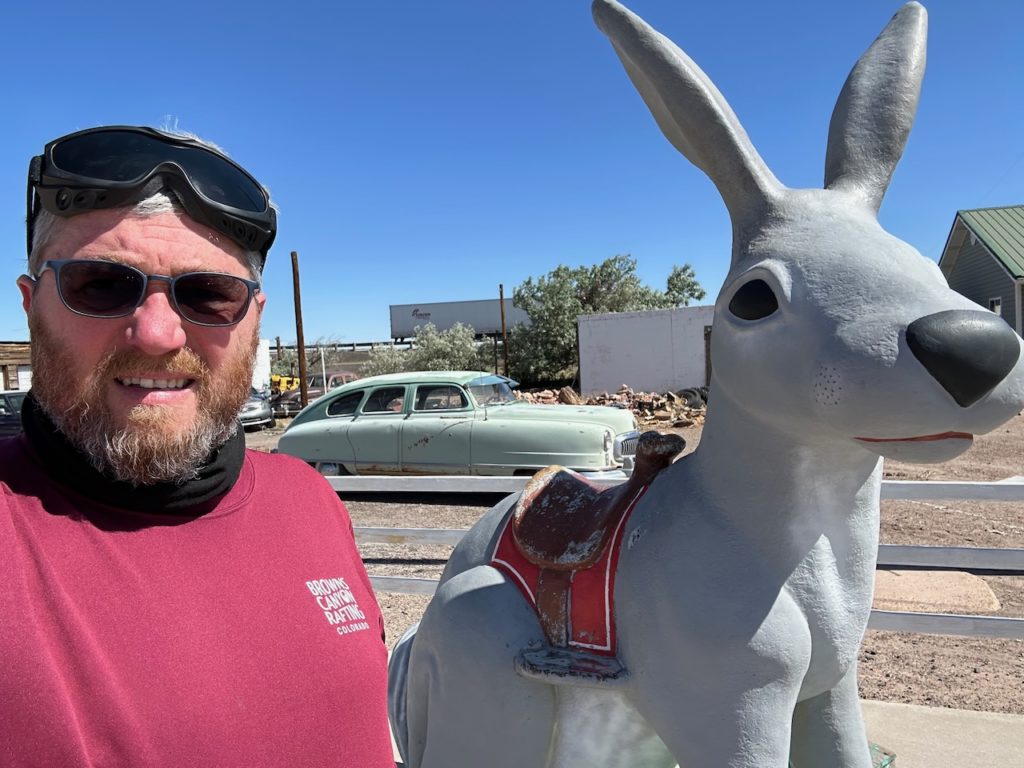
Next in the itinerary was Jack Rabbits Gift shop – a veritable warren of goods and chachkes. I bumped into a bona fide Brit, a chap from Derbyshire, who was also traveling Route 66, and we had a good chat about the old days.

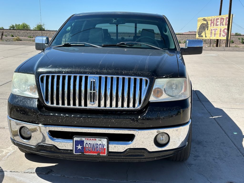
Parked outside Jack Rabbits was a truck, from Texas of course, with probably the coolest license plate I have ever seen:
At some point, I crossed into Arizona. It is in a different timezone to the one I had been operating in, so suddenly I had an extra hour in my day.
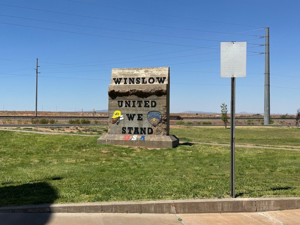
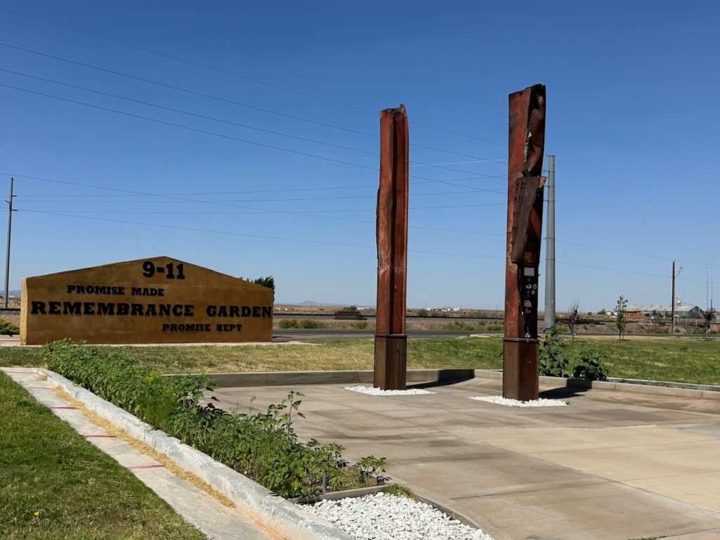
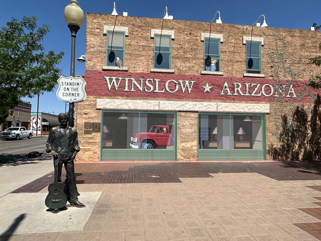
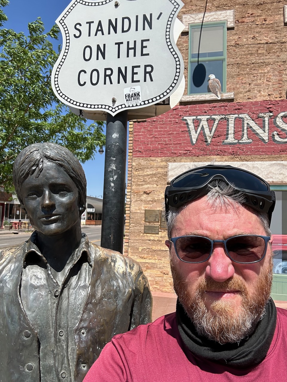
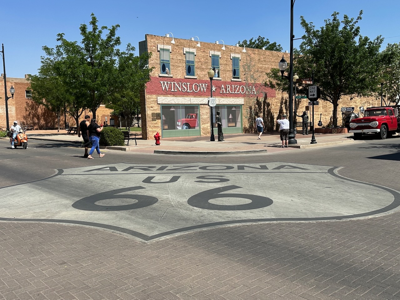
I won’t describe every stop of the day, but in Winslow, I stopped at their 9-11 memorial. This little town had somehow persuaded New York to give them 2 melted girders from the World Trade Center and there is a touching (though overly patriotic in a way that only ‘Merica can do) memorial in a park just at the city limit.
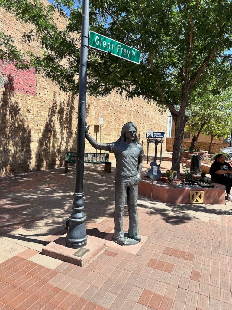
I am not one much prone to excitement, but Winslow also held a Route 66 attraction that I was agog about. The Eagles launched their first song, co-written by a a member of the band and Jackson Browne – called “Take it Easy”. It is a well know and much loved rock/pop song, and has stood the test of time. Anyway, the famous 2nd verse starts with the following line: “I was standing on a corner in Winslow, Arizona” – and the enterprising folk of Winslow had put up statues of the writers and created a “Standing on the corner” park. There was endless Eagles music pumping out of a speak in the street, and many folk stopped to take pictures.


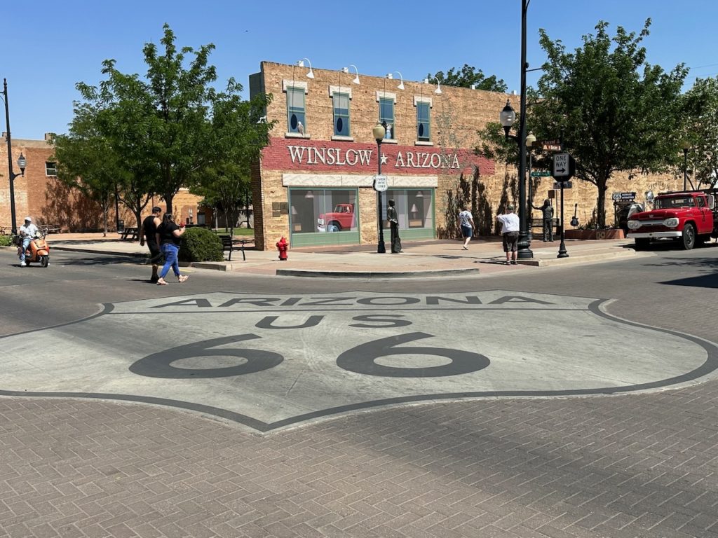

I took the obligatory few pics, then went and sat in a nice cafe (that had once been a bank) on the opposite corner to the memorial, and enjoyed a chocolate shake. It was very good, and I relished the cool cafe and cold drink – it was 29C.
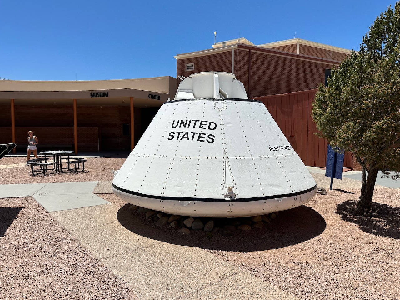
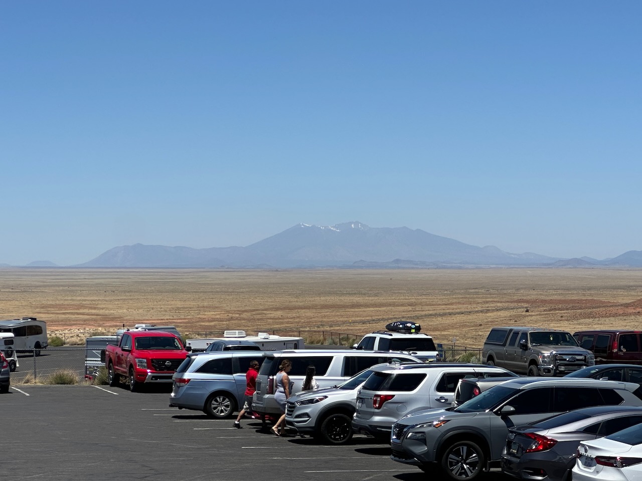
The next noteworthy stop was Meteor Crater Natural Landmark. Created by a meteor impact about 50,000 years ago, the crater is 3/4 mile wide, and 550 feet deep. It was deeper at the time, but the desert has eroded the rim and surrounds. It is very impressive, and they have a good visitor center too.
Apollo astronauts trained in the crater, as apparently it resembles many lunar craters. They must have been bloody hot while training, I can tell you. The meteor itself was 45 meters in diameter, and was traveling around 64,000 kilometers an hour. That means it was traveling at 18km or 11 miles per second. That is fast. No wonder it made such a big hole.

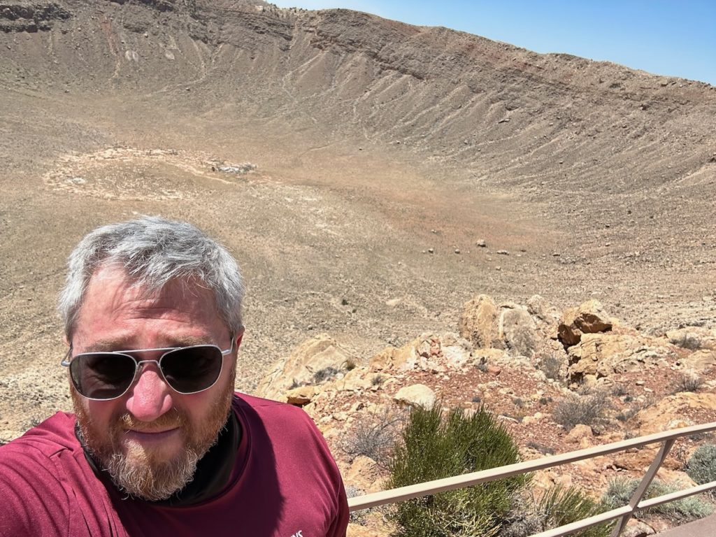


Someone there had a good sense of humour. The crater is about 5 miles off the main road. There are various signs along the route that made me smile. “5 miles to impact”. “Speed Limit: Vehicles, 50 mph, Meteors, 28,000 mph”. And the final sign as you got to the crater “Prepare for impact”. Nice work, people. Though one thing rankled a bit – they charge $28 to go look at a hole in the ground! It was worth it, though.
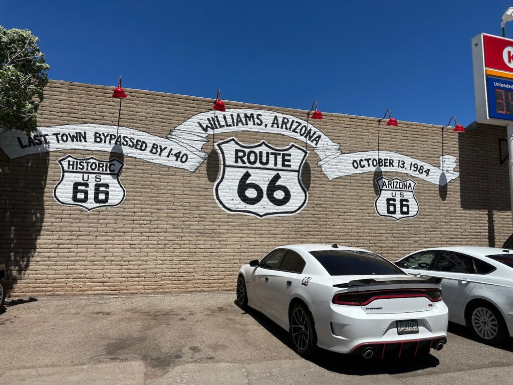
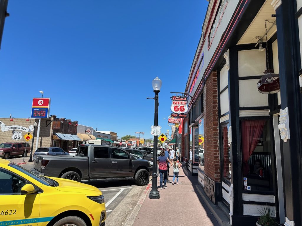
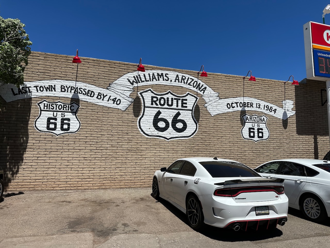
Winona, Flagstaff and others passed by, til I took the old road into Williams. This is the town from which the southern entrance route to the Grand Canyon is found, and there is a lovely train that takes a ride from here to the canyon and back. The old town is cute, and full of jewelers, souvenir shops, diners and other tourist-type establishments. I bought a baseball cap and a badge – I can’t fit much on the bike but needed a hat for the sun.

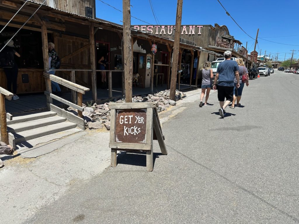
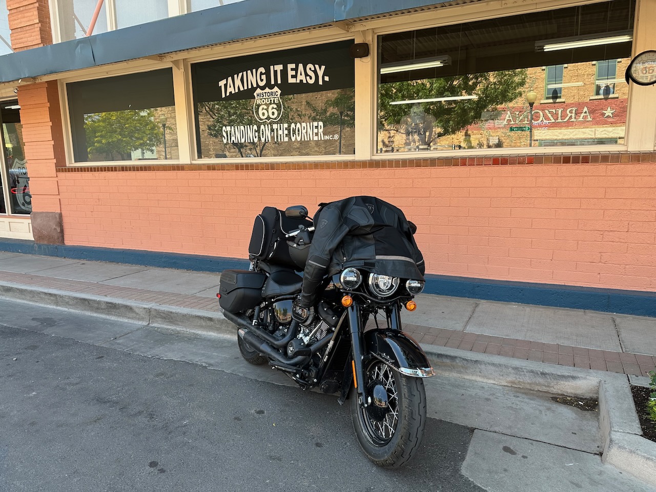
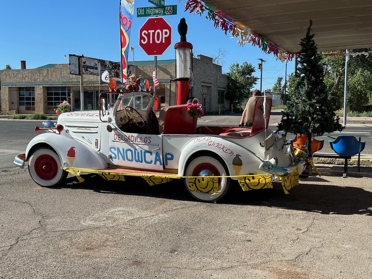
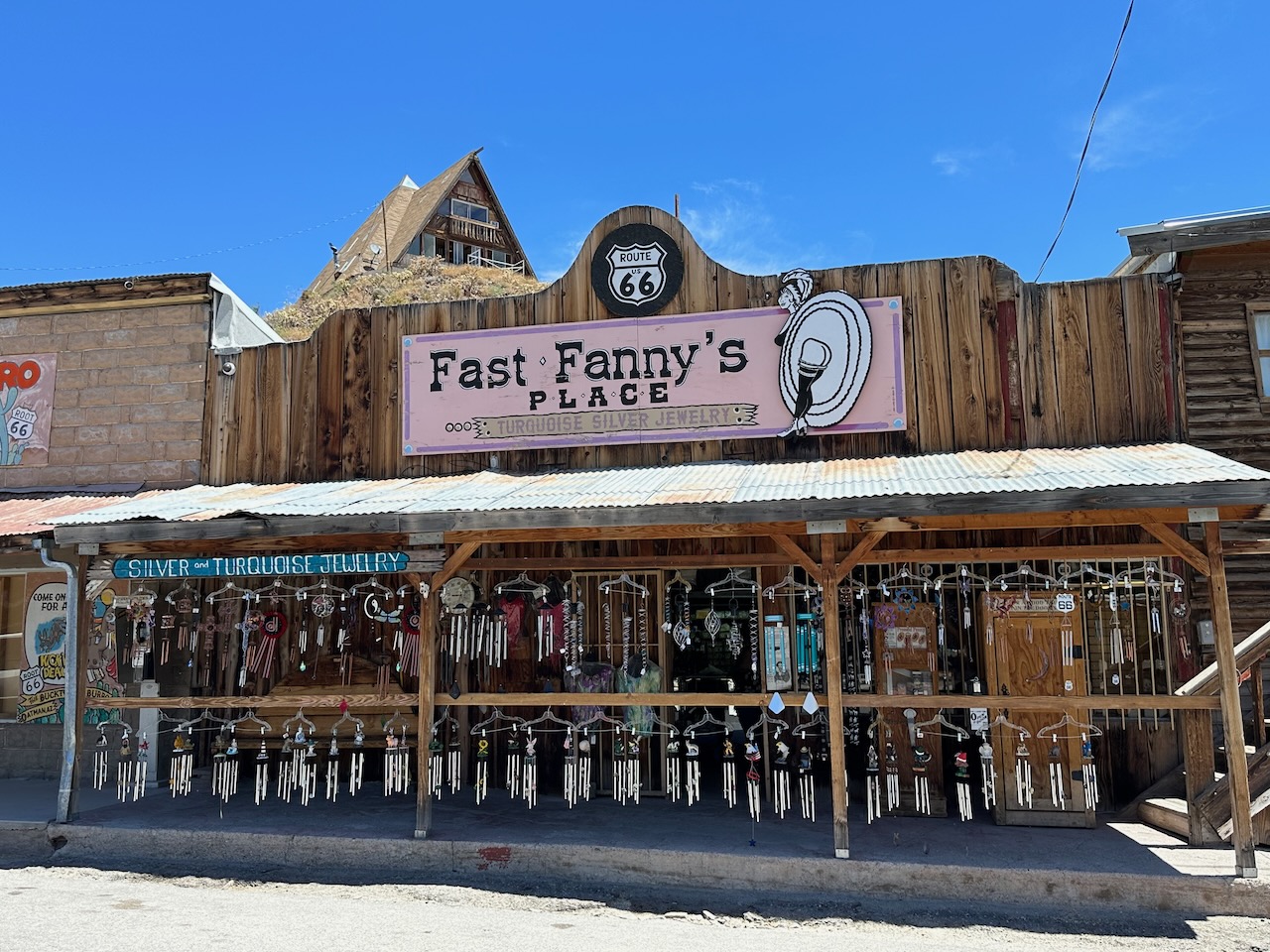
The final hour ride took me off the main highway for about 20 miles on old 66, and deposited me in Seligman, AZ. A sweet little town that has retained it 50’s style. It isn’t much but what there is retains the spirit of the old Mother road (at least in my imagination it does).
My motel is certainly from the 1950’s. A tiny room, no aircon (the temp hit 30C as I got here), and there isn’t even a desk. I am currently sweating my bits off in their shared space, a quite nice area for guests, that was unfortunately built out of metal, so it retains the days heat very well. I bet it is still fucking hot come midwinter. Anyway, mustn’t grumble.
I had my dinner in a lovely little place directly across the road from the hotel. Burgers, shakes, chips and beer, plus snow cones (I think those would be ice creams, but I didn’t try) are on offer. You order in the place – a shack – then sit outside so that there is no chance you will miss out on the delights of the local sandstorms that deposit bits of grit in your food. At least my beer was unadulterated, so I enjoyed that.


Hotel and diner across the road I am struggling with the upload of photo’s to my blog, so bear with me as I get that smoothed out. Meanwhile, another hot and sunny day on the road. Tomorrow morning I will break through the 1,000 mile mark for the trip -though I have only done 540 miles on Route 66 – so I guess there are about 460 ish miles left to go, mostly in California. I cross into Cali tomorrow morning. I have visited northern California a number of times, but this will be my first SoCal visit. I have managed to avoid LA for almost 60 years, so I guess that is pretty good going, but by the time Tuesday is over, I will have sullied my otherwise perfect record. Oh well, I guess that is what this road does to you.
Evenin’ all……
- Day 4 – Seligman, AZ to Barstow, CA: 308 miles.
WTF, California? We will get to you, once I cross the state line, but WTAF???
Today was a long day. I enjoyed much of it, but it seemed longer than most. I was ready to get going by 7, as per my usual routine, but only got to my evenings motel after 4:30 in the pm, which constitutes a long day. The miles and ridiculous heat contributed too.
I slept OK, and woke up just after 6ish. I did the usual shower/packing routine, and took my stuff to the bike to load it. I had reluctantly parked the bike in the motel car park, so it would be within sight and reach if needed. RI say reluctantly, because the car park was covered with large-chunk gravel, and I was concerned about the bike slipping on me. Big Harley cruiser bikes are not the most stable off the paved bits.
I decided to get the bike off the gravel first, then load up, as my bag sits over the passenger seat and it heavy, so it would destabilise the bike a bit. All was good, until I tried to gently move my bike back so I could ride it off the gravel surface. The wheels dug in to the gravel and I couldn’t move it. I was sweating and swearing as I tried, but couldn’t shift it. Fortunately (for me, not so much for him) a fellow motelier came out of his room at just the right time, so I enlisted his help to push me and the bike backwards until I was clear enough to gently drive it off the slippery surface. He did his part well, and I was then able to load up and final get going – but it was not an auspicious start to the day.
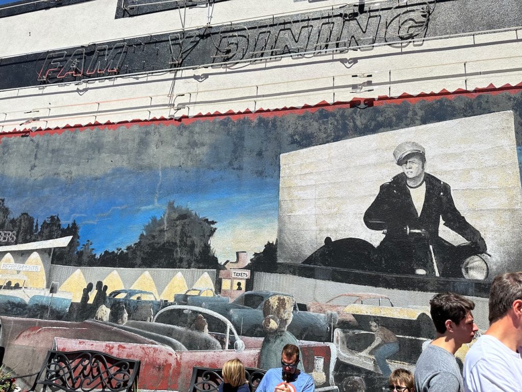
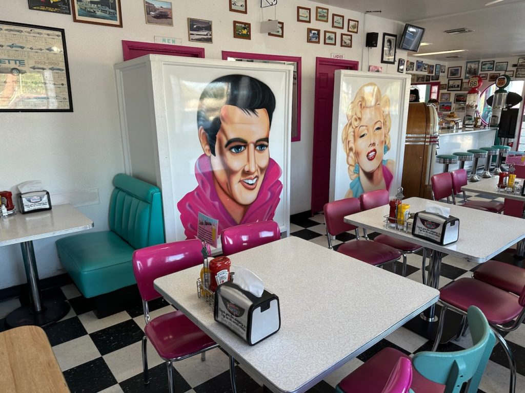
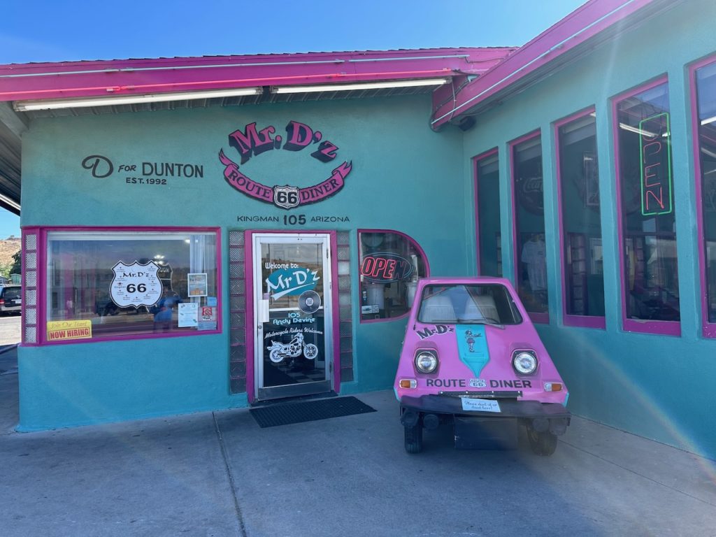
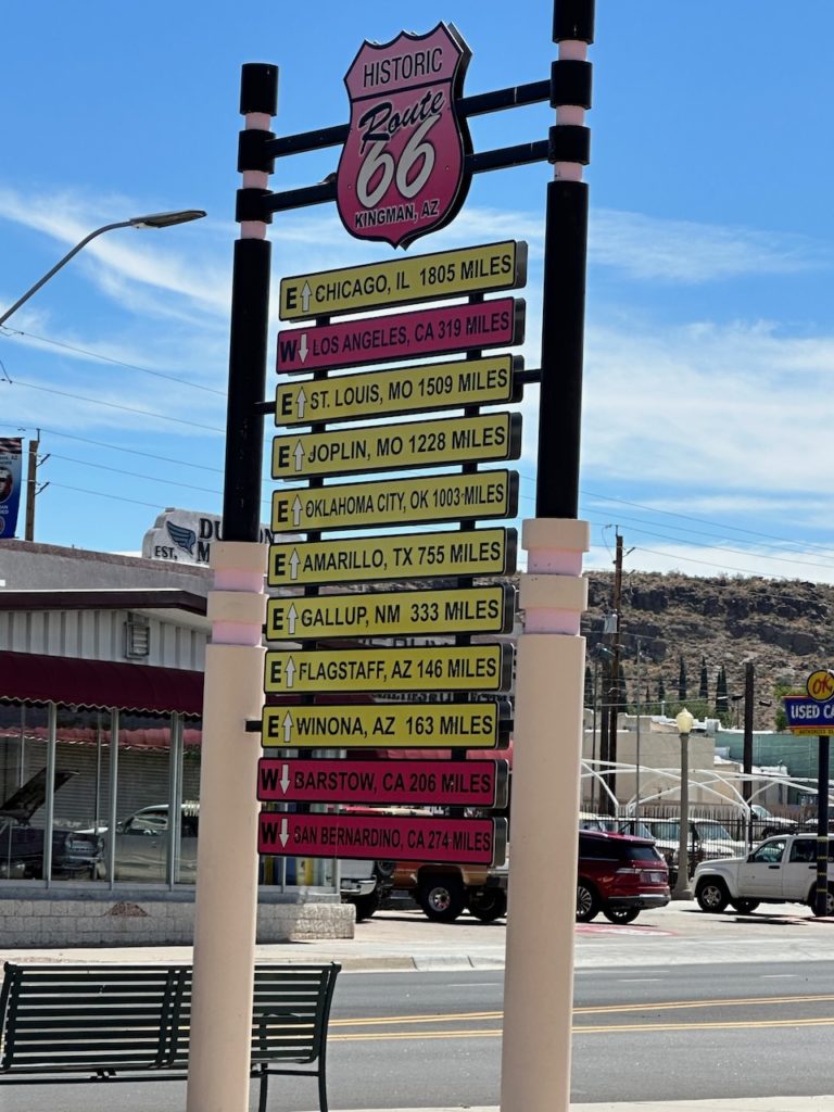
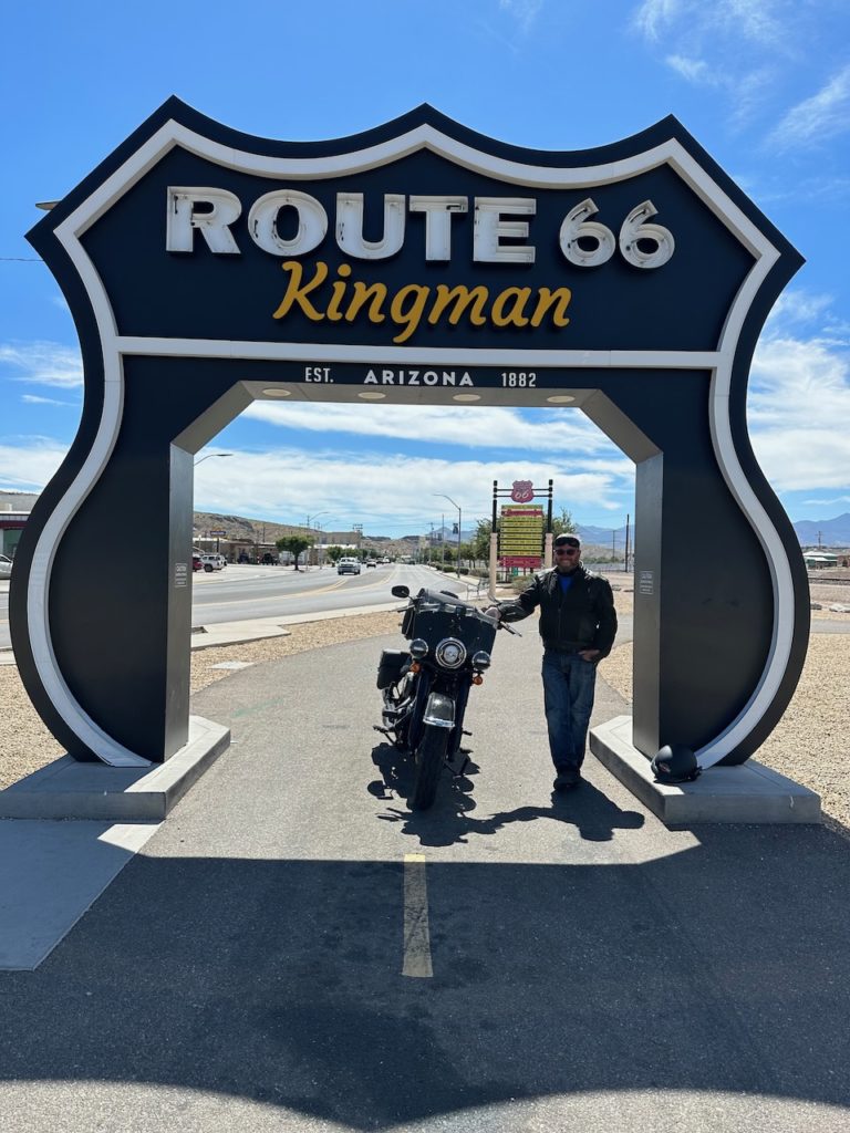
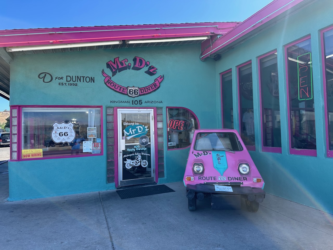
My mood did change pretty quickly though. From Seligman all the way to Oatman, the old 66 is in wonderful shape, and you don’t go anywhere near the motorway. I bimbled along happily, at sensible speed, and enjoyed the quiet scenery. Breakfast was at Kingman, at a wonderful, 50’s-style diner. Kingman is another town that markets itself heavily on the Route 66 thing, and a number of the establishments fit the theme.
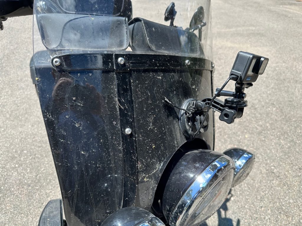
Breakfast was decent, and having eaten, I spotted a motor mechanic next door. On the mornings ride, I had noticed that my GoPro camera started point skyward – something was loose on the fixing. The camera did its job well, but captured an hour of blue sky – which is not very helpful. I walked over to the mechanics shop, to see if he had the right-sized nut to fit the screw that held the arm that supported the camera that lived in the house that Jack built. Happily, he did, and I went on my way having re-inserted the said screw, tightening the nut significantly with my LEATHERMAN Multitool.
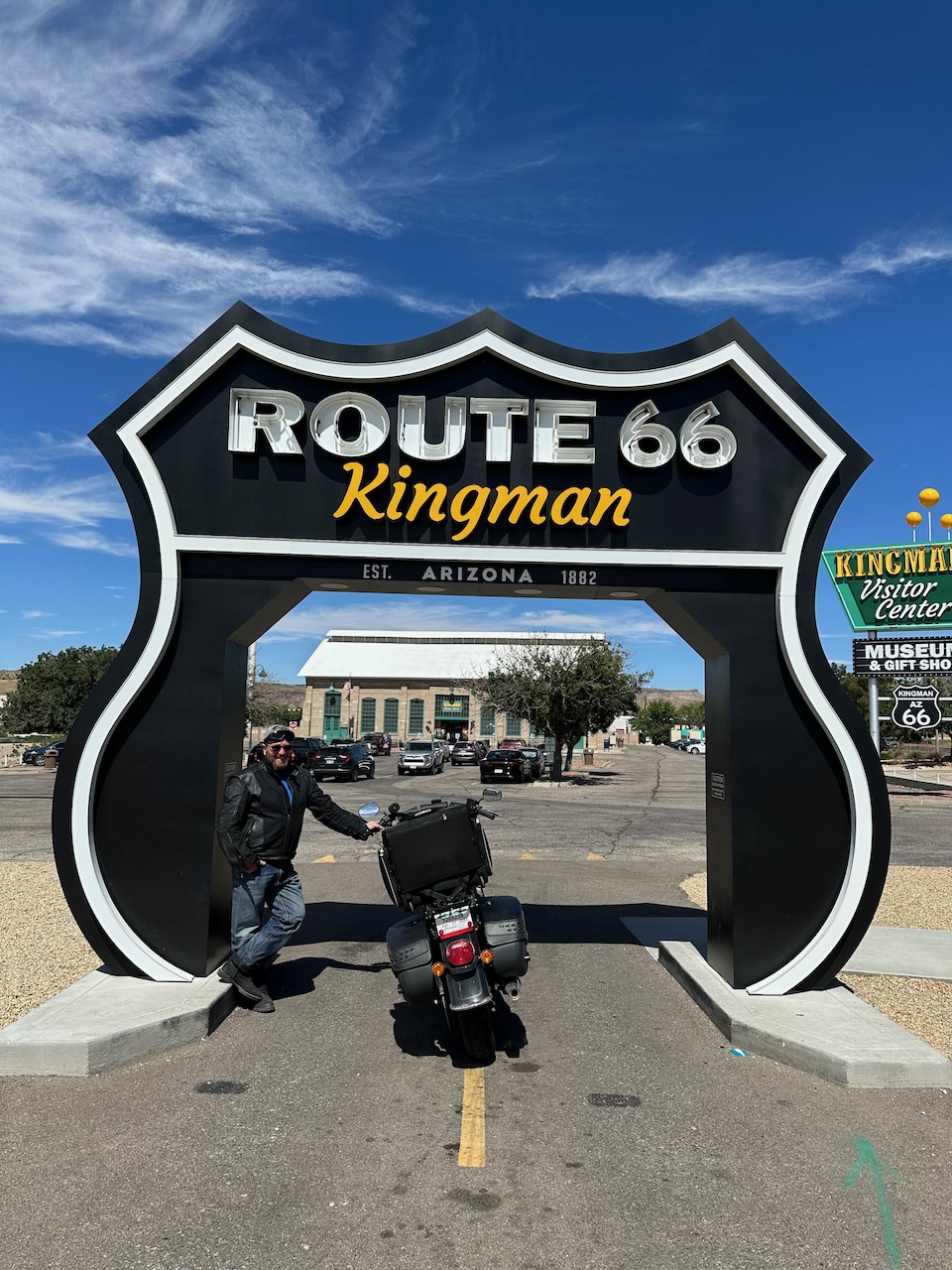
Directly across the road from the diner was Kingmans Route 66 museum. Many towns along the route have one. This had a drive-through photo-op, so I queued up, and waited patiently. When it was my turn to drive through the route marker, a young German girl offered to take pics for me – she had just driven through herself, and took pics of her partner. She was very precise and bossy (German!), and ordered everyone around, moving some Argentinian guys out of shot, waiting for some randomer who was walking by to get out of frame etc etc. With all this, her photo’s were ordinary. Still, I appreciated the help.

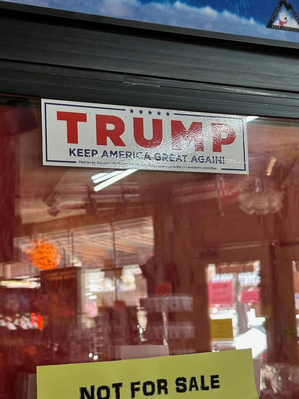
Kingman had one other curiosity that I noted. It seemed to be the capital of Trump land. A lot of shops had Trump messaging all over them. I saw a guy on a three wheeler dragging a massive flag around, which was black with white lettering, proclaiming: “Fuck Biden”. I think when the messiah comes, it will be to Kingman, Arizona.
The road out of Kingman continued the mornings theme of “quiet and remote”. I passed a sign which said “Mountain pass ahead – trucks over 40 ft, turn around here”. I was looking forward to a good pass – this trip is not one crafted for twisty roads. About 3 or 4 miles further on the road, long before the mountain pass began, I came across a curious scene. A large truck had obviously ignored the “turn around here” offer, but had decided somewhat later to turn around. However, there was not enough room for him to do so, and so he had jack-knifed and become stuck, completely blocking the roadway.
A young and sanguine State Trooper was there, and said that a few bikers had passed by and had squeezed along the sand behind the truck and managed to get through. He told me that about 10 times a year, the same occurs, where a trucker ignores the signs initially, then gets compromised when they decide to turn around at a later, unsuitable spot. No car would get through, but having walked through the suggested escape route, and verified that the sand was not too treacherous for my bike, I decided to try myself.
I drove slowly and deliberately, and got through fine- so tooted a farewell blast, and left the Trooper to scratch his head and watch as the tow truck attempted to shift the huge truck. I am sure they must have managed, but it looked a tough task.
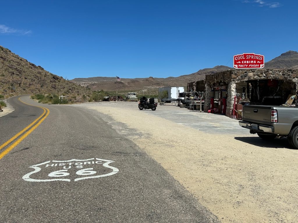
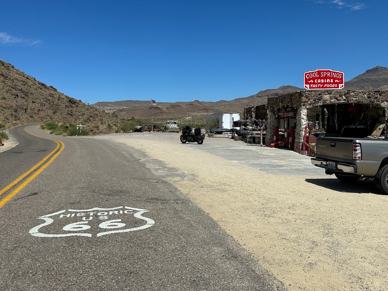
After a few more miles, I stoped at the Cool Springs Station, which sits at the eastern entrance to Sitgreaves Pass. A wonderfully eclectic souvenir store, built from the remains of an old gas station. It was a veritable mine of typical gifts that you find in all the Route 66 stops – plus a major wall dedicated to Trump hats, posters, postcards, pins, badges, stickers, t-shirts and more. I think this whole area is very excited about the orange guy.
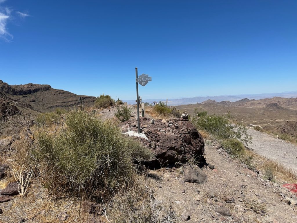
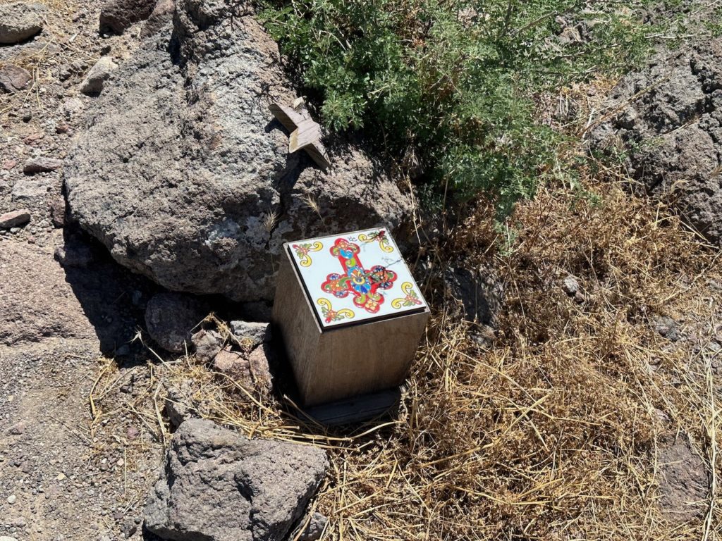
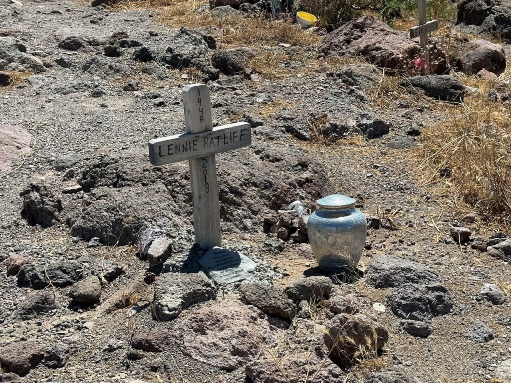
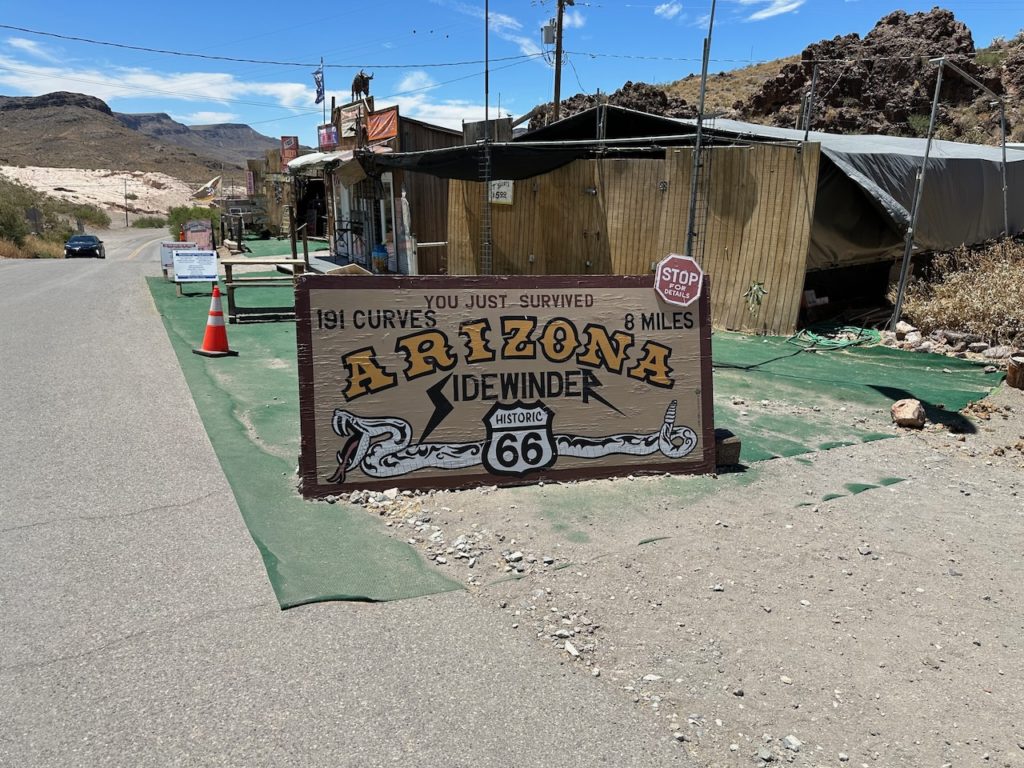
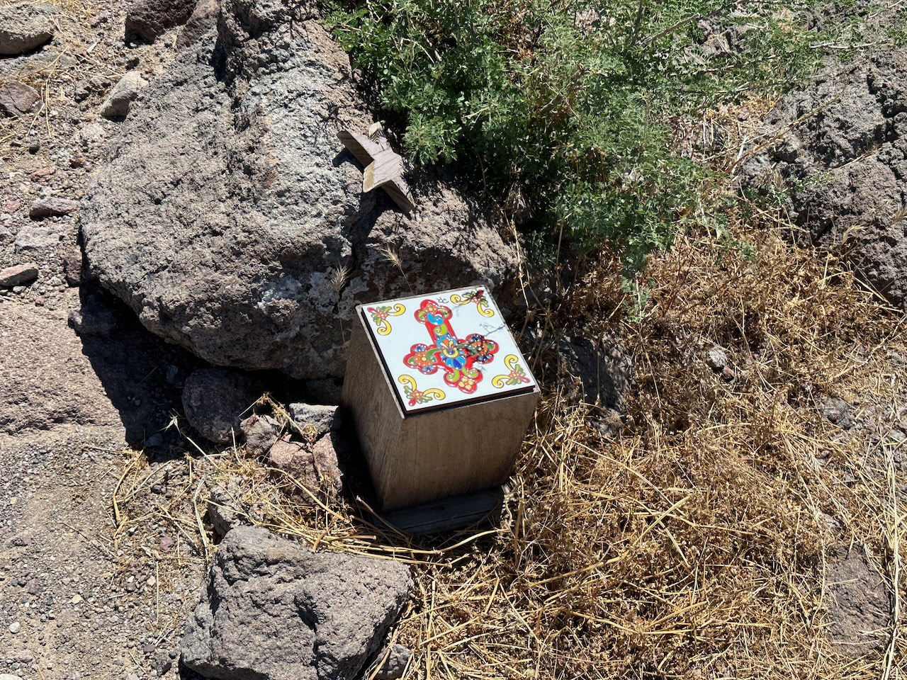
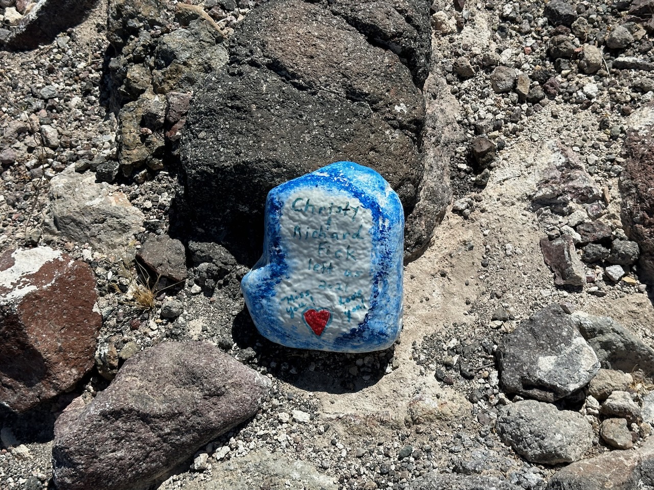
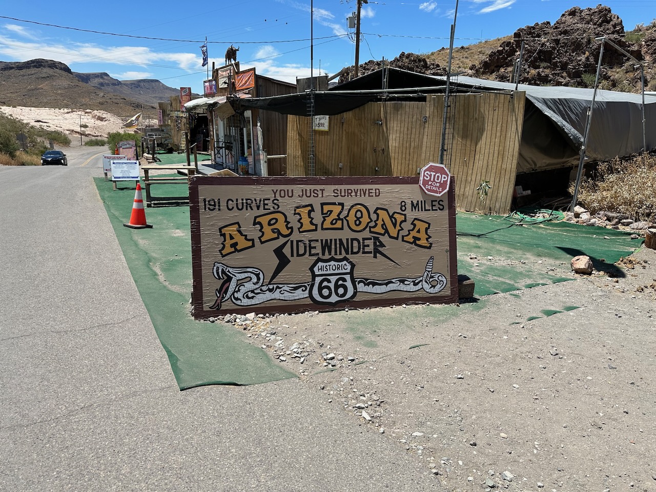
I left the gifty place, and quickly got into the mountain pass. It was pretty enough, with lots of curves (191 curves in 8 miles, I later learned). But, bear in mind, this mountain pass achieves an elevation of 3,580 feet. So not much actual mountain. It was very pleasant though, fun to ride, and decent views. At one point there is a little area, which has a great view looking west, at which many people have created small memorials or shrines to loved ones who have passed on. It was moving to walk around and look at the memorials and messages. I chatted to some French bikers who were touring Route 66 in a West to East direction. Well, chatted is a strong word – I speak no French and they spoke almost no English. But we all enjoyed the chat.

A little while later on the ‘mountain’ pass I crossed the 1,000 mile mark of my present tour.
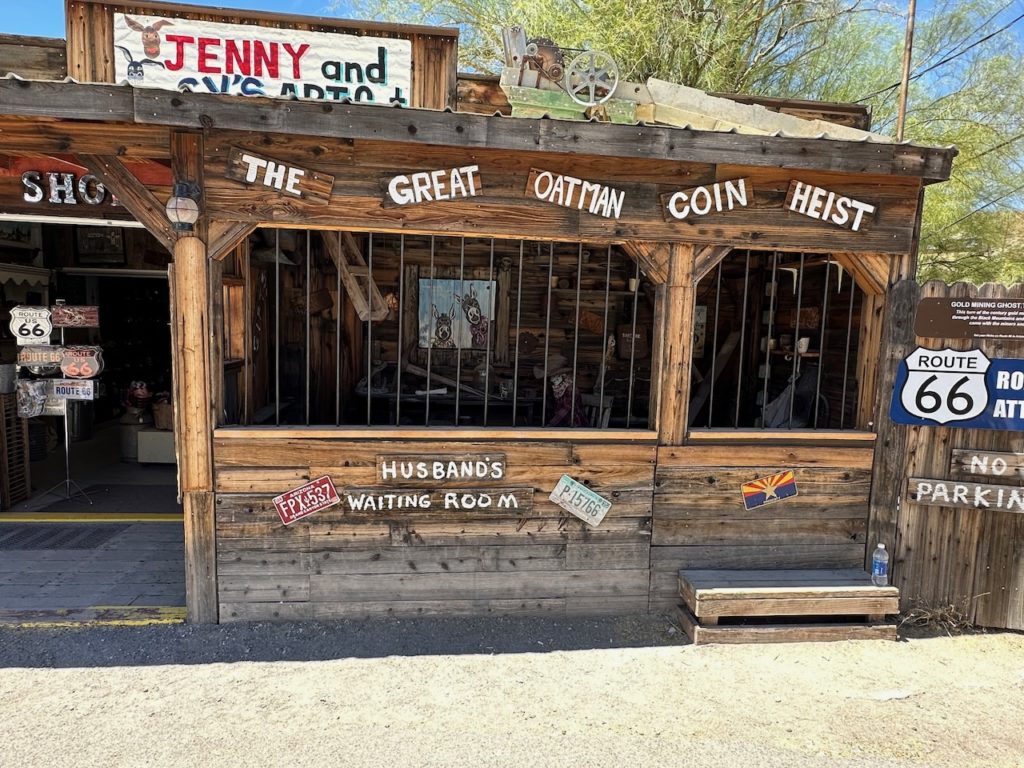
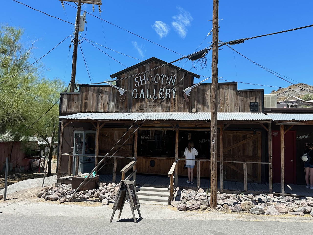
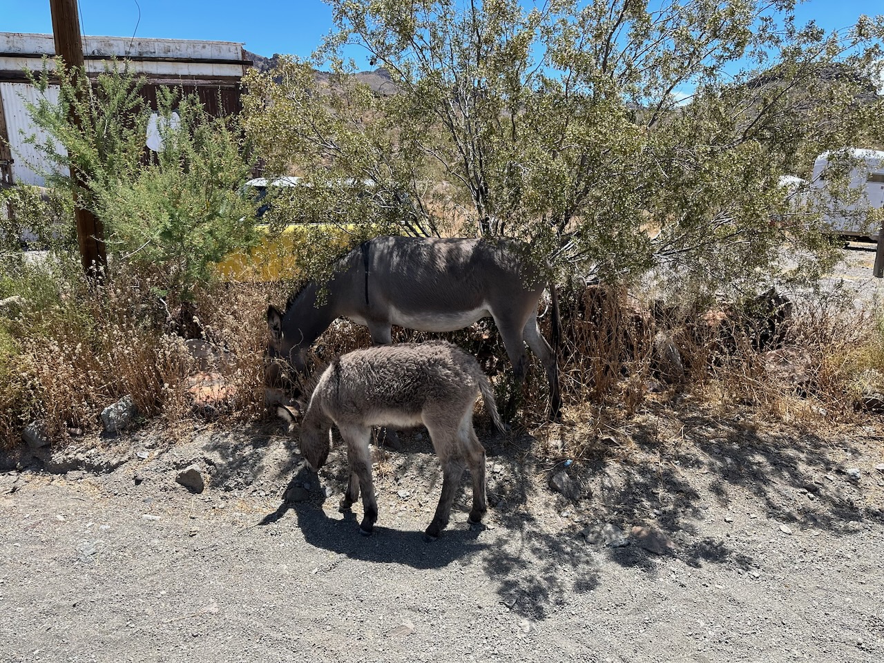
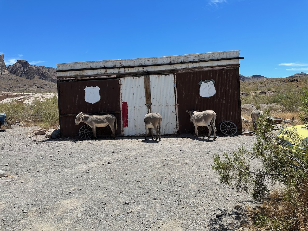
The far end of the pass brought me in to Oatman. Oatman is kept to look like a real old western town, with wooden boardwalks and a single line of shops and saloons on either side of the rode. The town hosts a bunch of wild donkeys, who come and go as they please – but getting fed by tourists pleases them a lot. They looked very cute, and it is easy to see why folk buy feed and keep the burros in the manner to which they have become accustomed.
In one of the shops, I saw and heard more pro-Trumpery. It seems to be all over this part of the world. The shop-keeper was loudly telling someone that her friends business had failed because “Biden, but just wait til the next election”.


As the faux “Wild West” show was about to start, I saddled up my own hoss, and headed outta town to evade High Noon. The final 20 miles or so of old 66 went through real wild desert, and I rode with another biker through the heat of the day – it was exhilarating while also kinda other-worldy. We saw no other vehicles during those 20 miles.

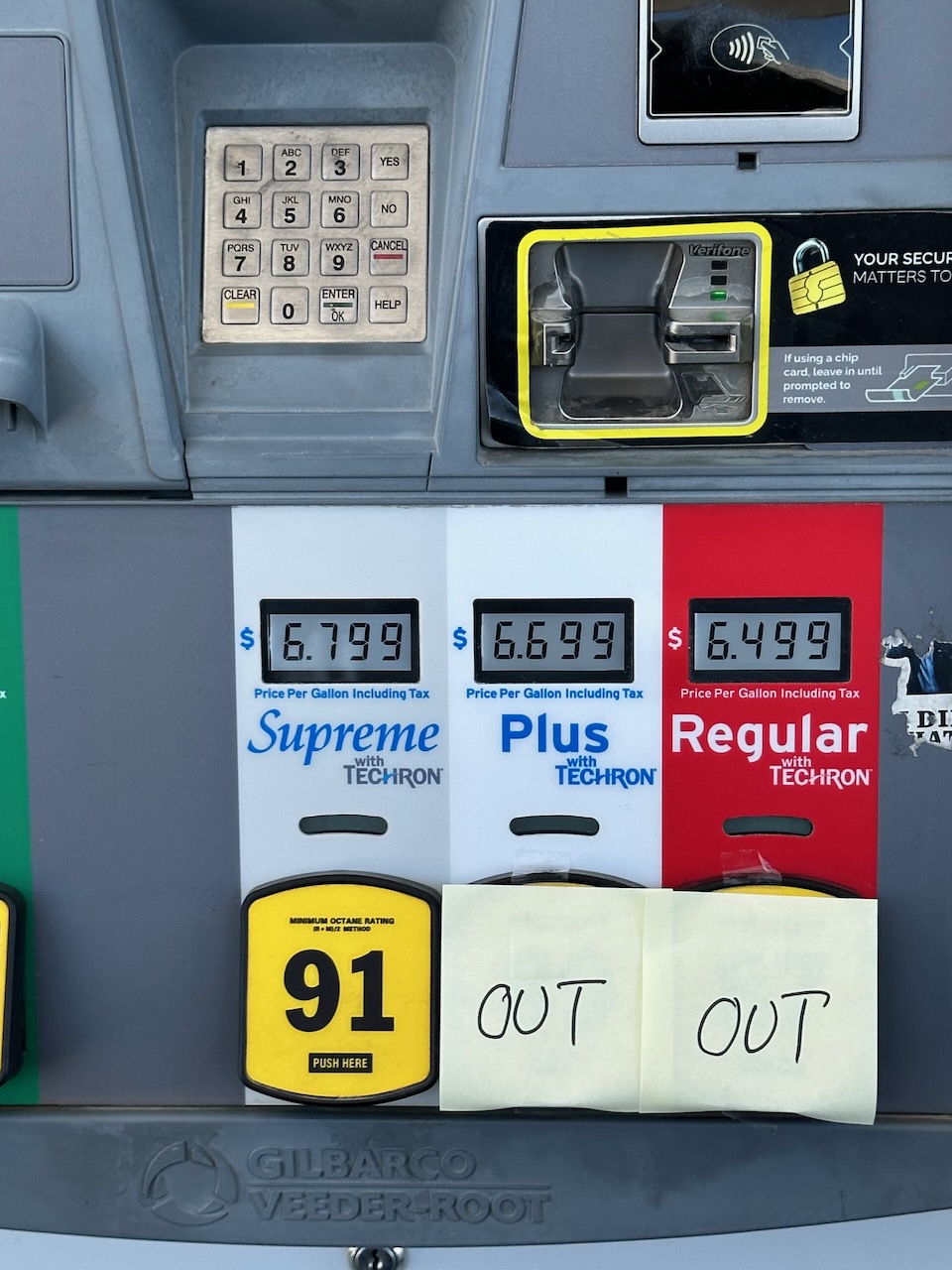
Unceremoniously, the old 66 dumps you back on I40, the Interstate motorway that accompanies much of 66. I had not been on the motorway at all today, so was OK to get some fast miles done. Almost immediately, the motorway crossed the Colorado river, and introduced me to California – the final state along Route 66. I was in need of fuel and a pit stop, so I took the first motorway exit and stopped at a local fuellery. Pulling up to the pump, I almost fell off my bike.
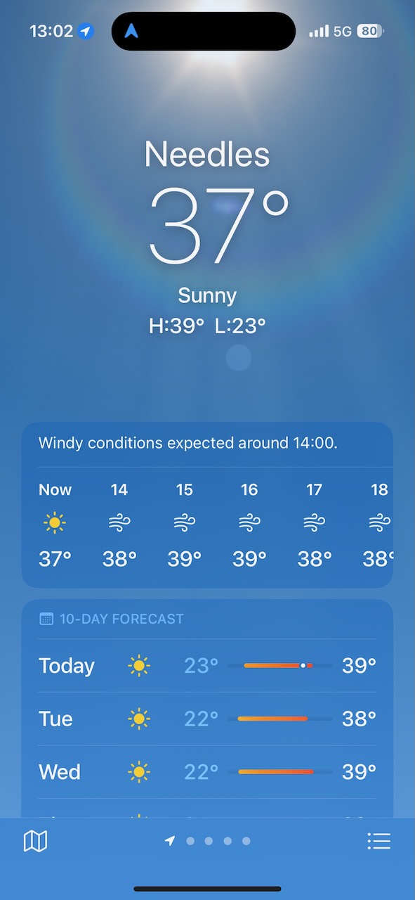
Gas (petrol to those who speak English) is about $3.29 per gallon in the civilized world in which we live – namely Colorado. It can be a bit more expensive off the trodden path, but that is the ball-park. The pump to which I was now riding up was offering gas at $6.79 a gallon. That is more than DOUBLE what we pay back in gods own state. I mean, WTF?

Then, as if to prove a point, I checked the temperature. it was 37C (99f). WTFF? Extortion at the pumps and heat that would melt a monkeys bum. Come on guys, get serious here. Who can live like this?

California did not cease to disappoint. The old 66 road was either very gravelly, or undergoing roadworks, so I had to stick to the I40. The heat was oppressive, even riding at 70 mph, and so I just got my head down and drove the couple of hours it took to get to Barstow.
Their gas may be extortionately expensive, but at least they have a sense of humour – an aptly named gas station Riding the last 15 miles or so on the old road before I got to Barstow, it suddenly ran into a dead end, and I had to retrace my steps. That will teach me for expecting good things here. Coming in to town, I realized that the sleepy, small towns that I have been used to for the last few days are coming to an end. I am on the last leg of the journey, getting into LA tomorrow – so I need to brace myself for the hordes of unwashed humanity. Not thrilled at the idea, but looking forward to completing this leg of the journey at Santa Monica pier some time tomorrow.
- Day 5 – Barstow, CA to Beverley Hills, CA: 174 Miles
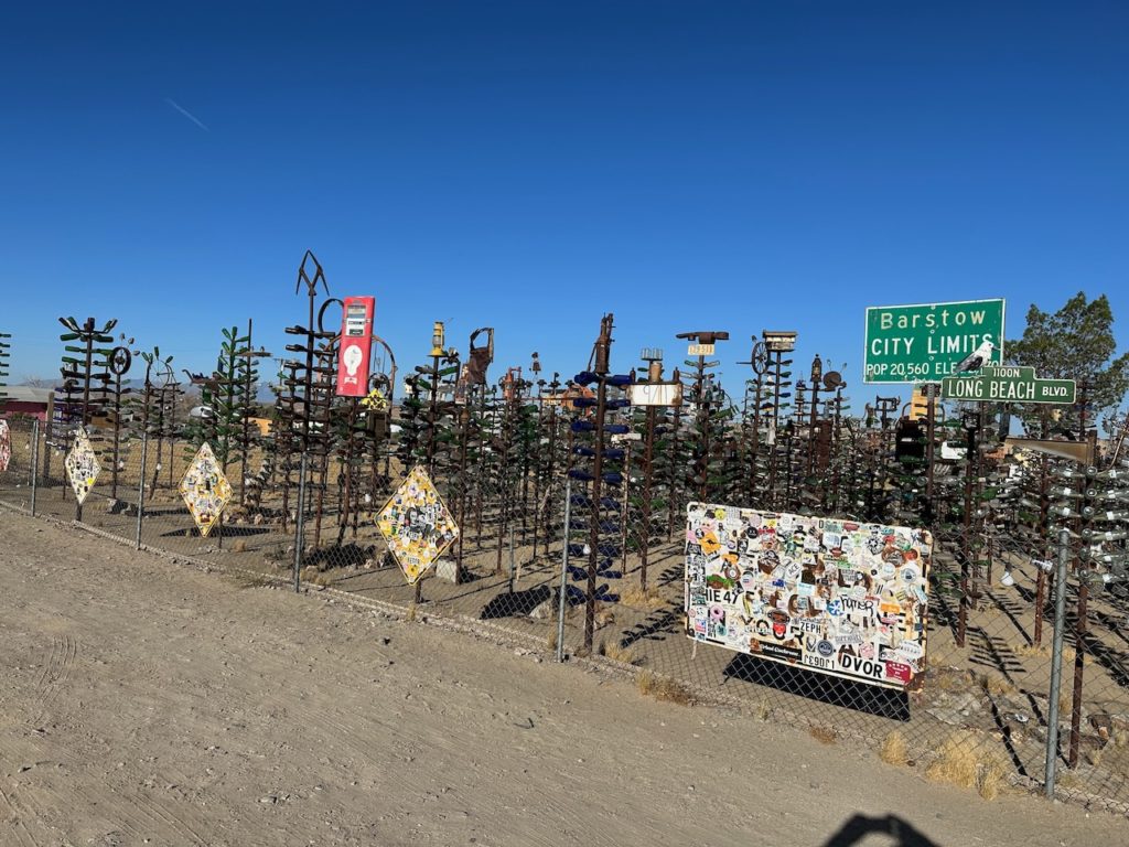
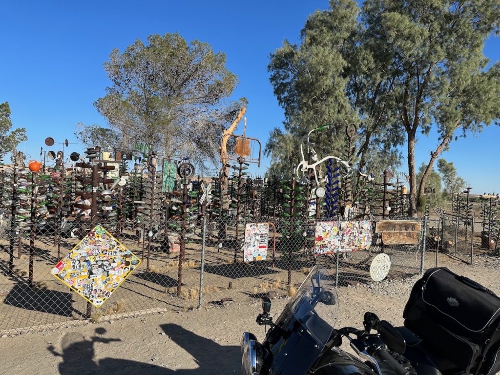
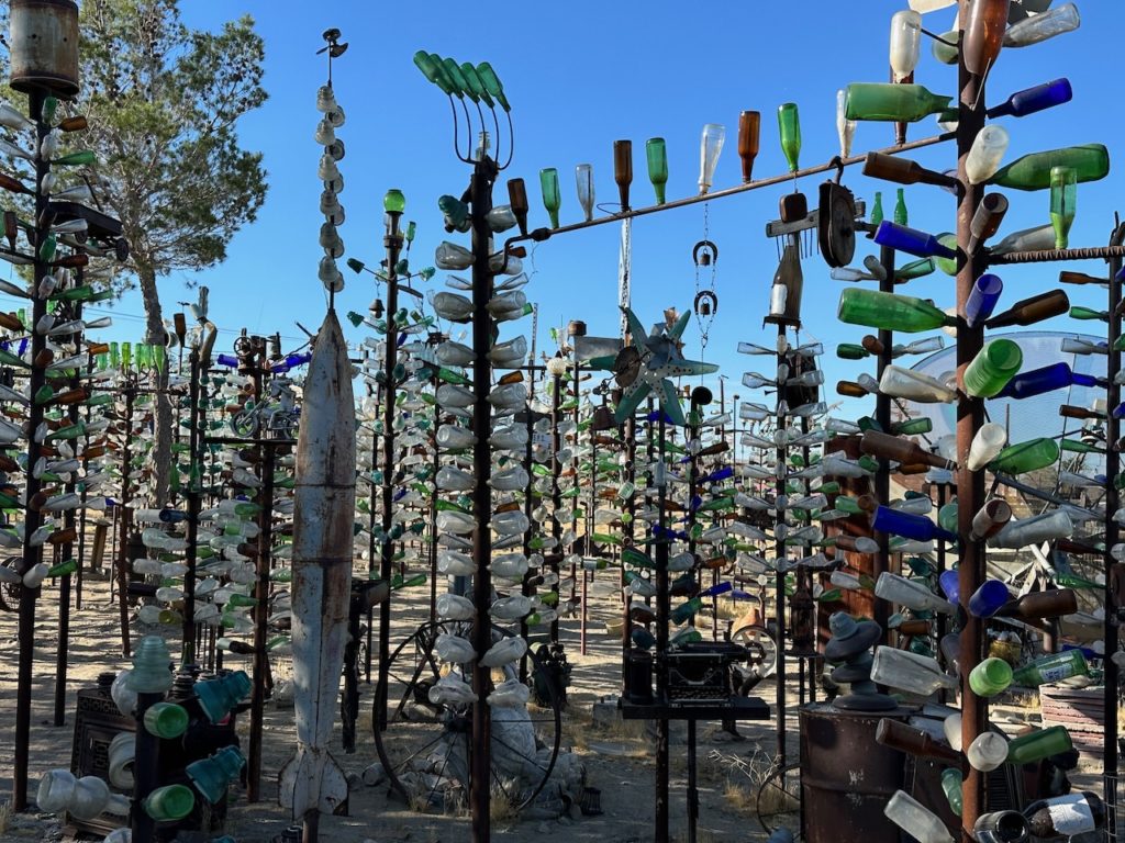
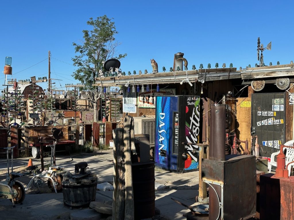
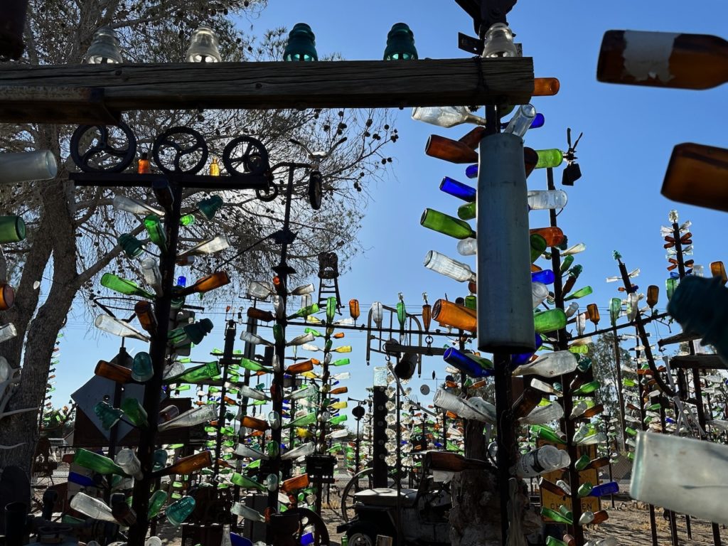
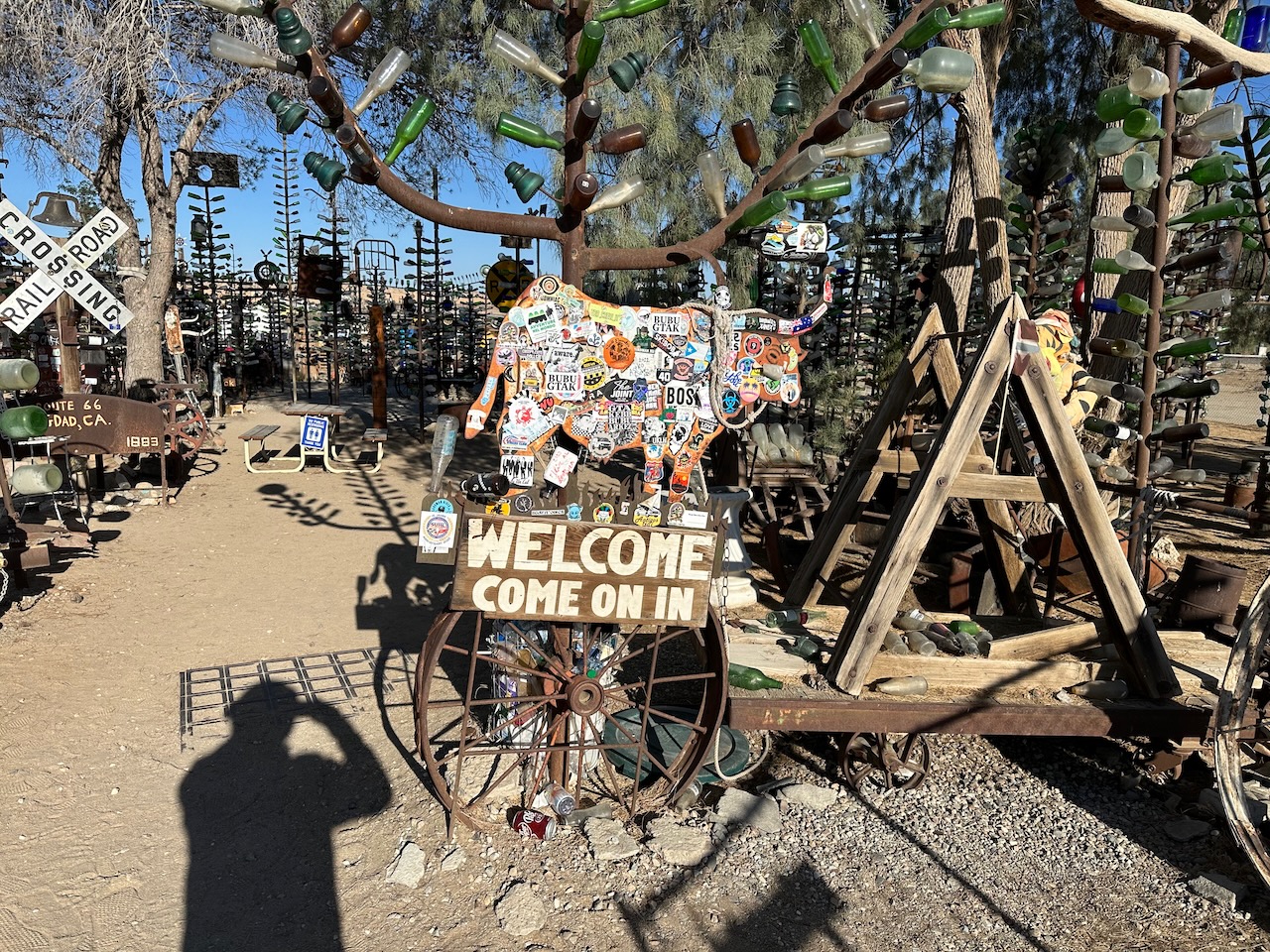
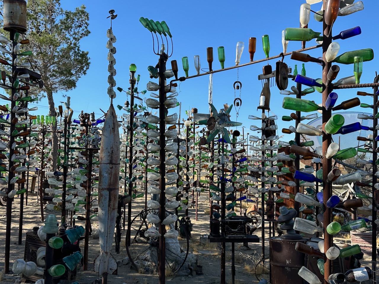
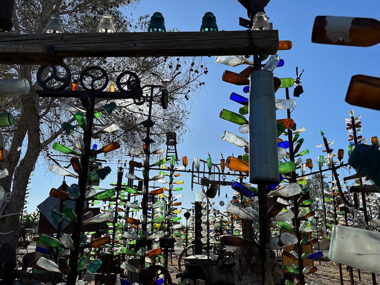
Last day (of the Route 66 part of the trip) today. Early rise in Barstow, and did my thing. All was smooth sailing this morning, and I set sail around 0700. About 20 miles out of town I stopped at Elmers Bottle Tree Ranch. Elmer (I think) has created trees, made of metal, with bottles as the fruit/leaves. About 200 or more of them. Unfortunately, I still am struggling with pictures, but will upload some when I get that sorted. Words don’t really do justice.

Breakfast was not too far from Elmers. A small diner outside Victorville, archetypical of the average American diner (and I should know, I have visited a few in my time). In fact, so representative is this diner, that it has featured in several films and shows. Kill Bill (Vol 2) is the one I knew best, but you can read more here.
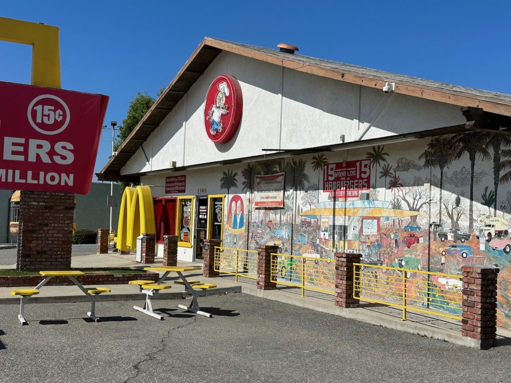
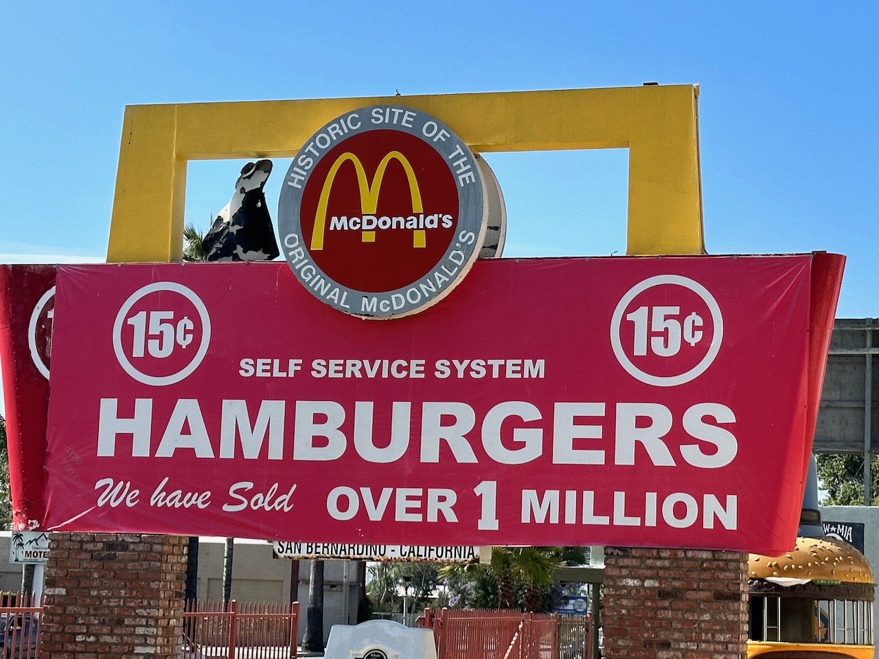
I rode a while, til I got to San Bernardino. There, in a scruffy-ish neighbourhood, is the very first ever McDonalds. It is a now defunct museum, with lots of big cartoon characters outside, and a massive mural covering the whole building. 1948 was when it opened. I blame a lot of the obesity epidemic in the US (and beyond) on fast-food, and McDonalds in particular. But it was fun to visit, even though the place was kind of abandoned.


Next stop was the San Bernardino version of the Wigwam motel that I had visited in Arizona a few days back. Much more neatly kept, it is also still operating as a motel. One day…..


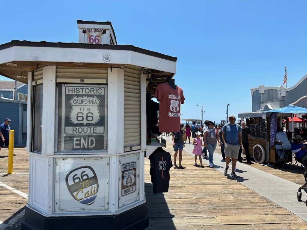
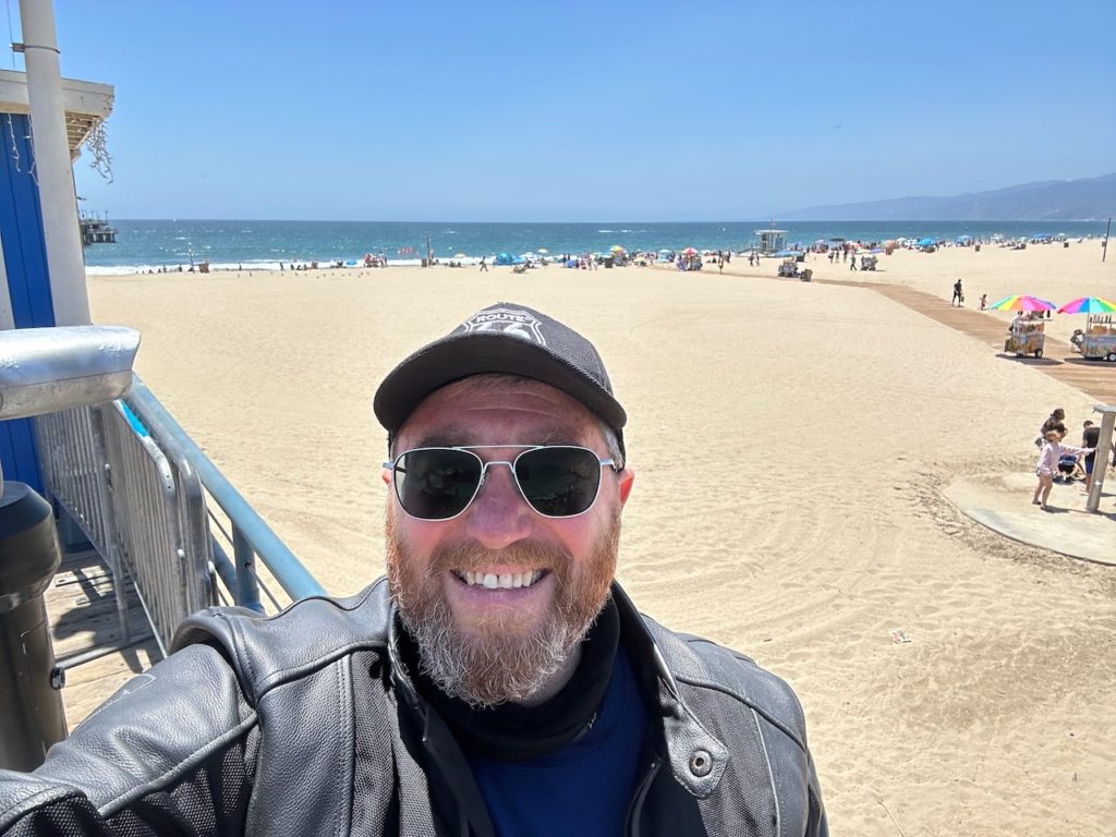
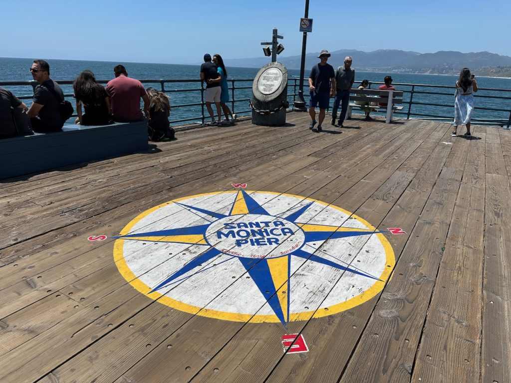
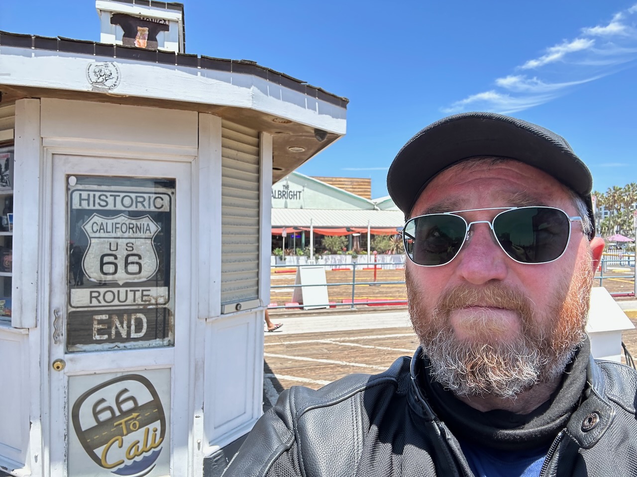
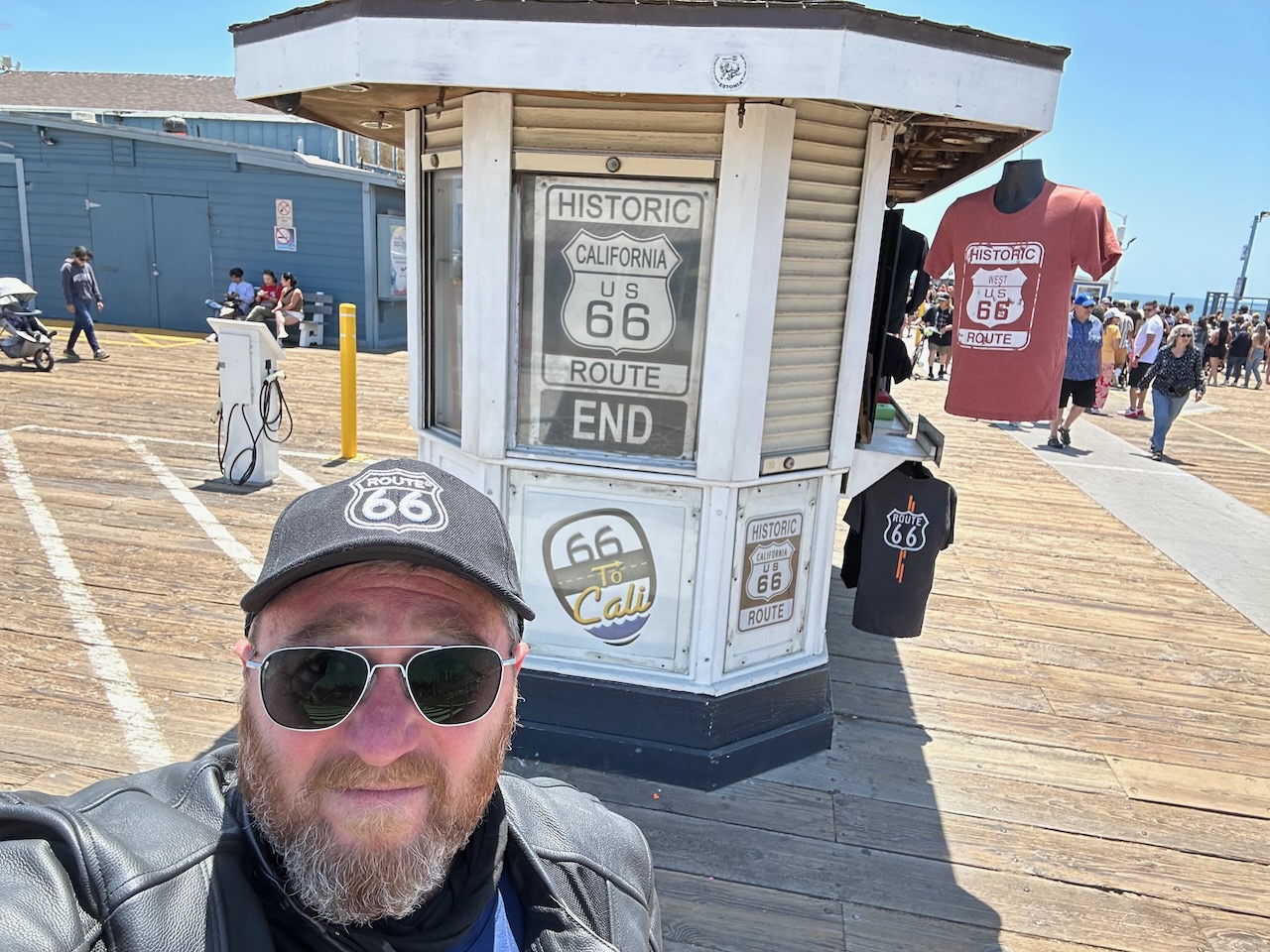
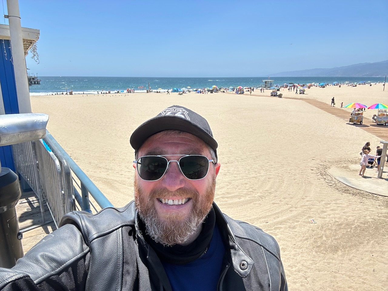
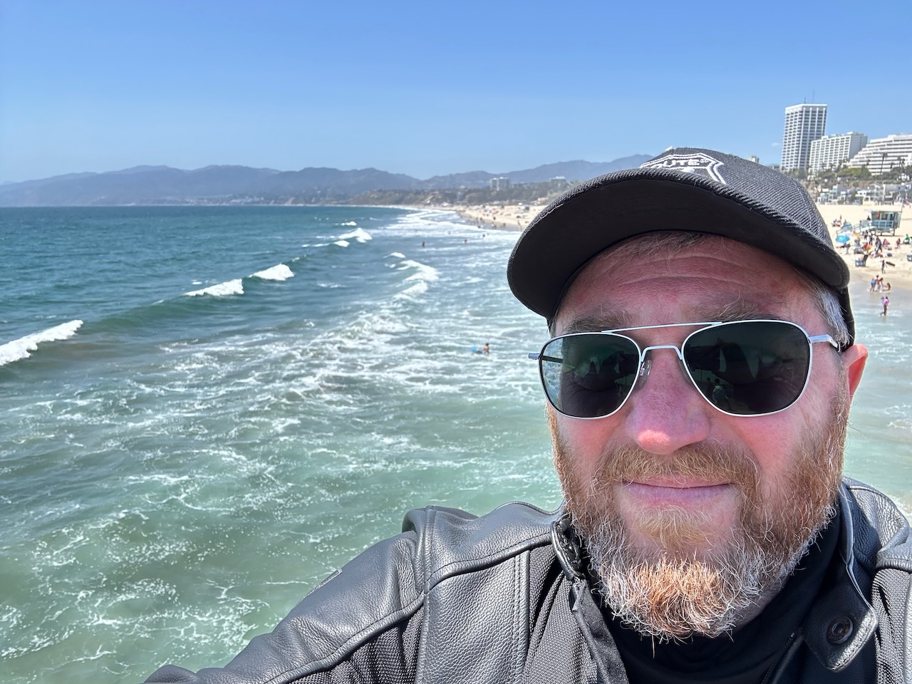
A couple of minor and less noteworthy stops, and I finally found the ocean, and Santa Monica pier. Route 66 ends here, and I was very happy to be able to stroll along the pier, take in the sea air, and doge the myriad tourists (cos I am a TRAVELLER, not a tourist, if you don’t mind).


Having done the obligatory, I chatted with some German and Italian bikers who were also parked on the wooden pier parking, with their shiny rented Harleys. They had just picked up the Harleys, and were visiting the pier before heading north up the coast towards San Francisco. I start that leg of my own journey tomorrow.
Having taken the pictures prescribed by protocol, I then hopped back on the bike, and rode for about 30 minutes to Beverley Hills, where cousin Jonny lives. He is graciously accommodating me tonight, so we are currently each completing our necessary work in order to free up the evening so we can go and do whatever it is that aging South African guys do.
I loved the Route 66 part of my journey. And am really looking forward to the next part, and whatever the road brings next. I did 1,018 miles of Route 66, and have completed a total of 1,363 miles on this trip so far, at an average of 272 miles/day.
I can’t finish this entry without an update on my views about California, as a continuation of yesterdays opinions. I have found 1 or maybe even 2 things that California has to commend it.
Firstly, on dual carriageway, multi-lane motorways, trucks and any towing vehicle have to travel at a maximum of 55mph, while the speed for other vehicles is 70 mph. This means the obstructive trucks, caravans, trailers and other things are out of the way on the fast roads. Or, at least, that is the theory. What I think I have figured out, is that unlike the rest of the USA (or maybe the world), the signs showing numbers for what one might expect as speed limits are indeed limits, but actually they are a lower limit.
The trucks all go at 70, and they do pass each other. The cars go at 90 as a minimum. It was all a bit overwhelming for me. I had been pootling along little country roads, through one-horse towns for a few days, and suddenly everyone was trying to knock me off my bike, and get everywhere at breakneck speed. The highway system here in LA is insane. Literally. There are so many different ones, with some going east-west, some going north-south, and some going round and round. Whoever devised this system (if indeed it was devised – I think they might have grown organically in a lab as a fiendish experiment, and spread to the wild accidentally in a horrible accident). If you ever want to come to LA, I have some advice for you. Don’t!
I do also appreciate the fact that California, uniquely among all of the US States, allows motorcycles to filter between lanes, or (as they say here) ‘lane-splitting’. In the UK it is just a natural thing – as it is, in fact, across much of Europe – but somehow the founding fathers forgot to enshrine this right in the Constitution, and so most states do not allow you to ride between the lanes of cars when the traffic is slower than usual.
All good things, right? Except, that (at least on the LA roads and motorways), they have made the lanes pretty narrow – so you can’t really navigate easily between the lanes of slow traffic on a bike, Or at least, not a larger Harley cruiser with luggage. A small plastic Japanese bike would probably be fine – but that is NOT what I have, so mostly I had to sit in a combination of heavy traffic and sweltering heat for much of today. Tell me why I do this, again, please.
Laters, Crocodiles.
- Day 6 – Beverley Hills, CA to Monterey, CA: 341 miles.
The longest day. By 1 mile, sure – but the longest ride yet on the current trip. I also went through mile 1,700 of the trip as a whole about 5 miles before the end of the ride today. Good going, if I must say.
I was up pretty early again – about 5:45, and did my thing. Shower, pack, tidy, load, check maps and destinations and approximate timings, and get rolling for the day. Today was about the ride, not too many stops planned along the way. I rode Highway 10 from near cousin Jonny’s in Beverley H to the pier at Santa Monica, but then turned hard right, and carried on up the coast.
I rode the Pacific coast from Seattle to SanFran 4 years ago with Ben, so now I was starting the ride to complete the US Pacific coast (mostly). The ride from LA to SanFran is about 400 miles ish (if you take the most direct route), and when I complete this tomorrow, I will have ridden almost all of the US Pacific coastline. And yeah, the pedants will get all excited and rail on about Alaska, and the fact the neither LA nor Seattle are the extreme coastal points on the contiguous 48, but they can go and fuck themselves. I think I am well within my rights to place a big check mark next to the US Pacific Coast Highway on my bucket list.
The quickest route between these two major Cali-cities is Highway 5. It looks to run inland, about 100 miles from the coast, and joins the dots effectively – but probably quite boringly. Highway 101 follows the coast more closely, but not completely. There are some non-highway coastal roads, and the options to bob between 101 and the coast are quite good.
The coast rode is quite pretty. I rode through some very familiarly named areas – Malibu, Ventura, Mussel Shoals (not THAT one) – until I reach Santa Barbara about 2 hours and 90 miles after take-off. It is very well manicured, with a lovely promenade, and some nice restaurants looking over the seafront. I chose one of said eateries, and enjoyed a really good Huevos rancheros. For those unfamiliar, it is a Mexican breakfast combo, eggs, sausage, sour cream, guacamole, salsa and carbs – mine were tortillas today. It was lovely.

Having completed my repast, I trundled out again, and soon turned back onto 101, and then very quickly abandoned it to take route 154 over a pass to run by Lake Cachuma, which was serene and pretty. The whole area around the lake is held by the Chumash tribe, a native American people that will likely have my father agog with permutational tribal possibilities.
I rejoined 101 20 or 30 miles later, and then basically followed it for about 200 miles. Some parts pretty, some agricultural and functional. All parts were sunny, but approaching my 101 departure point just south of Salinas, it got pretty windy. I hove westwards at said departure form the 101, heading down towards Monterey, mon repose for the evening.
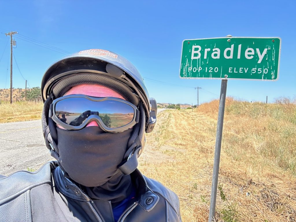
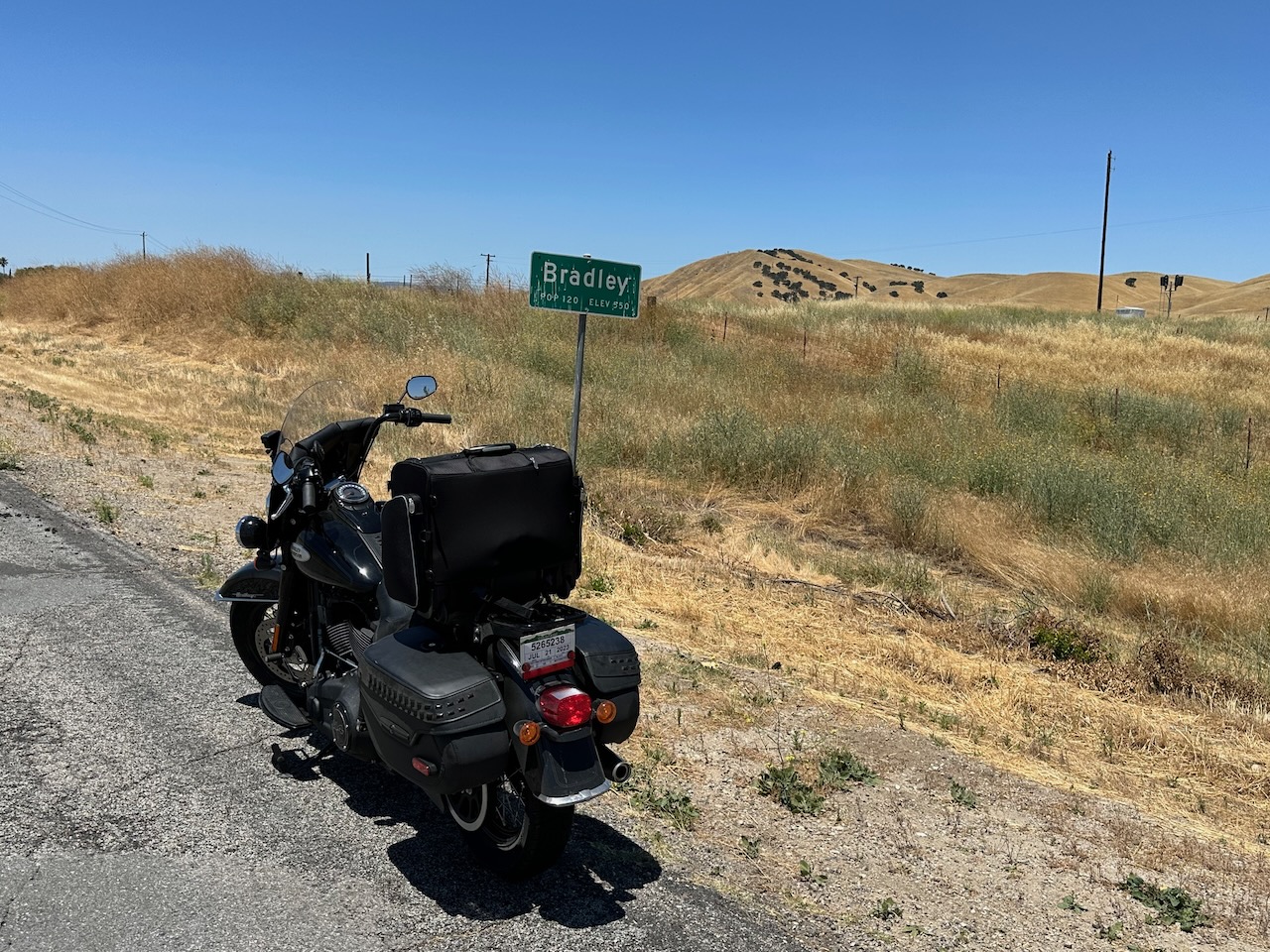
While riding the 101 somewhere before my turn off, I saw a sign for a place called Bradley. I simply HAD to detour to take a look. A one-horse town, for sure. Population 150. Still – the photo opportunity…..

The last 20 miles or so of the day took me back towards the coast from the 101. Rounding a large hill, the temperature suddenly dropped, and the sky became overcast. It was 17C when I reached my hotel for the evening – after days of sweltering through the south west, it was a pleasant change, but somewhat of a shock to my system.
Talking of pleasant changes, my spot for the night is well appointed and even may border on the luxurious compared to my usual motels. The reception staff certainly maintained an air of high class and snootiness, which is mildly deserved here. Still, just a fancy motel – but it does have a pool. However, it is not warm enough to go for a paddle, so am bashing out these words, then gonna shower and make myself presentable, after which I will go and get some dinner.
In a while, Alligators
- Day 7 – Monterey, CA to San Anselmo, CA: 139 miles
From the longest day yesterday, to the shortest day, miles wise at least. While doing my last-minute scramble to plan my late-breaking Route 66 trip, I realized that I would be in LA at the end of the ride, and my best friend Dave lives only a short 450 mile ride away from there. It would be rude not to include a quick visit to see him.
This morning, I set out a bit later than usual. I had been having some issues with my blog and the pictures (which basically wouldn’t upload), and in the shower this morning a potential solution came to me. I dried off quickly and went to try it out – and lo! – a miracle. My blog posts now come with full technicolor photos as accompaniment.
The day was gray and cool and dreary. California continues to disappoint. In fact, I had to add layers to my outerware it was that cold. The road I took followed the coast more or less, but in may places was inland enough so the gray sea was not visible. Lots of agriculture and a bit of industry here and there.
I stopped for breakfast at Davenport, a 0.025 horse town. There were quite a few folk in the breakfast eatery, including a pack of 5 or 6 Canadian bikers – so we had a good old biker chat, as one does. Breakfast was good
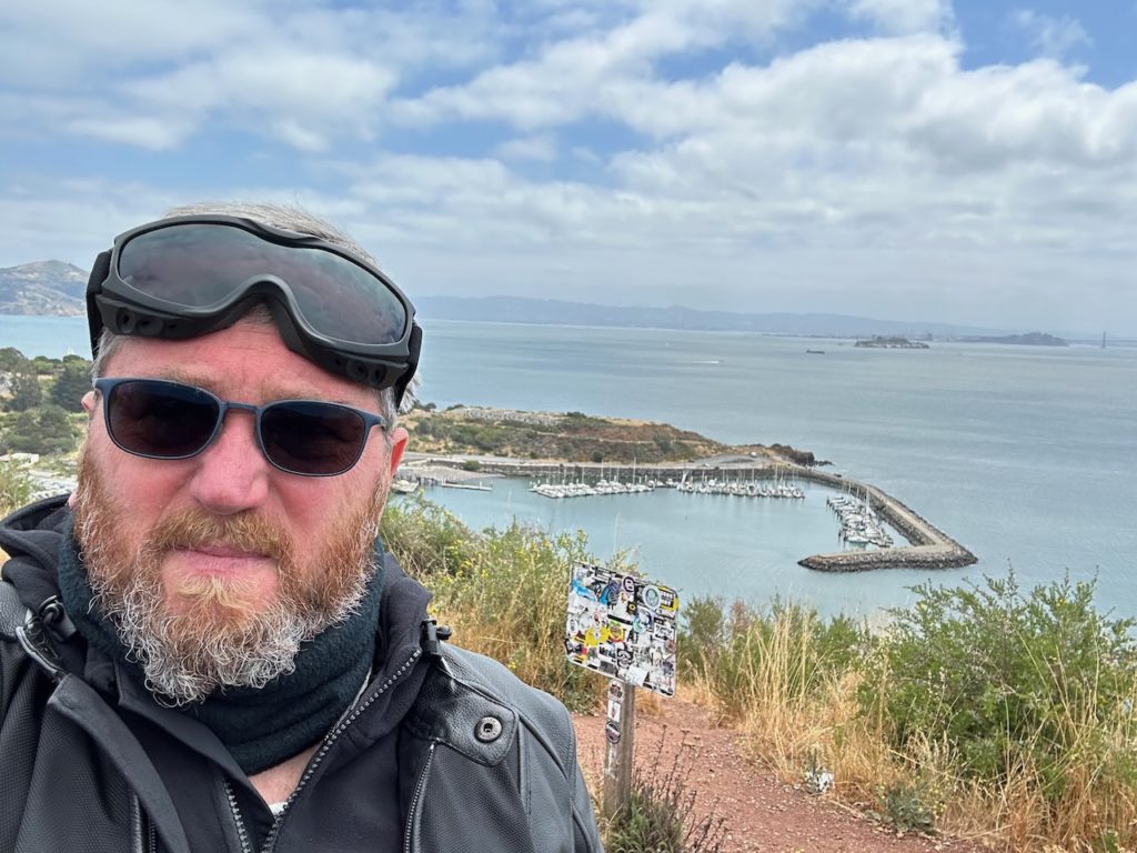
After breakfast, the weather didn’t improve, but the riding did. The coast stayed nearby, and the road was more curvy with a good sprinkling of ups and downs. About an hour or so of this, and I ran into San Francisco.
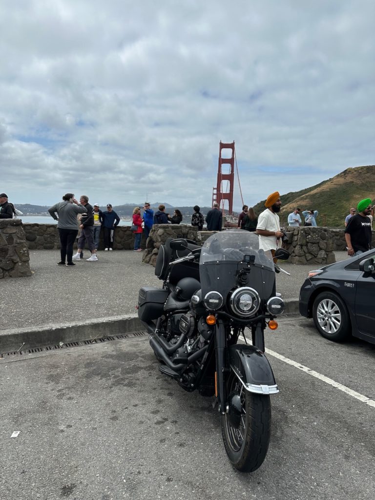
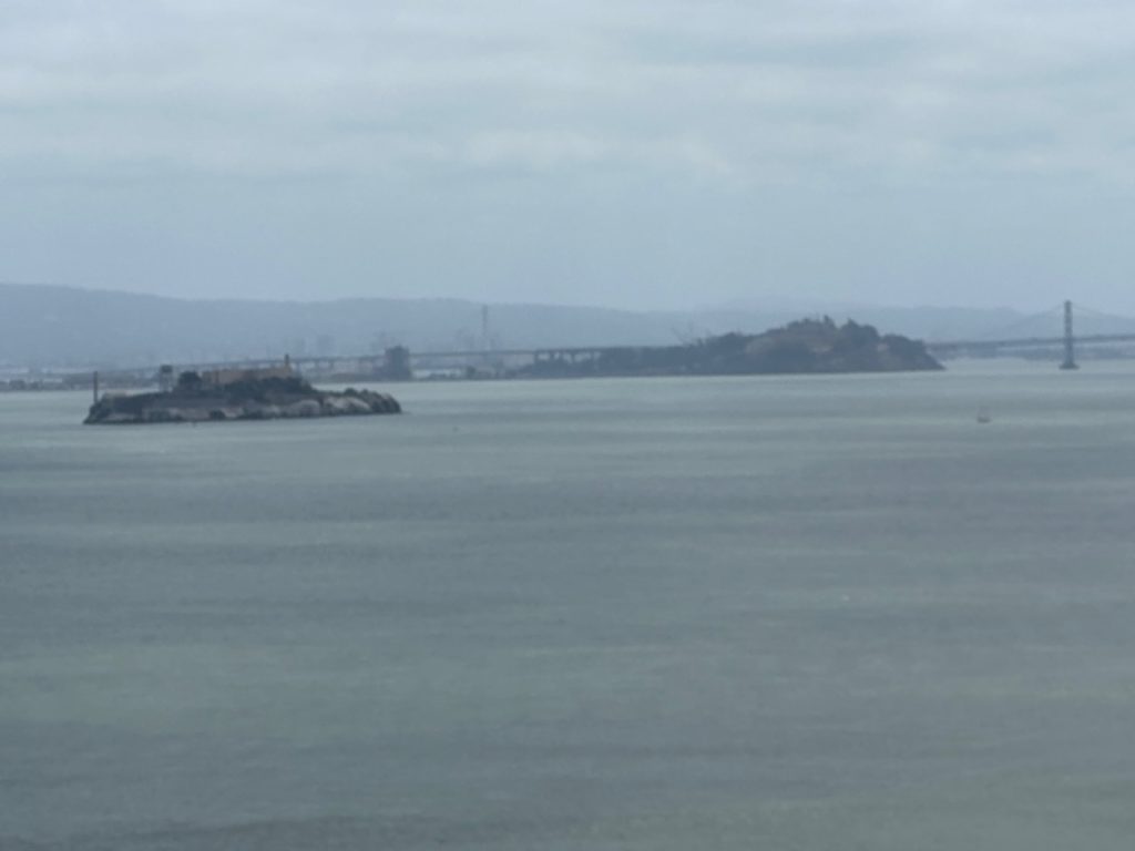
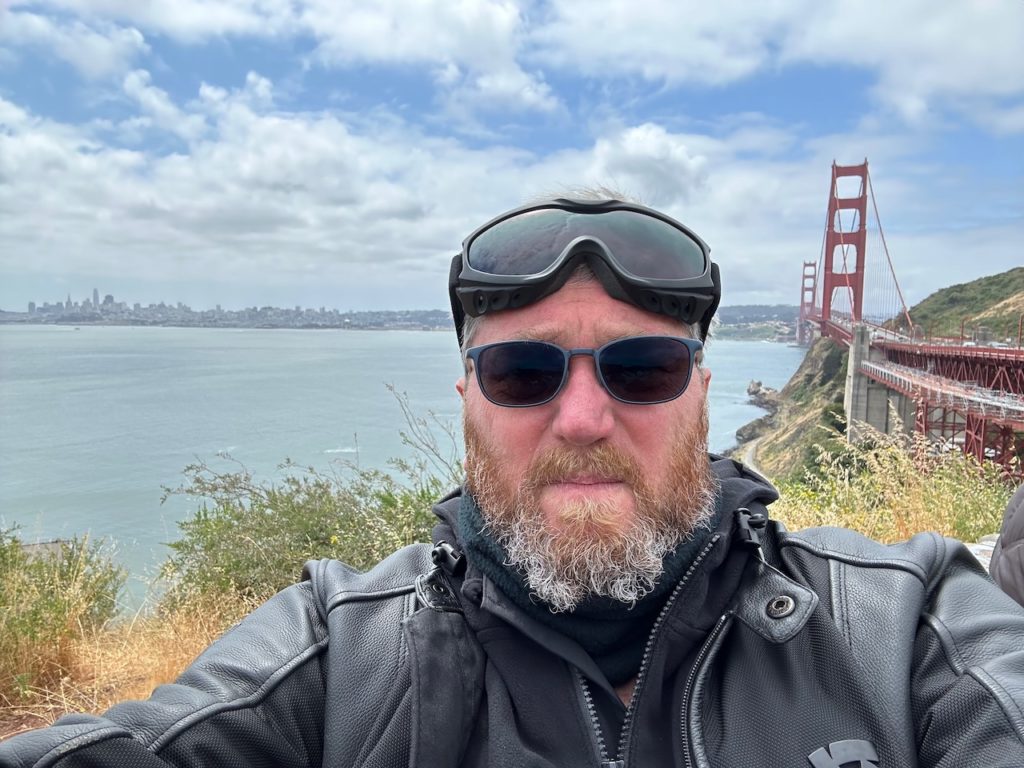
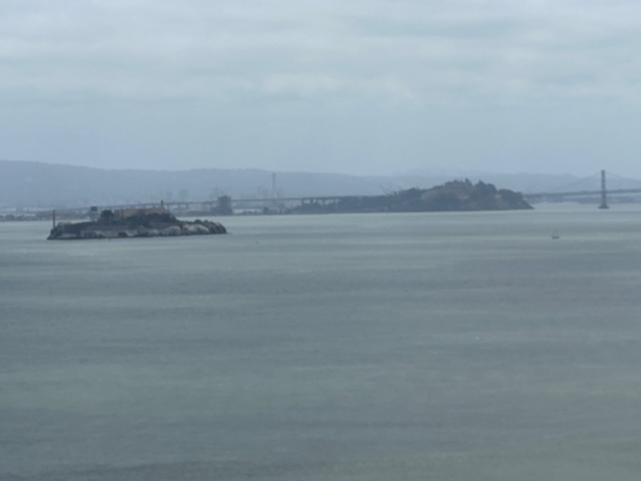
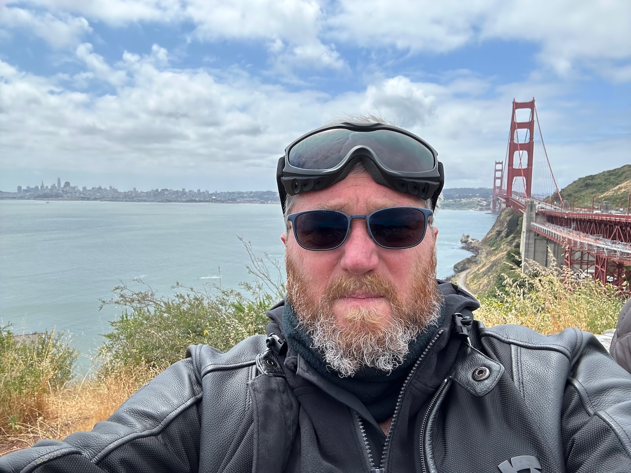
Dave lives half an hour north of the city, so I rode through the traffic, and found myself on the Golden Gate Bridge, I stopped on the other side, at the vista point, to have a break and take some pictures
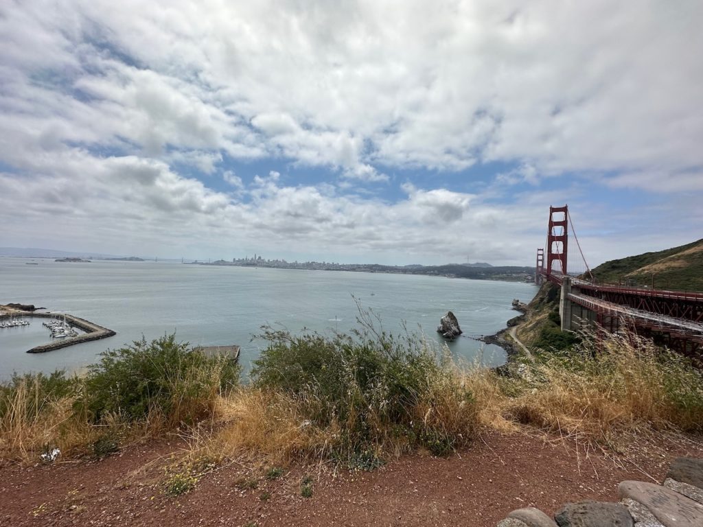
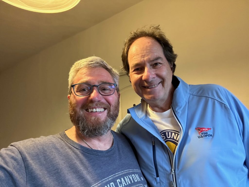
Another 20 or 25 minutes riding beyond the bridge brought me to a cute little town – San Anselmo. Dave has been here a year, but I haven’t visited during that time. He lives in a lovely house quite close to the town, and we are now both ignoring each other and fiddling with our laptops.
I think this is the end of stage two of the trip – this was the official Pacific Coast bit of the trip. Tomorrow, the trek eastward begins, starting with a ride to Fallon, Nevada. See ya there.
- Day 8 – San Anselmo, CA to Fallon, NV: 295 miles.
Daves guest room has a loft bed. It was comfortable to sleep on, but a bit tricky to get in and out of when you are bleary-eyed and a bit disoriented at 3:38 in the a.m. Still, no necks or ankles were broken, and I slept OK.
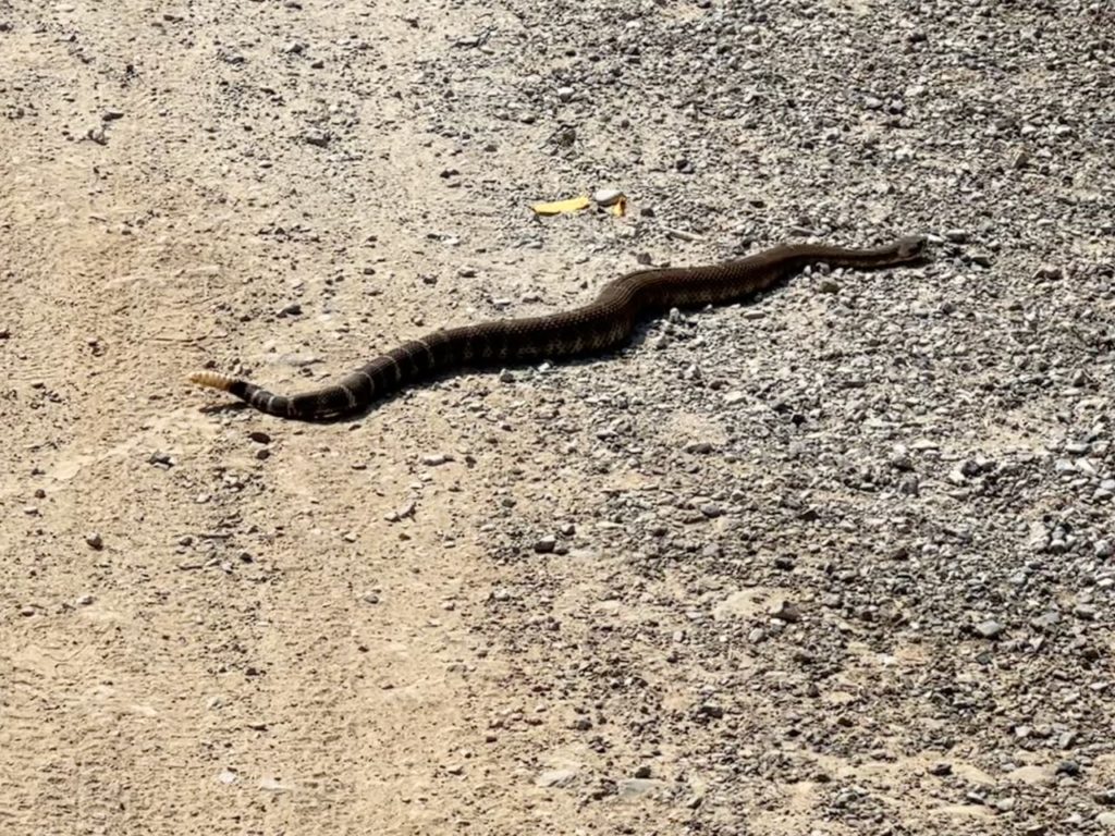
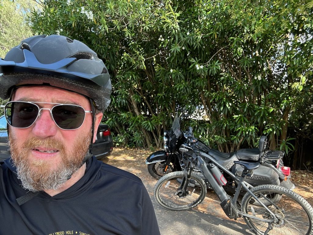
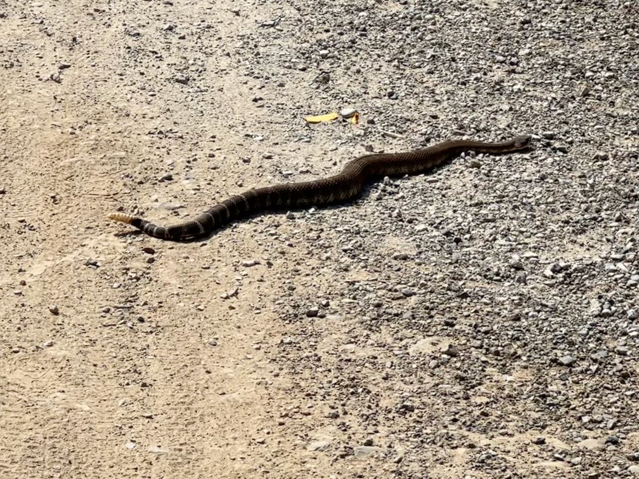
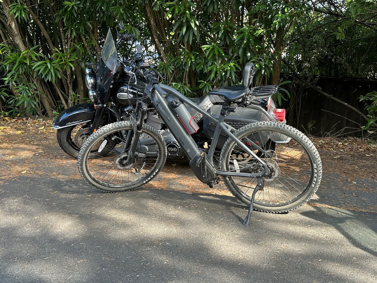
We had a nice afternoon yesterday once I unpacked and blogged and stuff. We took Daves bikes (pedal, not motor) and cycled to Phoenix Lake, about half an hour from where Dave lives. The bike Dave gave me to ride had assisted pedaling, so while I still had to work, it was a help riding up the hills. Excitingly (I think it was exciting), on our descent, a young lady stopped us, and pointed to a snake that was emerging from the grass at the side of the path. It was a rattlesnake. It is not usual to see these there – in fact Dave said he had not seen one on the 20+ years he has lived in California. We watched it slowly slide across the path, and disappear into the grass on the other side.
Morning, and once again I was up before the alarm – about 05:48. I did the thing, loaded the thing, and rolled out of there about 07:20. California, once again, was underwhelmingly cool and gray, and I needed my layers and thickest pair of gloves. Coming out of the Bay area was uneventful, but I enjoyed the traverse of wine country.
Breakfast was a mistake. My mistake. I had targeted a diner before I set off, and when I rode into the car park, it was actually a Mexican fast-food place. No worries, I don’t mind that. I had a spice breakfast burrito. The combination of spicy burrito with last nights Indian curry did hold my stomach hostage later in the morning, I escaped unscathed overall. The mistake was that when I left the breakfast place, I saw that exactly behind where I had parked was the diner I was aiming for. Doh!
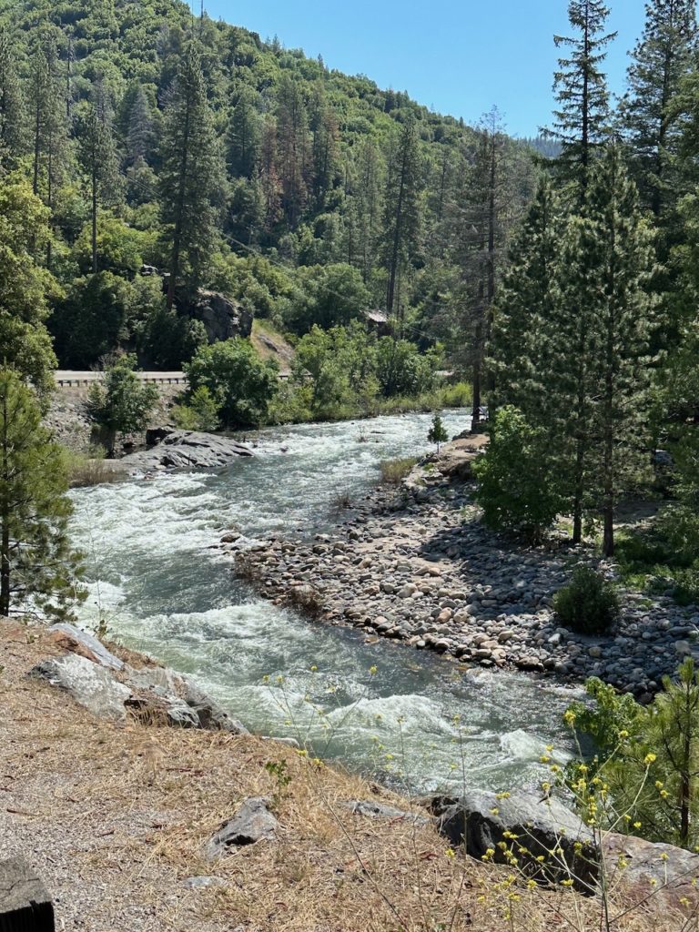
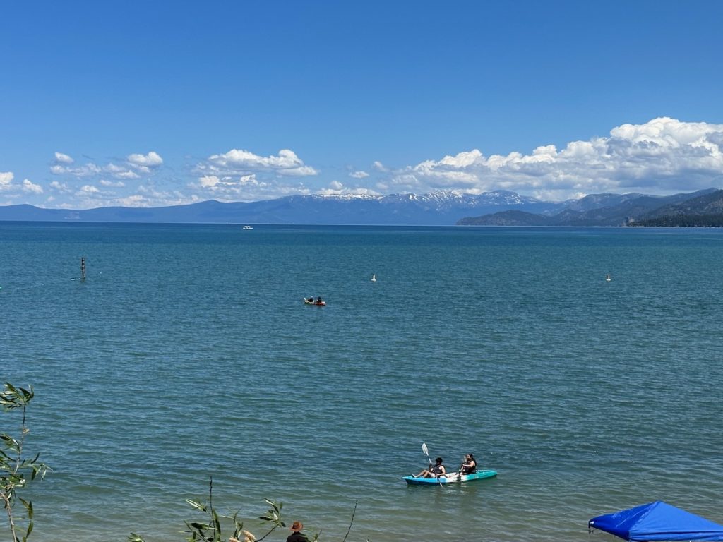
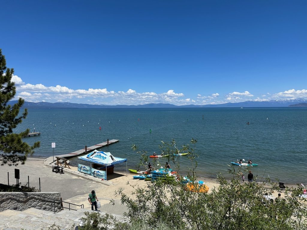
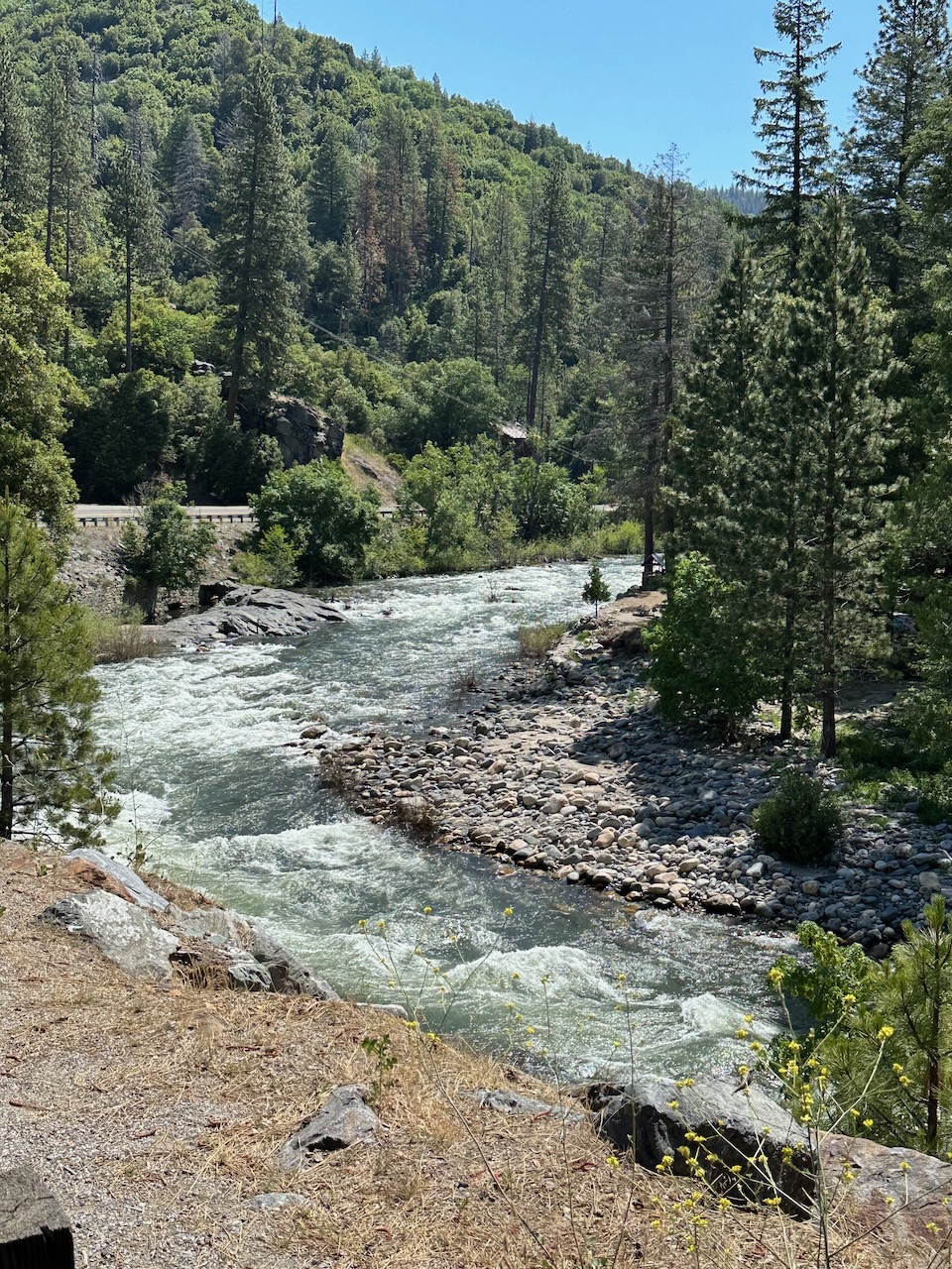
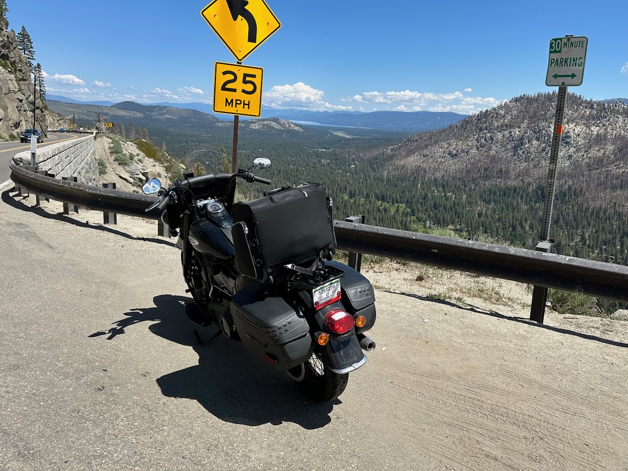
Breakfast was just outside Sacramento. From there, I started to slowly climb, until I was actually in some mountains, with a lovely river tumbling alongside the road. There were lots of twists and turns in the road, as it rose up through the forest. Somewhere around here, I clocked my 2,000th mile of this current journey. It is a long one, for sure. Eventually, the road topped at around 7,100 feet, and brought with it great views of the southern portion of lake Tahoe.

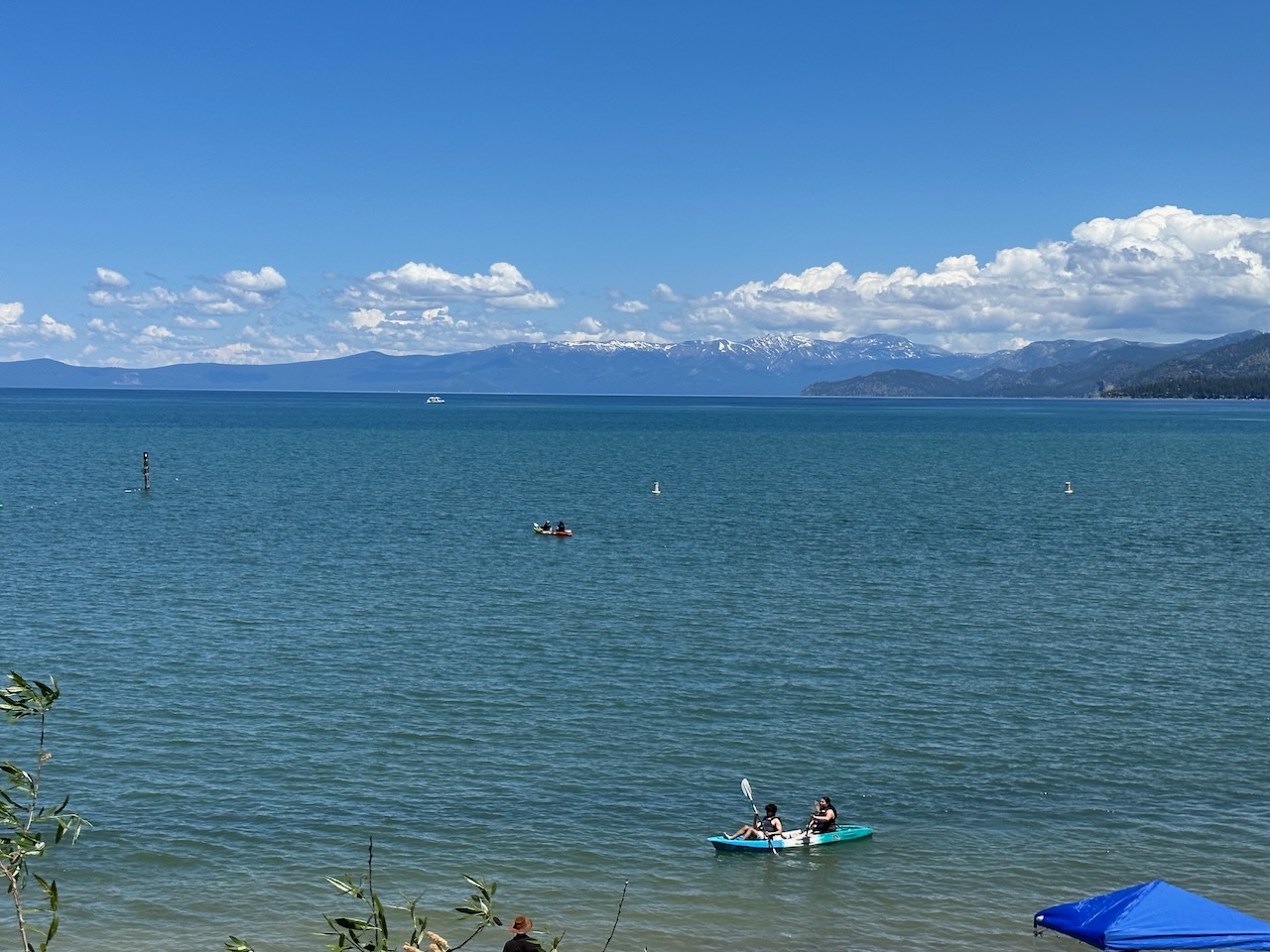
I rode down the other side – another lovely winding descent, and stopped at the lake to enjoy the views.
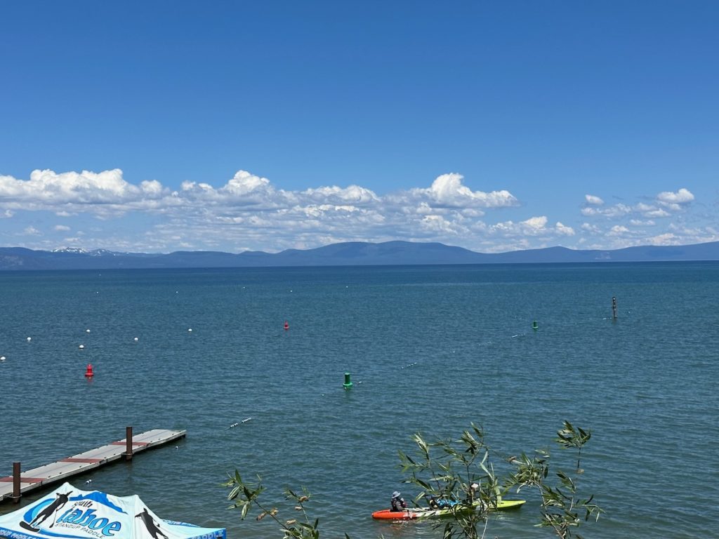
The state border with Nevada runs through the lake – and through the town of South Lake Tahoe. I didn’t notice any border signs, but the California side was classy and rustic, then suddenly there were a few chain restaurants, and then a bunch of gaudy casinos. The casinos proliferate in Nevada, for some reason. Still, with my experiences of the last few days (time with Dave and cousin Jonny aside), I was happy to have California behind me.
The road wound along next to the lake for some miles, and climbed up an equivalent height – to over 7,000 ft to get away and aim towards my next destination.
Nevada seems to be largely flat, hot and boring. I spent an hour in the company of these three ladies, and arrived at my motel mid-afternoon. I am somewhat tired – Dave and I had a lovely evening but went to bed late – so I will probably have the quietest Friday night of anyone in all of Nevada. See ya on Saturday.
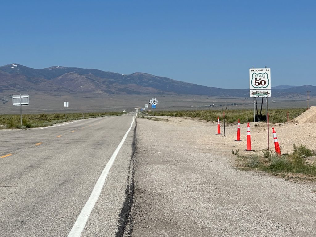
- Day 9 – Fallon, NV to Ely, NV: 274 miles
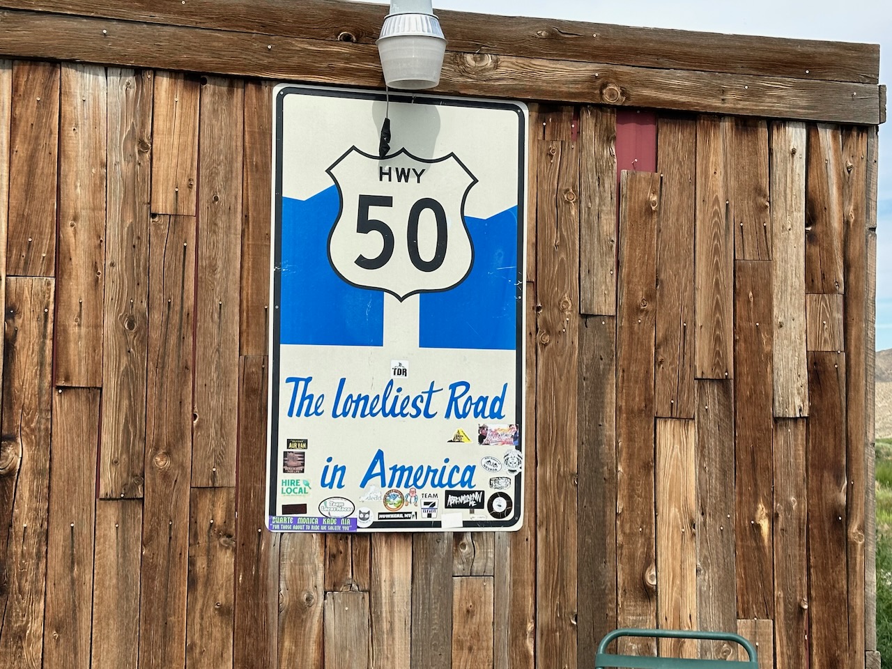
I packed up this morning, turned right out of the hotel car park onto Highway 50, and rode 274 miles without turning once, til I got to my sumptuous accommodations for this evening. The end.
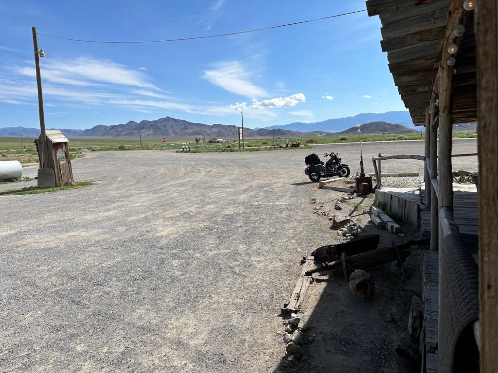
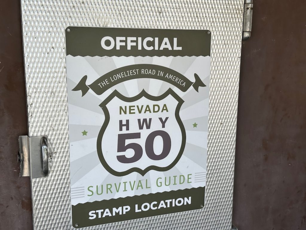
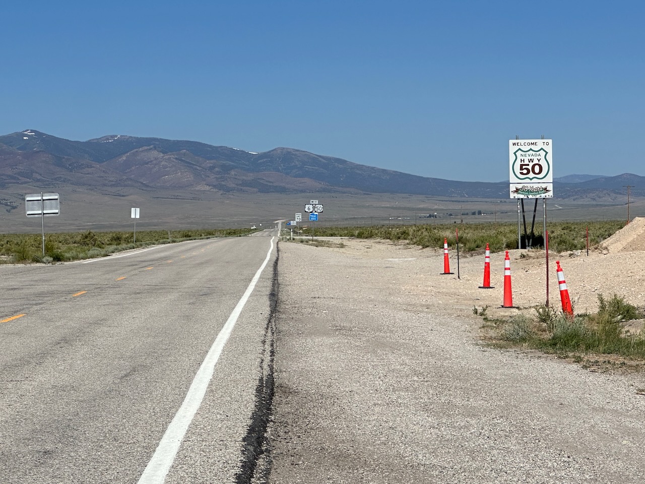
Highway 50 is billed as the loneliest road in America. It is probably not, but might be the loneliest highway here. I think I passed two “towns” and one RV Park/diner the whole day.
Almost the entire road is dead straight, and runs east-west. I am heading eastwards back towards home, so rode into the sun all morning. Fortunately, there are no cars, and no scenery, so I didn’t need to see anything aside from the sun, bleaching my retina.
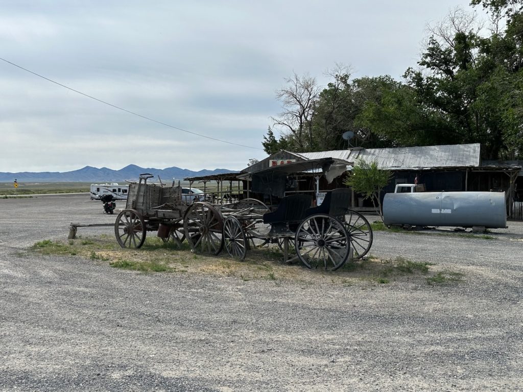
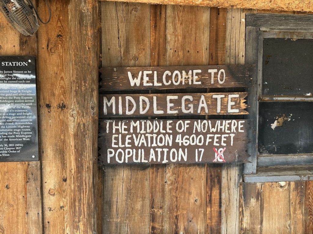
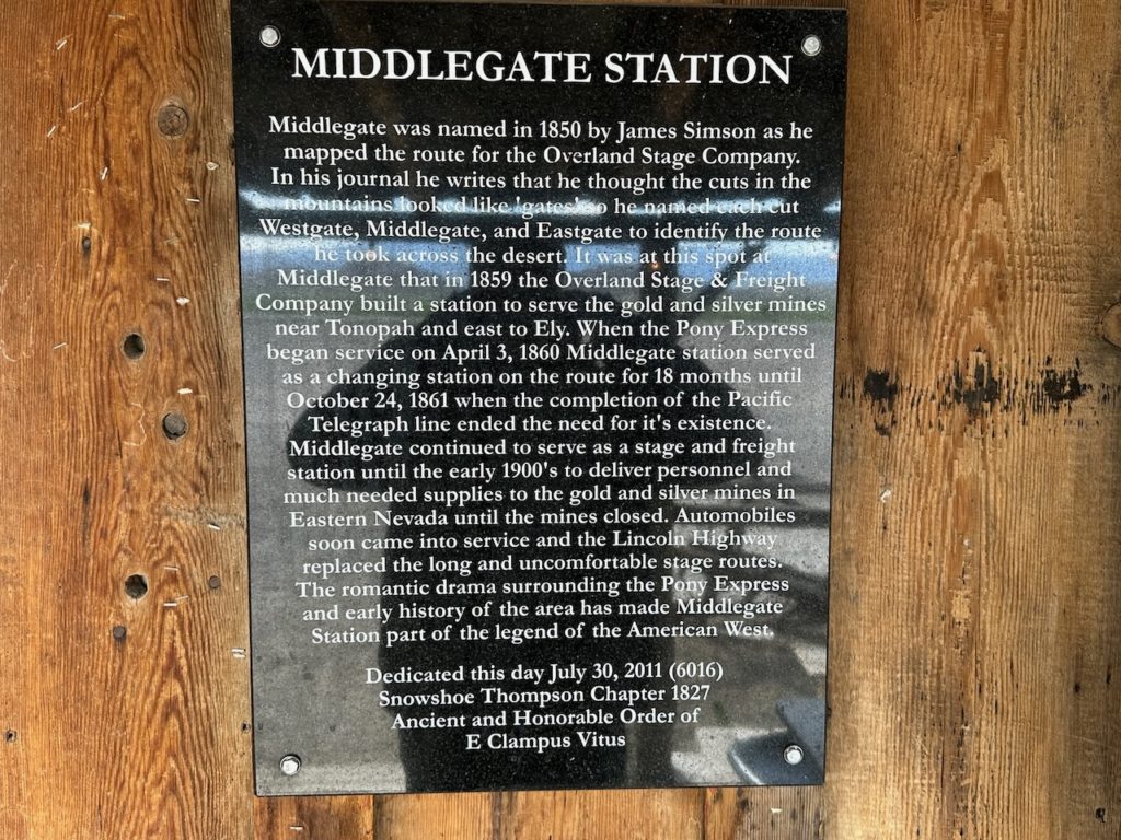
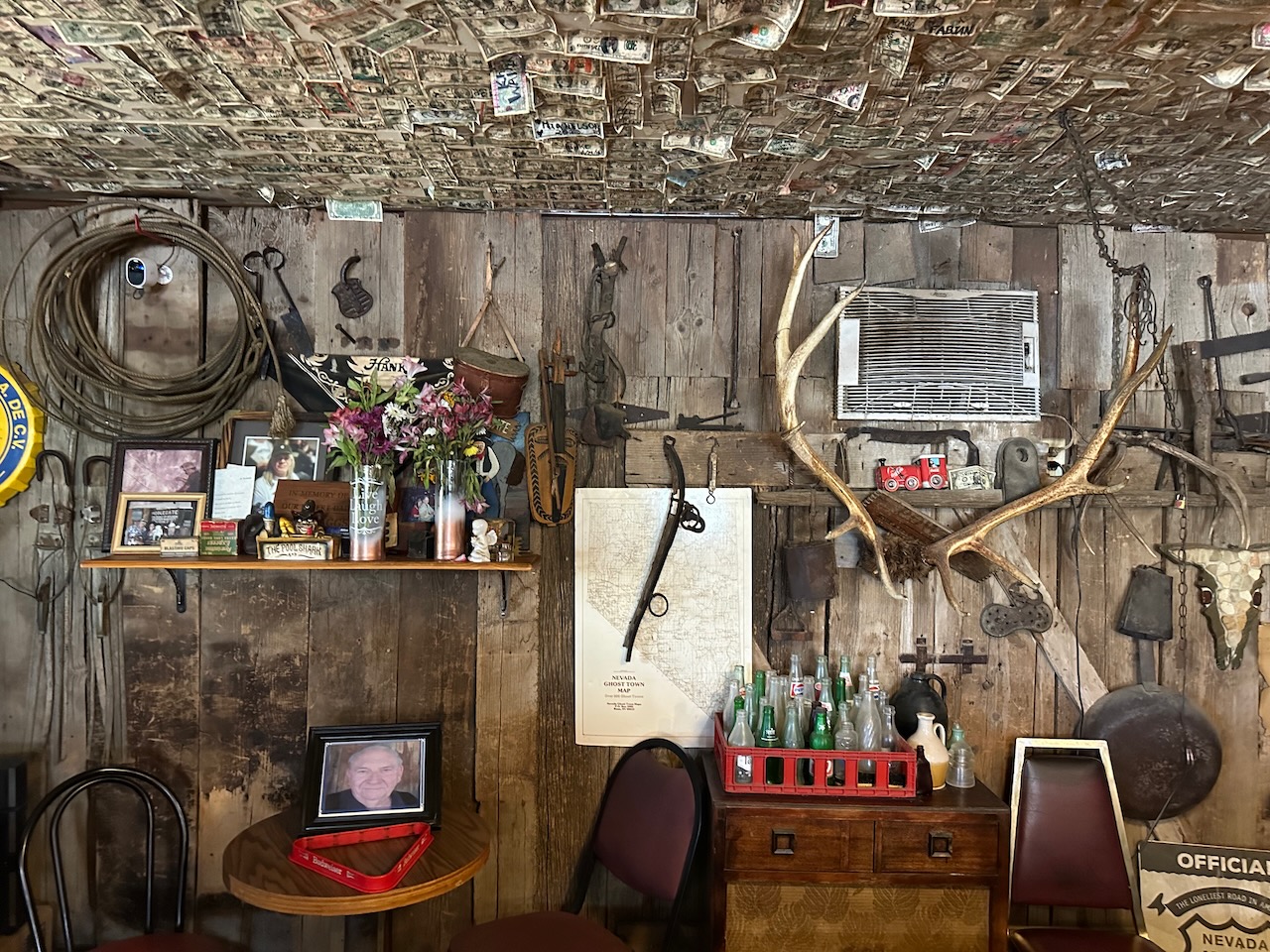
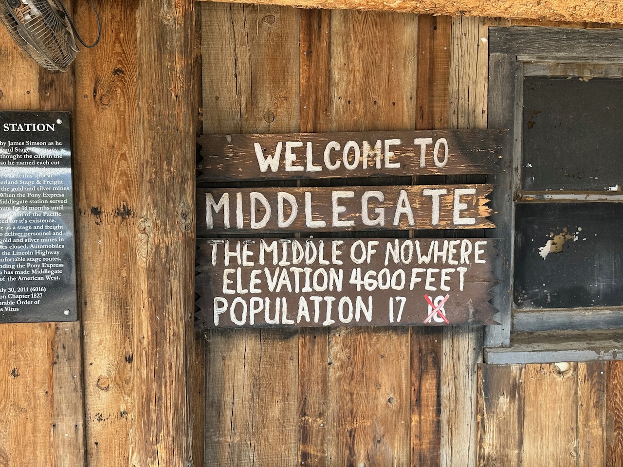
I stopped at the one non-town for breakfast. I was not sure it would be open, but fortunately it was. I do have a packet of beef jerky with me, in case I don’t find a meal stop – but it went unopened today. The Middlegate station provided a good meal, and some interesting history.
The highway 50 runs along the old Pony Express route. The station was built 150 ish years ago as a waypoint, and also was where teams would switch wagons as they ferried mail in both directions. One wall of the place is still the original, and though it was quick ramshackle, it had a good atmosphere. I chatted with the owner, and she gave me some good insights into the place.


Apparently it has rained incessantly for about 6 weeks – just like for us back in Colorado. In fact she said yesterday was the first nice summer day – I am glad I missed the rain. Everywhere is pretty green, which she says is very unusual. She said that summer is usually “50 shades of brown”.
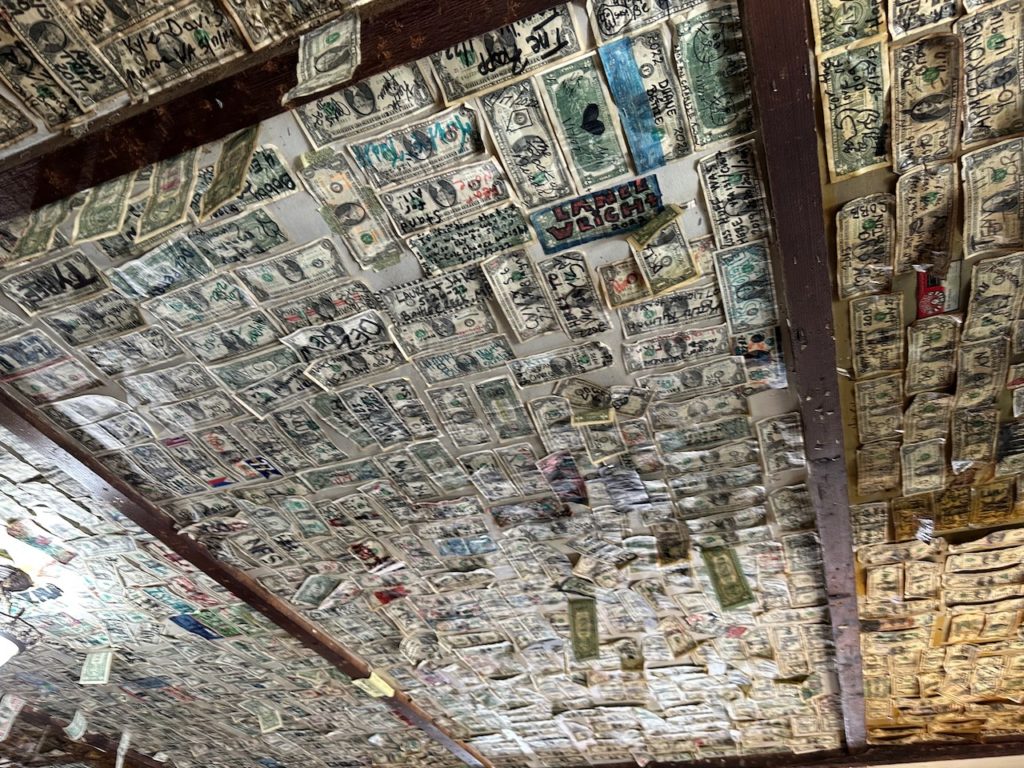
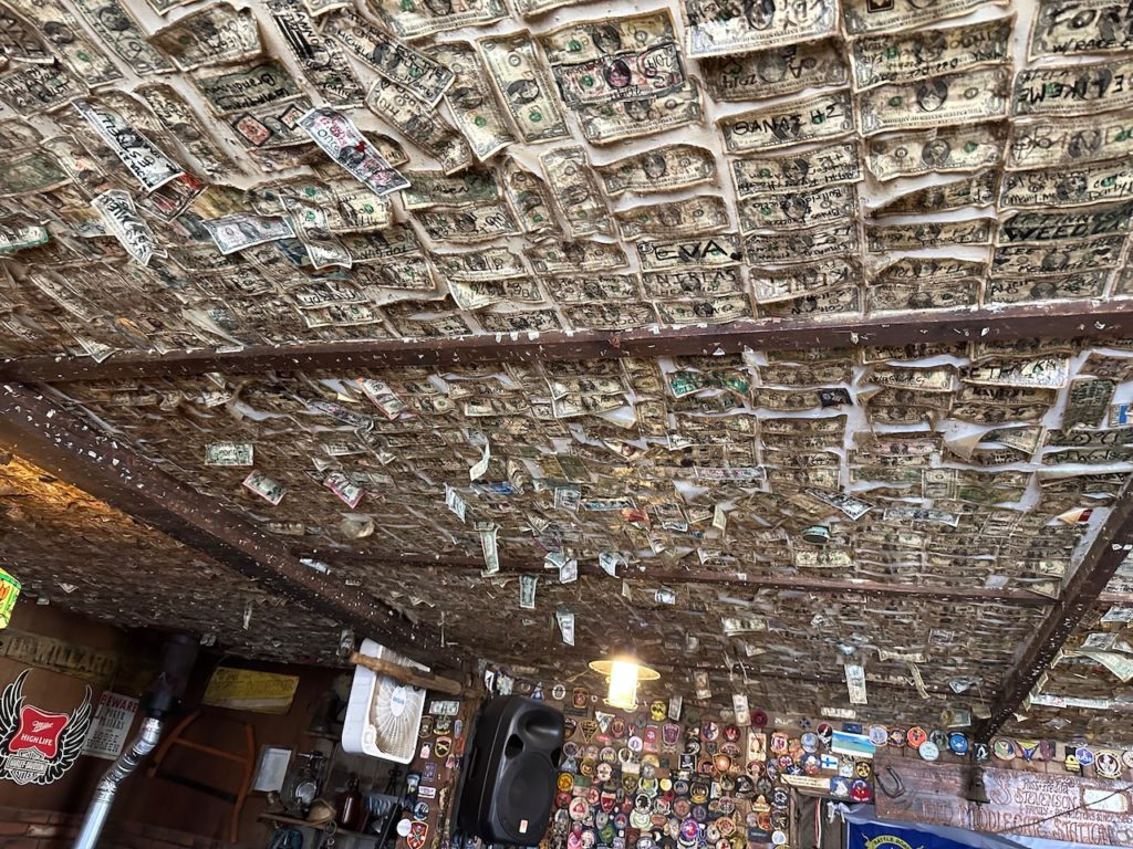
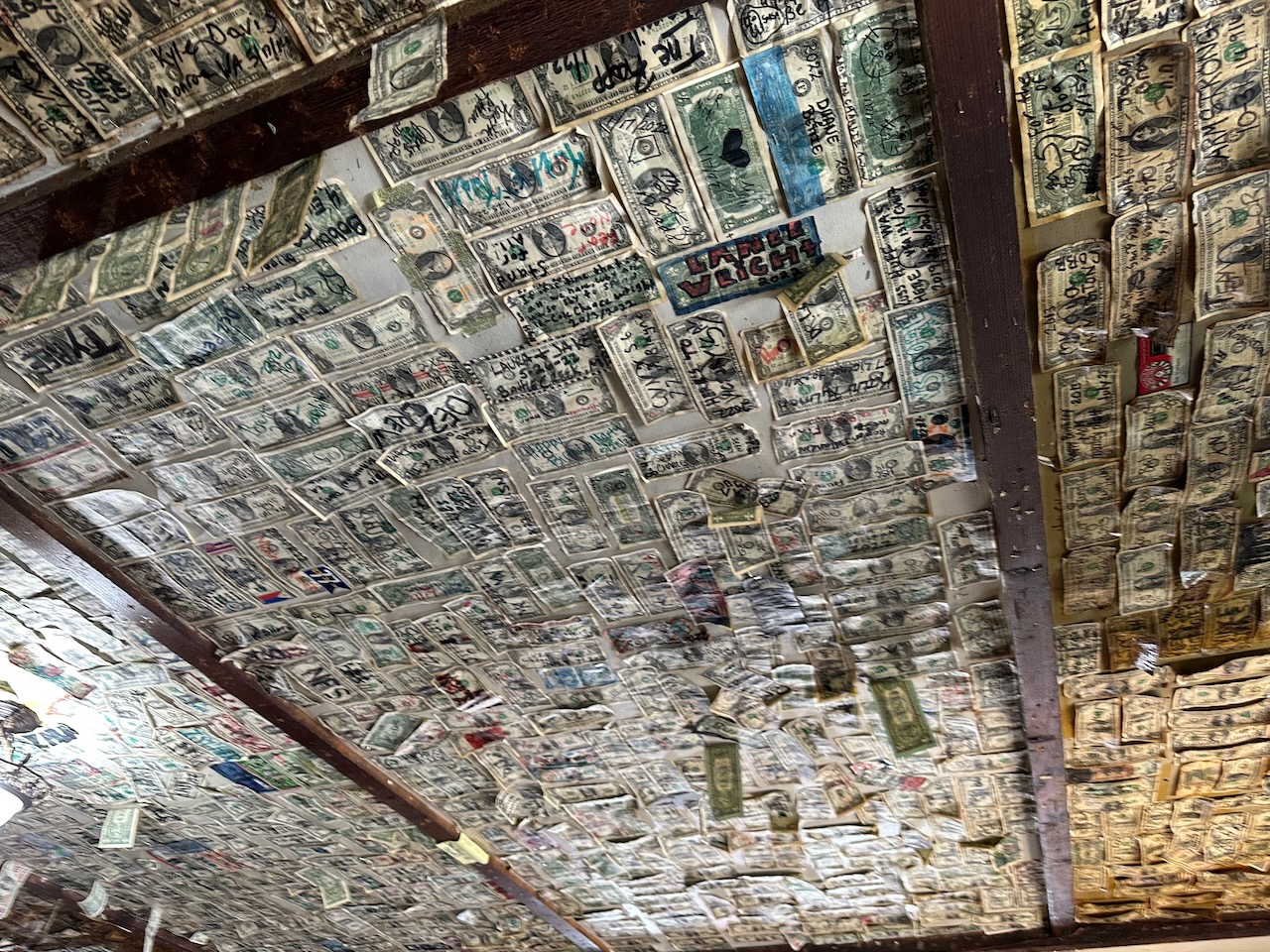
The roof of their place was covered – literally – in dollar bills, that people had put notes or messages on, and stuck to the ceiling. It was quaint, odd and a bit weird.
The scenery was actually OK. I loved the fact that there was literally no civilization (and I use that word lightly, given where I am) all the way today. Just rolling countryside. I went over a few passes – all decent elevation, from about 5,500 to 7,500 feet. It was quite funny – every now and then there would be a slight kink or bend in the road, and they had put warning roadsigns there. The road is literally so straight you have to warn people if there was a slight shift left or right by a couple of degrees.
Anyway – a fuel stop, a wee stop or two, and that was about it. I arrived as usual at my evenings destination, but my room is not ready, so I am at the bar, having a drink, and being forced to inhale cigarette smoke. Apparently it is legal in this town (maybe in Nevada?) to smoke indoors. I am very happy that there is a smoking ban in most places, and this reminds me of how good the ban is.
My hotel is an old fixture of this town, built in 1926. I don’t think it has had a refresh since – it has a gambling hall too. I think Gambling is legal in Nevada (I guess Las Vegas, right?), and so everywhere one goes there are casinos or slot machines. There were betting cards at the place I ate last night – didn’t really look at them, but the restaurant wasn’t a casino (I think).
Because the place is a casino, they make room and drinks super-cheap to attract people. It does attract people, but probably only those who want to gamble in a 4th-rate place while smoking, and drinking cheap beer. A pint of lager was $2.50, which is very cheap indeed. I had to wait while my room was being readied (I arrived too early), and was very surprised how cheap the beer actually was. At least there is that in this gambling, smoking hell-hole.
See you later, peoples
- Day 10 – Ely, NV to Provo, UT: 274 miles
I am back in the right time zone. Exciting – it means I am getting closer to home, to my honey, my dogs and my cats. I love my time on the road, but love my people and pets more, and I am missing them. Two more sleeps til I can get home.
Today started out quite cool – probably 11 or 12 degrees when I got the bike ready this morning. I stayed on the same road – the lonely Highway 50 – for a big chunk of today, too. I usually have a plan for a breakfast stop, but the map offered nothing, so I set out, half expecting to get hungry at some stage, and stop to eat my beef jerky.
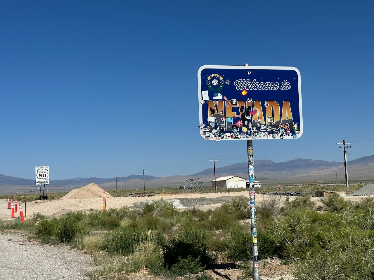
I am generally not much of a beef jerky fan, but I found one brand that does a decent job of smoking and curing the meat – so I don’t mind having some of it. After about an hours ride, I saw a small service station and what looked like an inn. Turns out, it was exactly on the Nevada Utah border, and is probably the first/last place people can gamble in, so there were already a few sorry souls there, at 0820, pushing their coins into machine.
Breakfast was OK though, so I did not have to break into my jerky rations. After breakfast, I moved my bike under the “Utah” sign, and took a few pics.
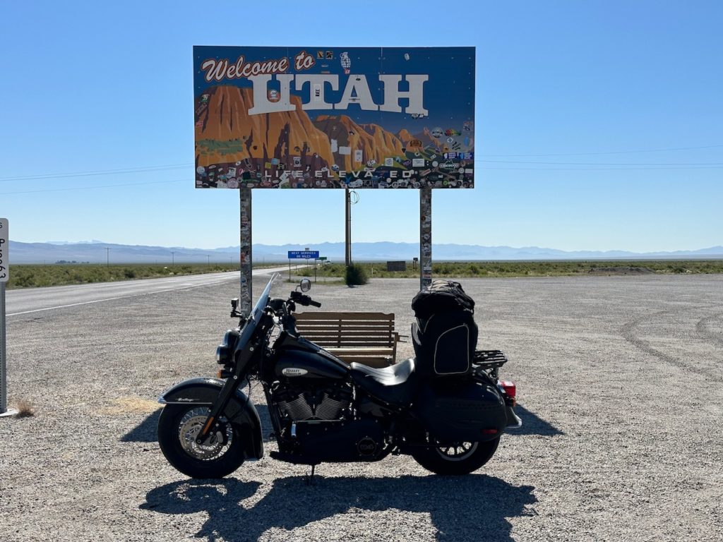

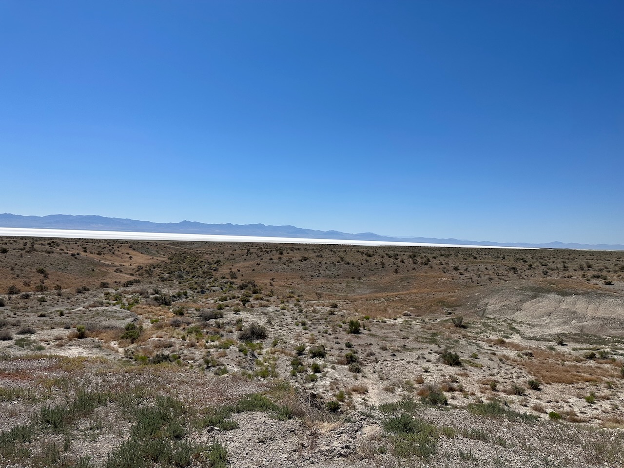
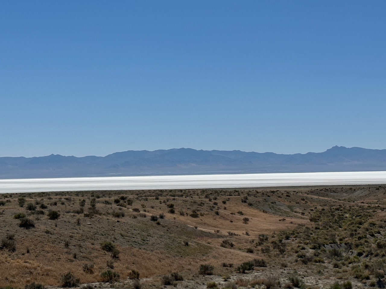
Crossing in Utah, my timezone went forward by an hour, so I was suddenly late. Another 90 minute of the same kind of rising as yesterday brought me over a crest, and an odd sight opened up below me. There was a huge lake – or it looked like a lake – but he surface was white. At first, I thought it was just sun reflecting off the water, but then I realized it was actually mineral deposits.
Sevier Lake lies in the lowest part of the Sevier Desert, Utah. The lake has been mostly dry throughout recorded history. It was certainly a striking view.


I finally parted ways with Route 50 at Delta, and took a smaller road which continued east. This brought me to the start of the Mt Nebo loop, about 30 miles or so south of Provo.
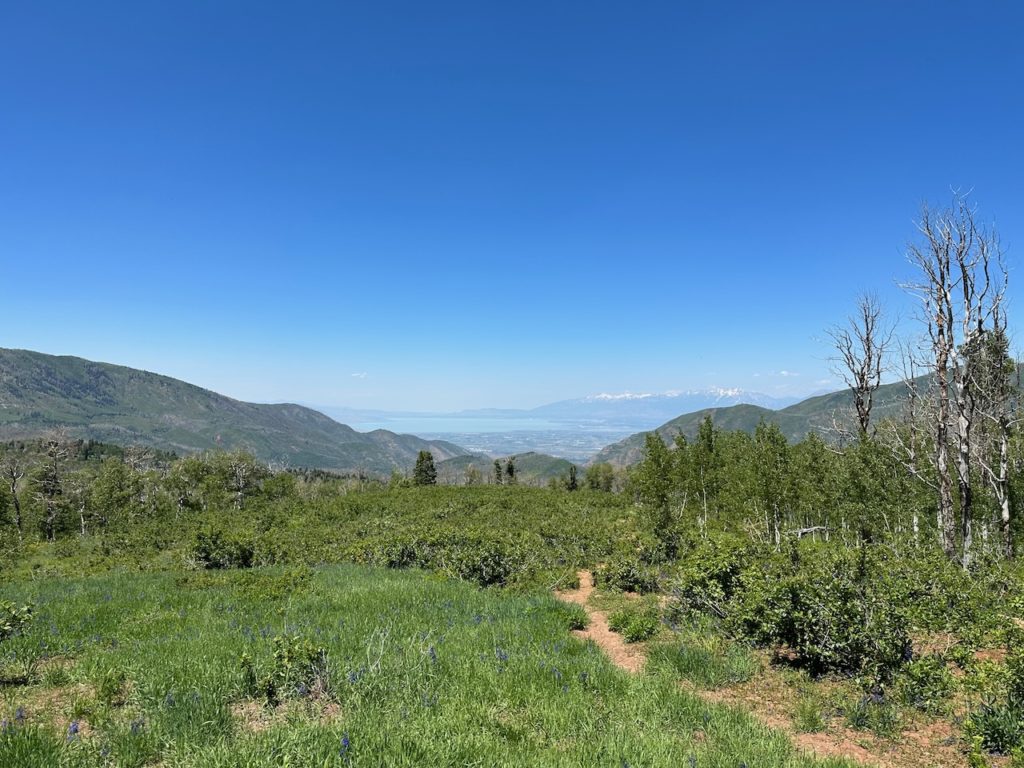
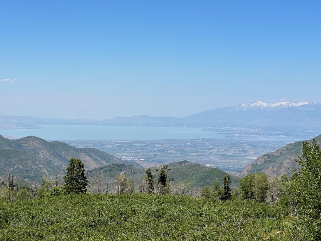
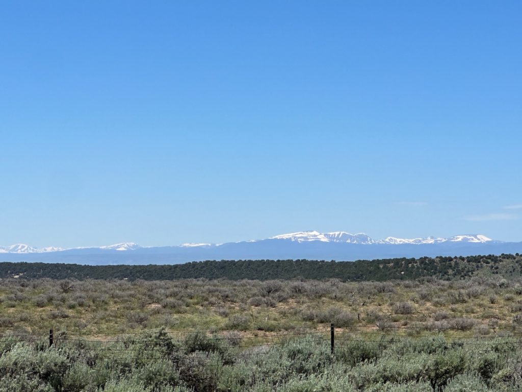
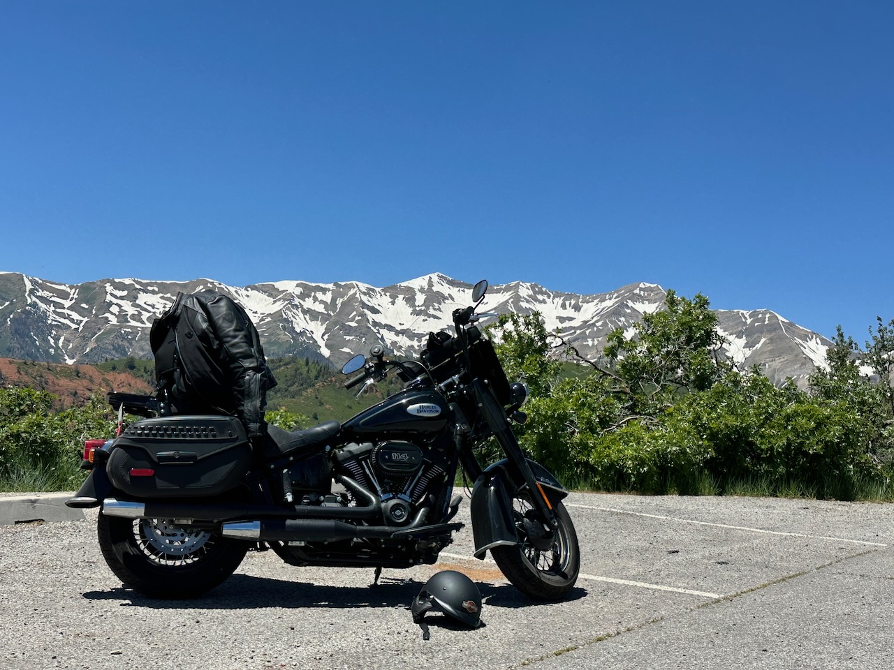
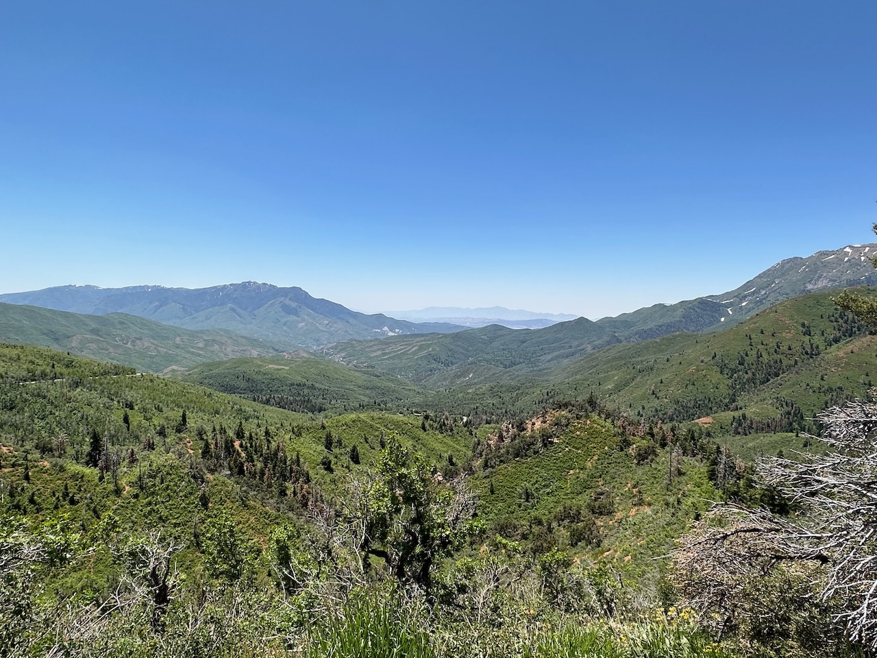
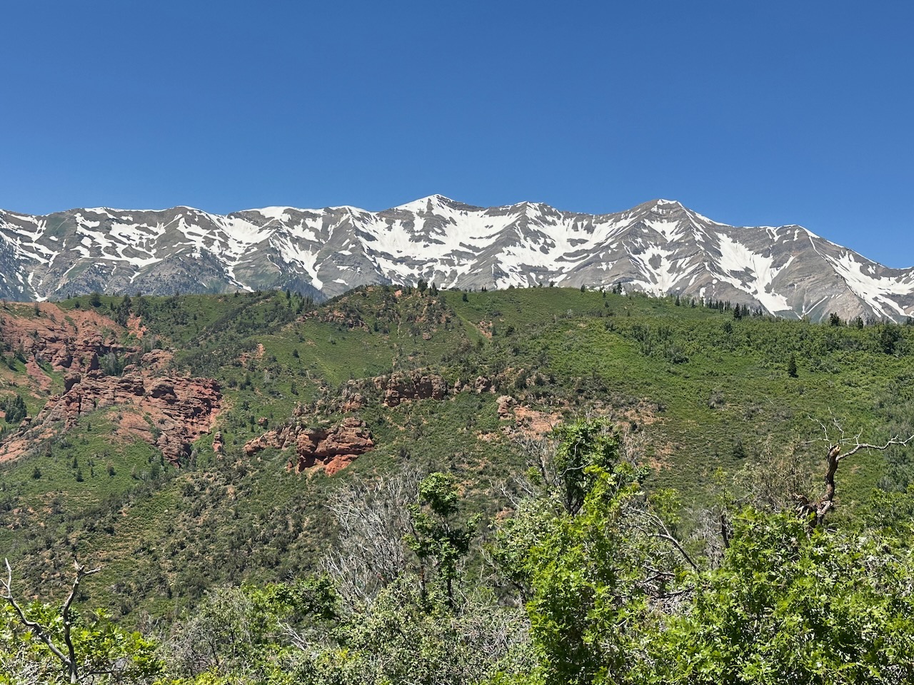
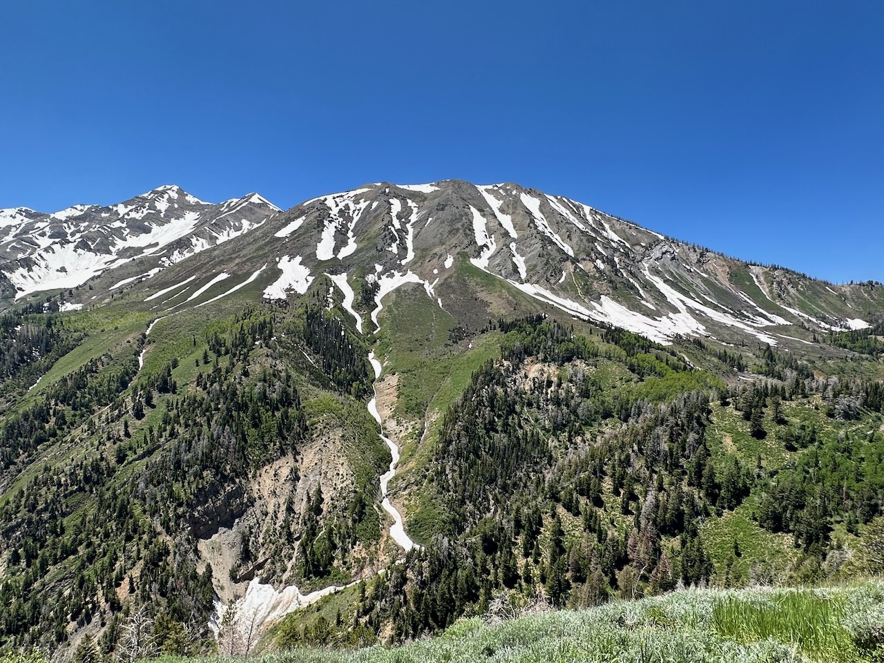
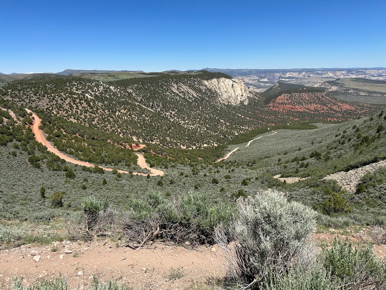
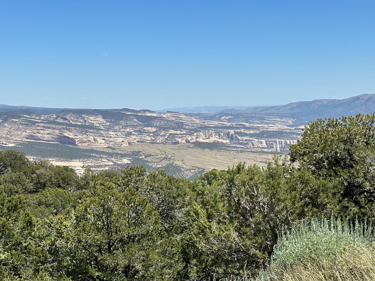
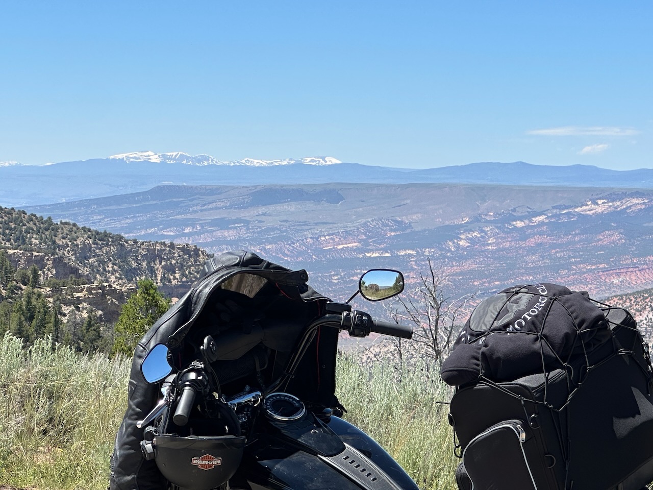
Mt Nebo is just shy of 12,000 feet high, and can be seen from many many miles away – I had certainly been eyeing it for an hour. The ride was wonderful – after days of straight roads and unchanging scenery, the path was very twisty, windy (windy as in wind, not as in wind) and steep. I stopped at various vantage points, and have included a few pics:
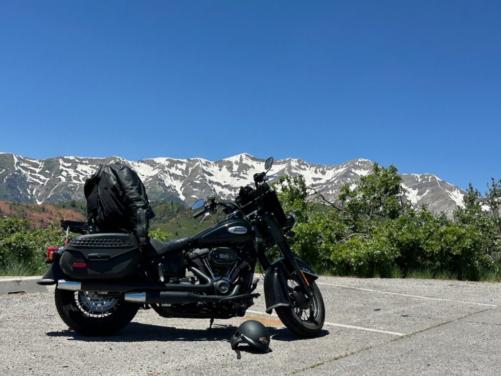

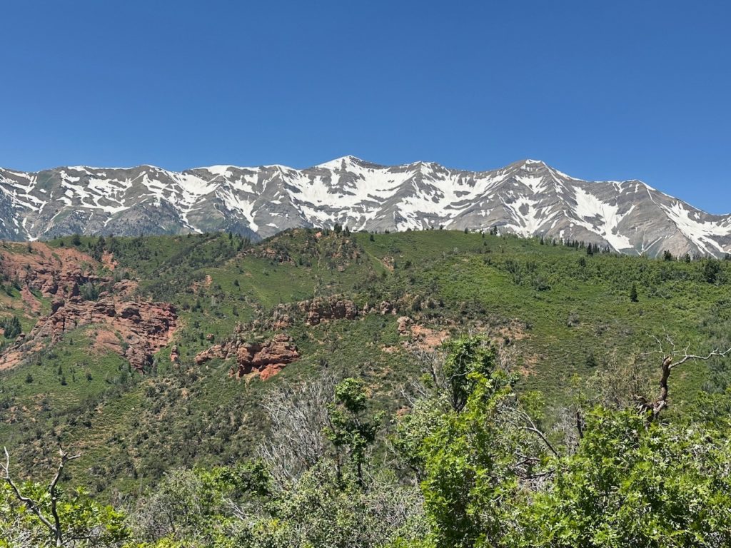
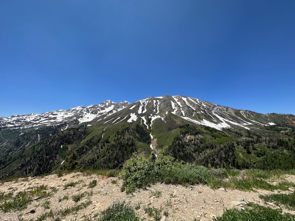
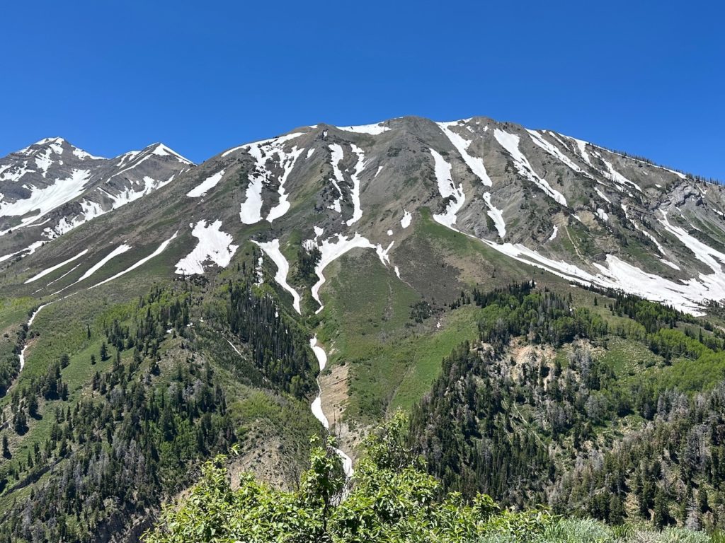
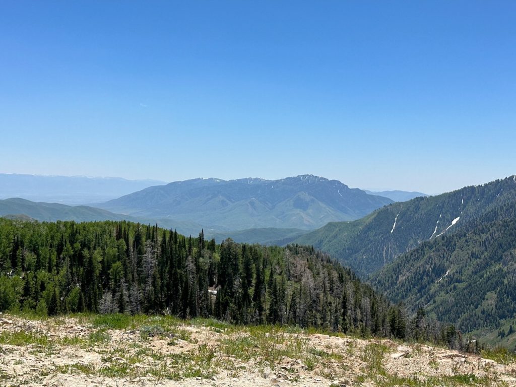
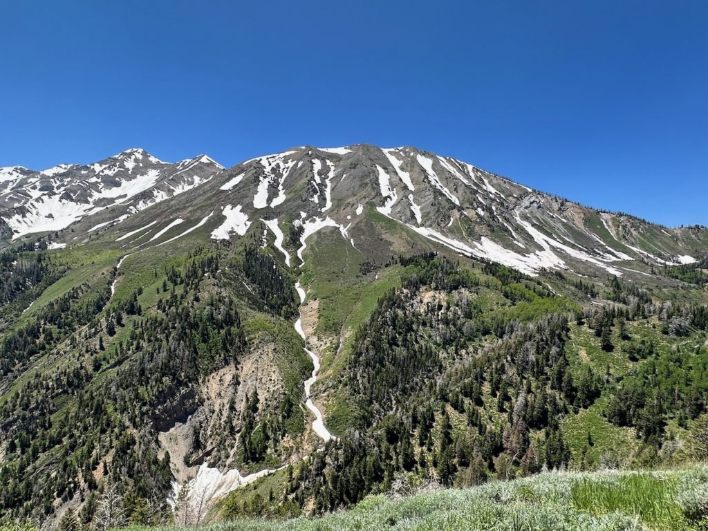
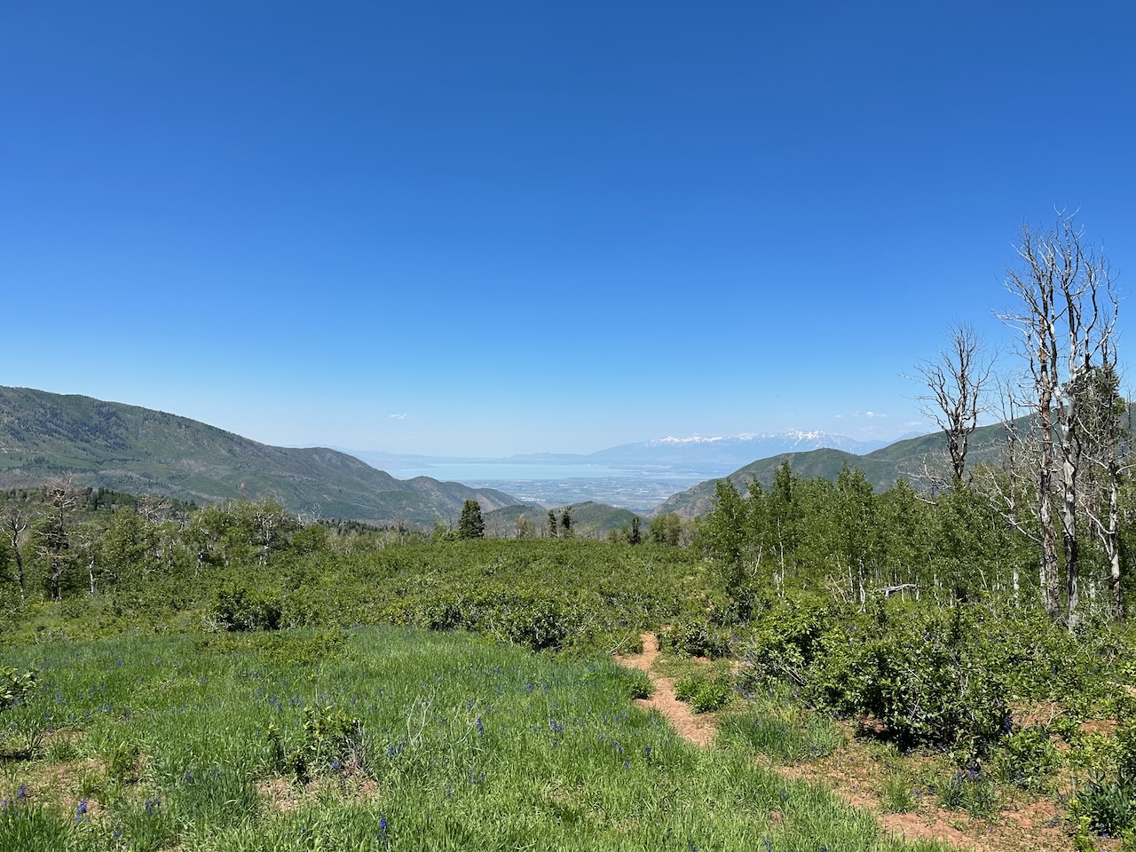
There was snow by the road from about 8,700 feet. It was not cold, but rather pleasant, as the surrounds of Utah are really hot. My final vista stop was to look at Lake Utah – the large body of water that sits about 30-40 miles south of the Great Salt Lake.
The bear came down the mountain, joined the fast and busy motorway, and found his way to a clean, modern, and very sanitized hotel pretty close to absolutely nothing, which is my perch for the night. I need to plan tomorrows route – I cross the state line back into gods own state at some stage tomorrow – excitingz.
- Day 11 – Provo, UT to Craig, CO: 386 miles.
Yay – I am back in Colorado. I am staying in a small NW Colorado town called Craig. When planning my route, I saw this town, and decided I needed to stay here. My brothers name is Craig, so it tickled me to find a town with his name. Even more coincidentally, I passed a town in California called Bradley. S0 now I have 2/3 siblings accounted for. I have no idea if there is a town called Nicky in the USA – I will need to google that.
OK – googled. There is no Nicky, but there is a Nicolet (her full name) in Canada, and a Nicolet Forest in Wisconsin. Maybe one day…..
Anyway – back to this morning. I found a wonderful-looking ride not far from Provo, which I had planned to start the day with, before heading eastwards. I set off at the usual time, but at the entry to the canyon, there was a sign saying the road was closed in 7 miles. I have ignored “Road Closed” signs in the past, and have regretted it, so I decided to turn back.
Because Provo is wedged between some mountains and Lake Utah, there are not too many routes directly east – so I had to do a big loop, retarace my steps, and waste an hour before I was where I needed to be heading. Ho hum. Still, Provo is a wonderfully clean and well kept town (you feel there are Mormon missionaries hiding behind every tree, just waiting to rush in and pick up any litter, or tidy any mess anywhere).
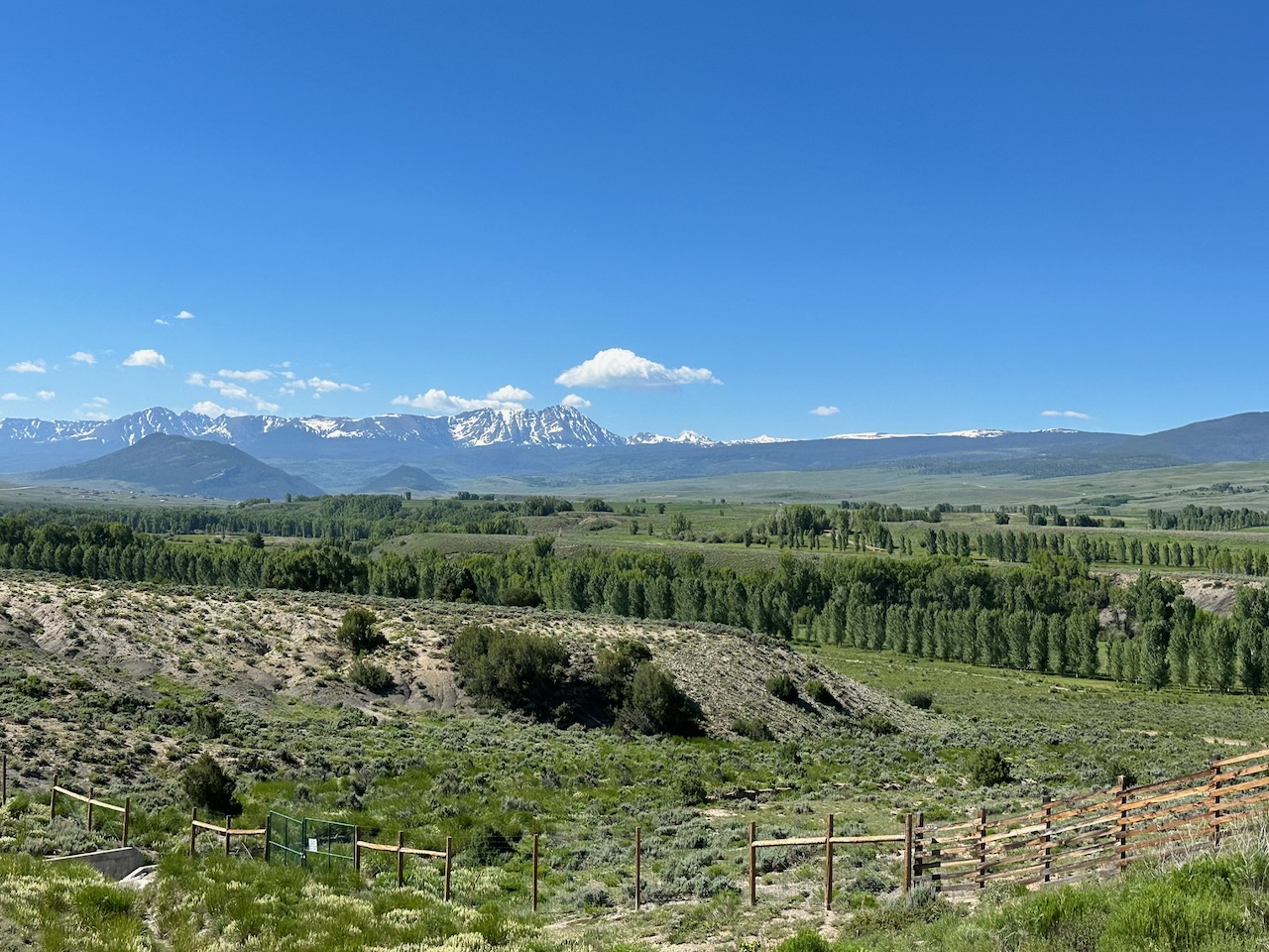
Anyway, the surrounds of Provo are really pretty. Lakes, rising hills, snowy mountain views and good riding roads. I really enjoyed the 2nd hour of my days ride. I stopped in Heber for breakfast, and found a lovely bagel shop which made pretty good bagels and breakfasts.
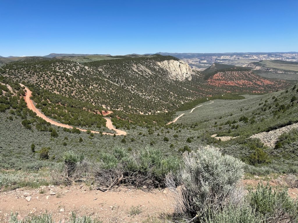
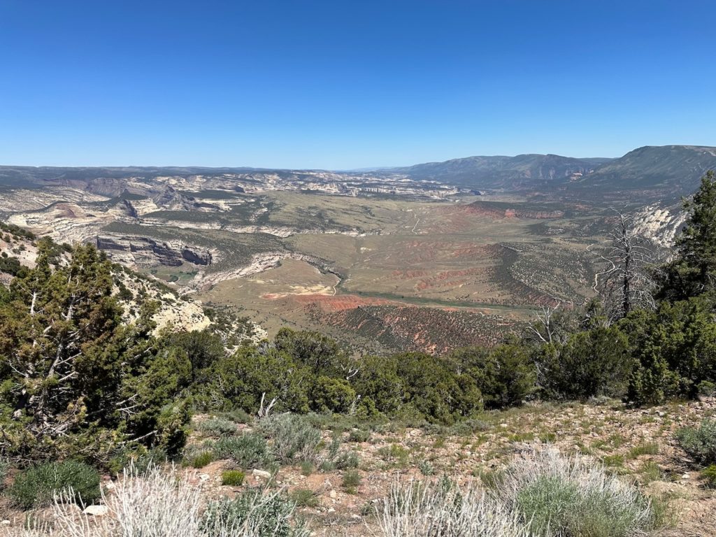
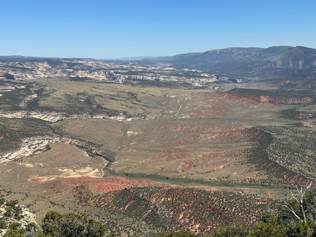
From Heber, I struck east along Route 40, which runs all the way to Colorado, where I found myself around 12:30. I was very happy to be back in the best state in the union. Shortly after crossing the state line, I stopped in Dinosaur to fill up. Yes, Dinosaur. A small spot, but they had a good sense of self awareness. I stopped at the visitors center which is on the corner of Stegosaurus Freeway and Brontosaurus Boulevard. I popped in to check on the state of my next road, and was told all is good, bar a bit of roadwork.

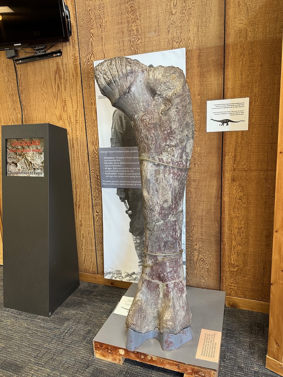
A brontosaurus femur My next road took me into the Dinosaur National Monument. The turn onto my target road is only 1.5 miles from Dinosaur, and runs 32 miles to a cul-de-sac. About a mile along the road, I hit some roadworks, and was stopped for about 10 minutes with a chatty woman who was handling the Stop/Go sign. Once through, the road started climbing up to some pretty pastures and lovely views of various canyons and mountains.


I didn’t see any dinosaurs – in fact, there was not much to see except the lovely views. Except, that I saw a biblical-sized plague of crickets. I drove through bloody miles of the Mormon Crickets – known because they up and ate the first crops that some mormons planted in Utah. They are, in fact, not even a cricket – how galling is that. They are from the Katydid family, and are brown, squat and ugly. They also have few natural predators (except their own kind, apparently – and seagulls).
Apparently strong winds diverted a flock of seagulls to Utah, and they ate the plague of crickets back in Olde Times, and so today, the state bird of Utah is actually the California Seagull – no irony intended.
Anyway, I crunched through millions of the crickets, enjoyed the sights and ride, took some pictures, and then return from whence I had came, and rejoined Route 40 to take the 87 miles onward to Craig.
My motel is way on the edge of town, and there seem to be no walkable eateries. I am ready to eat after my longest day of riding, so gonna hit “Post” on this entry, and head to the bustling metropolis of Craig. I will add some pictures later – the internets are slow here, and I don’t have the patience right now to watch my days photos upload and sync.
This is my last night on the road, and am very ready for getting home – though I have some wonderful scenery and riding for tomorrow to look forward to before I get there.
TTFN
- Day 12 – Craig, CO to Bailey, CO: 217 miles
Happy Day! I am back in the cradle of something or other.
Today, I rode the quickest routes – which I don’t tend to do normally while on tour- but the prospect of being home was a strong draw. Also, there were high winds forecast from mid-morning, and some of the roads I had originally planned for are high and exposed, and I didn’t want to take a chance of being blown into trouble. Especially not when I was so close to home.
Craig, CO was pretty quiet, as were the roads. They were quite pretty, and took me through a lot of green hills, a couple of high passes, and also presented some fabulous vista’s.

I did stop at the foot of the final pass I had planned, in Georgetown, to check the wind while I fueled for the last time, but the gusts were too strong, so I took my chances staying on the motorway. Otherwise, it was pretty uneventful.
A serendipitous occurrence made me very happy for the last couple of miles. I travel with music playing from the bikes speaker, and as I turned off of the last highway, US 285, into our neighbourhood, the song “Take it easy” by the Eagles started to play, and it accompanied me home. Those who have been following my current tour will understand why this was the perfect song to bring me home – it was an echo of a perfect moment along these 3,289 miles.
I will publish some stats later, but for now, I have some organising, unpacking, being licked by dogs, cuddled by cats, washing to throw in the machine, and (especially) a bike to wash waiting for me. 3,289 miles puts a lot of dust and splatters on a bike. Off I go – looking forward to see you again on my next travels, whenever, wherever and whatever they may be. Thanks for staying with me on this ride


So – I was going to take an un-planned road trip or a week or so, but a few days ago I hit on the idea of riding one of Americas classic roads. Route 66 runs from Chicago to Santa Monica in LA, so I started by looking at the option of railing my bike to Chicago, and then riding from there all the way to the coast.
However, logistics didn’t work out, so I then though about riding Route 66 starting from somewhere along the way, based on the easiest access to the mother road. I did some map-reading, and chose Santa Fe, New Mexico, as my entry point. So, I will ride south and get onto the historic Route 66 (much of the road is not designated as “66” anymore, but it is still mapped and celebrated as such), and ride the remainder of the route – about 1000 miles from Santa Fe to Santa Monica.
Then, while looking at the plans, I thought that maybe I should ride up the California coast, and do a quick stop just north of San Francisco, where my best buddy Dave lives. So have planned that extra detour, and am now in process of figuring out a good route back from San Francisco to home – probably ride across Nevada and Utah to get back to gods own State.
Route 66 was the first fully paved highway in the US. It ran about 2,450 miles, and goes through the following States: Illinois, Missouri, Kansas (for just 13 miles), Oklahoma, Texas, New Mexico, Arizona and California.
It was recognized as a full route for about 60 years, but was slowly decommissioned, with the last segment, in Arizona, being taken off the federal highway system in 1985. However, many states maintain the original road as part of their own highway systems, so most of the original road can still be driven.
I am frantically preparing for departure, but – as always – I plan to chronicle my travels. Keep coming back to the blog to see progress and hear about my daily travels and travails.